MyTopo
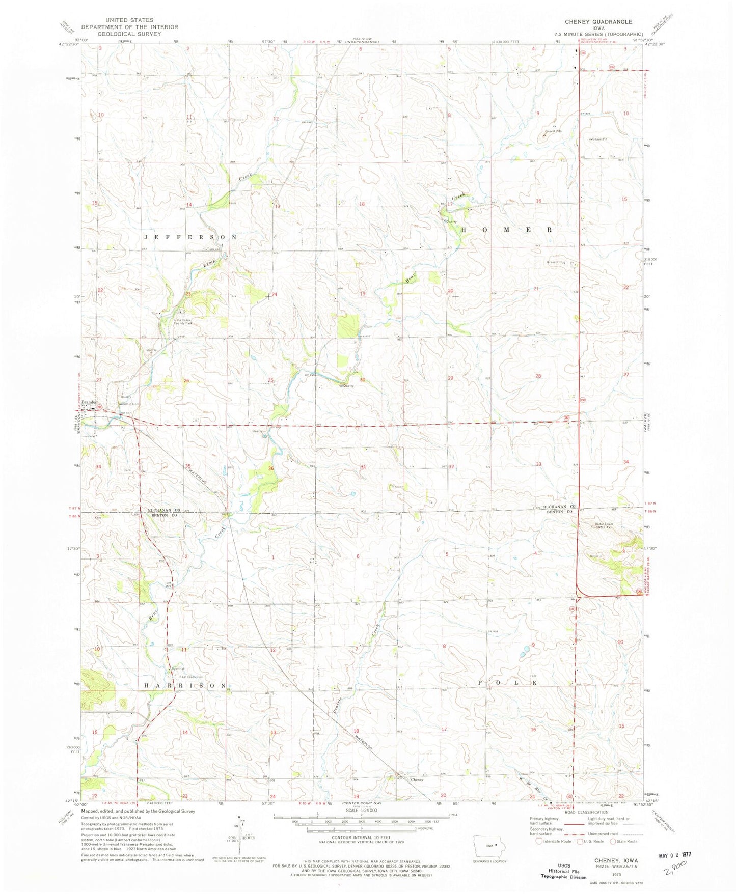
Classic USGS Cheney Iowa 7.5'x7.5' Topo Map
Couldn't load pickup availability
Historical USGS topographic quad map of Cheney in the state of Iowa. Map scale may vary for some years, but is generally around 1:24,000. Print size is approximately 24" x 27"
This quadrangle is in the following counties: Benton, Buchanan.
The map contains contour lines, roads, rivers, towns, and lakes. Printed on high-quality waterproof paper with UV fade-resistant inks, and shipped rolled.
Contains the following named places: Beachler Cemetery, Bear Creek Cemetery, Bear Creek School Cemetery, Bearbower Sand Prairie Area, Burke Post Office, Cheney, Clayton Cemetery, Hamerville, Hamerville Post Office, Harrison Townhall, Jefferson Township Cemetery, KGAN-TV (Cedar Rapids), Kounty Pond - Hoffman Woods Area, Likins Post Office, Lime Creek County Park, Polk Township Wildlife Area, Township of Harrison, Township of Homer, ZIP Code: 52210