MyTopo
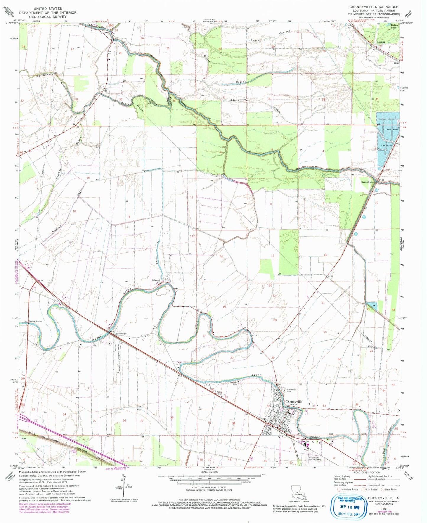
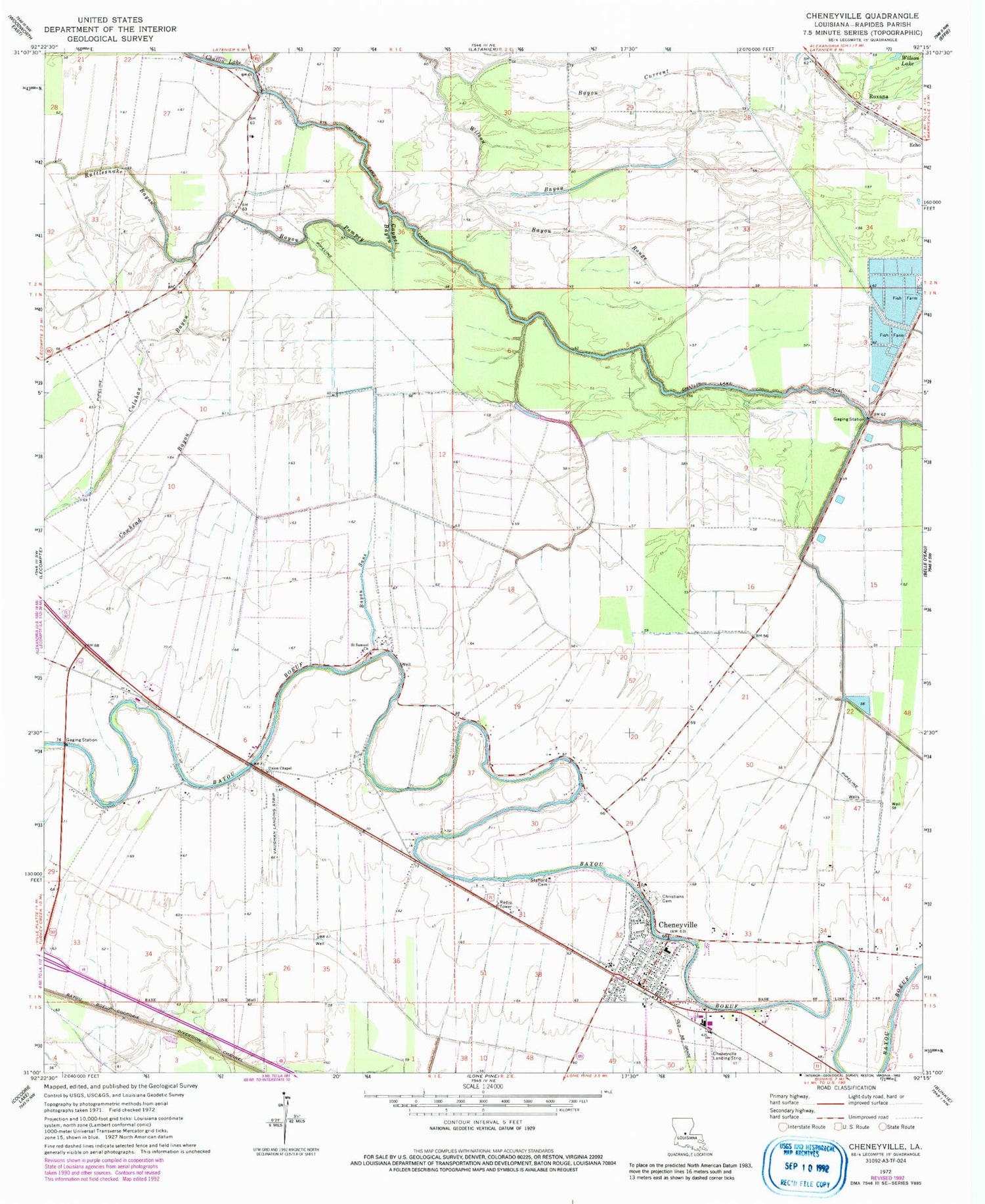
Classic USGS Cheneyville Louisiana 7.5'x7.5' Topo Map
Couldn't load pickup availability
Historical USGS topographic quad map of Cheneyville in the state of Louisiana. Map scale may vary for some years, but is generally around 1:24,000. Print size is approximately 24" x 27"
This quadrangle is in the following counties: Rapides.
The map contains contour lines, roads, rivers, towns, and lakes. Printed on high-quality waterproof paper with UV fade-resistant inks, and shipped rolled.
Contains the following named places: Bayou Current, Bayou De Scott, Bayou Pompey, Bayou Rouge, Bayou Sans, Beulah Baptist Church, Bird Pond, Calahan Bayou, Cappel Bayou, Cheneyville, Cheneyville Landing Strip, Cheneyville Post Office, Christians Cemetery, Cowhead Bayou, Cross Bayou, Edgefield Baptist Church, First Christian Church, Fish Lake, KRBG-FM (Bunkie), Loyd, Lyles, Morgan Bayou, New Hope Plantation, Rapides Parish Fire District 12, Rattlesnake Bayou, Roxana, Saint Samuel Church, Second Edgefield Baptist Church, Stafford Cemetery, Town of Cheneyville, Union Chapel, Vaughan Landing Strip, Wilson Lake, Witchwood, Wytchwood Plantation, ZIP Code: 71346