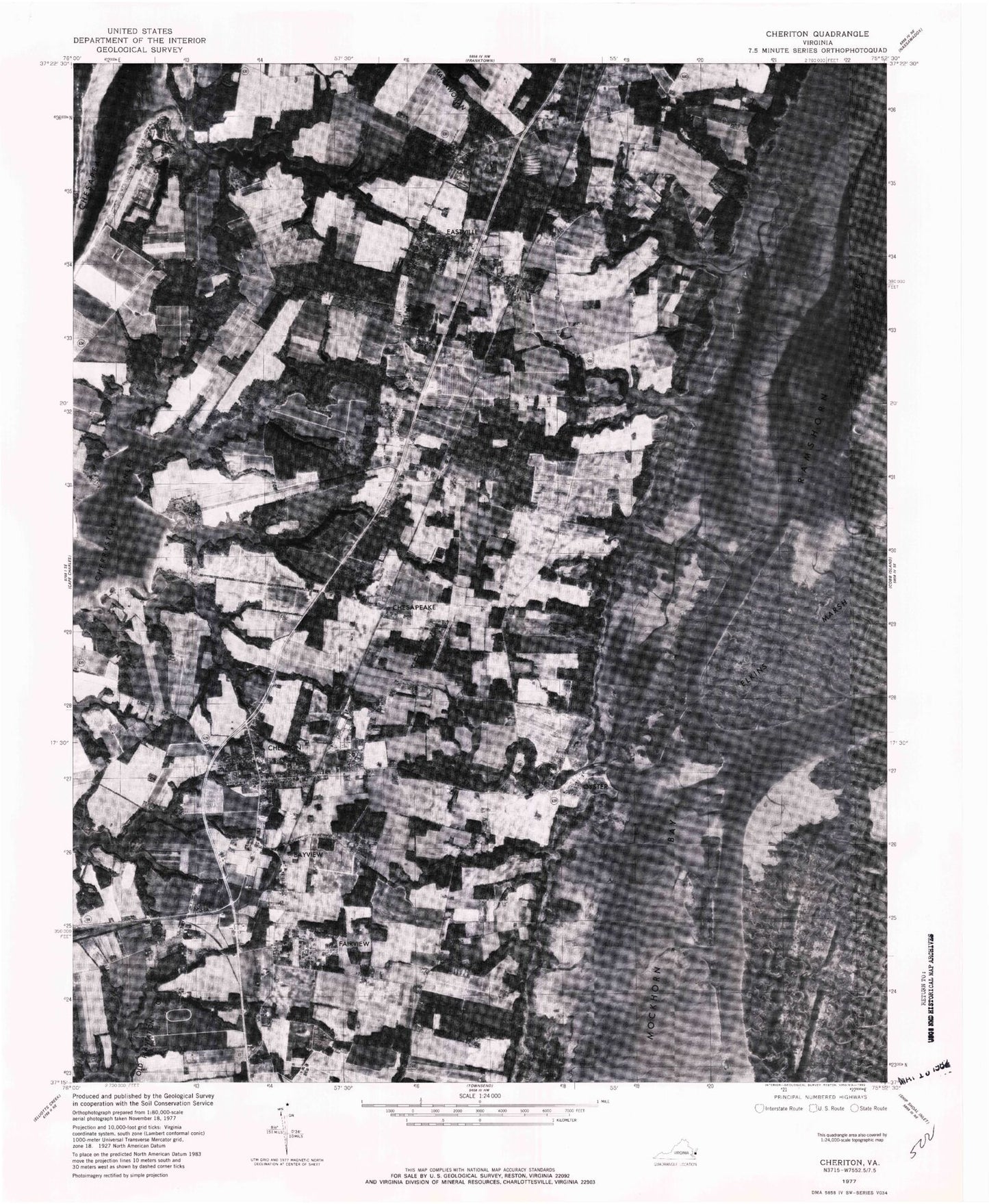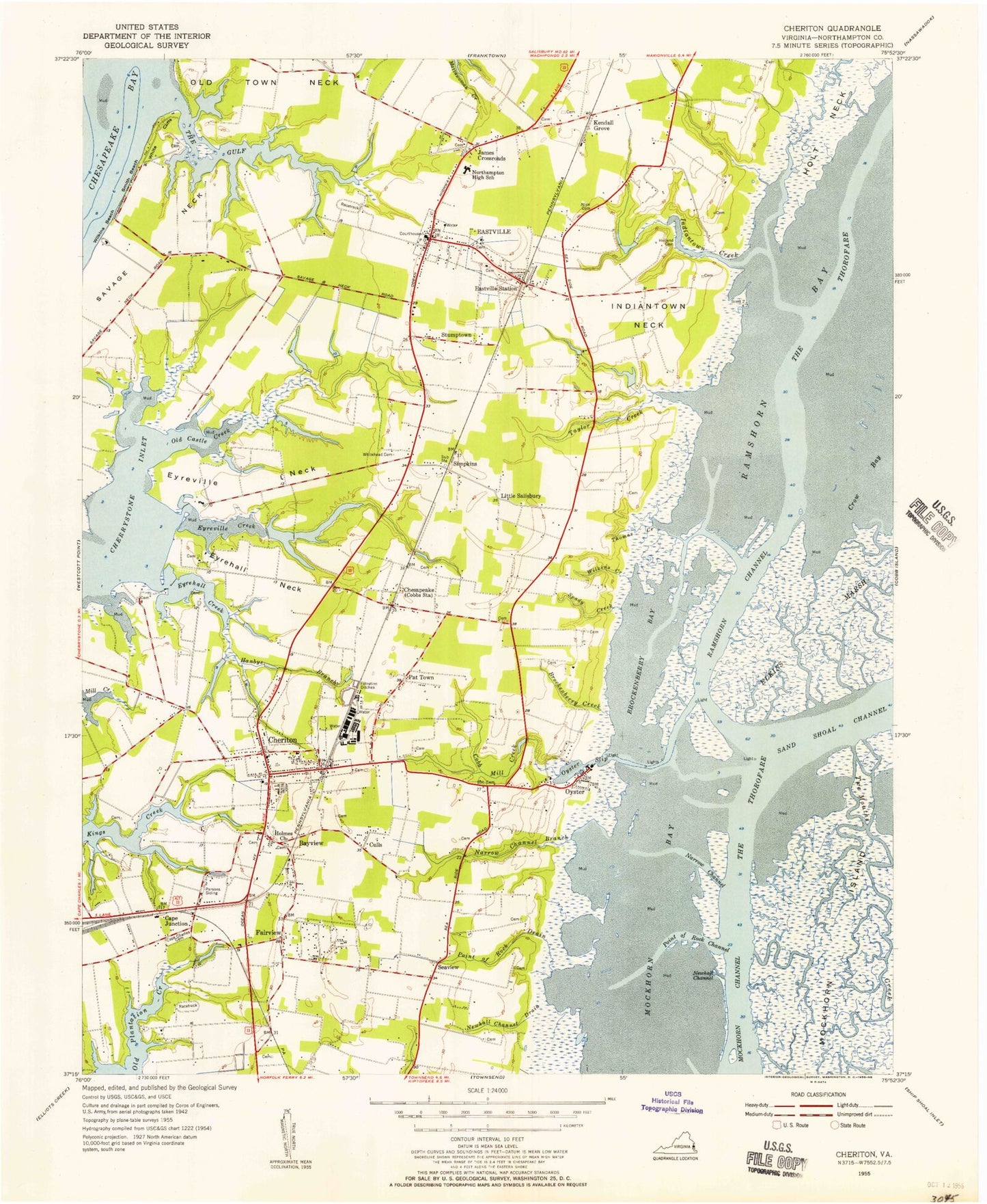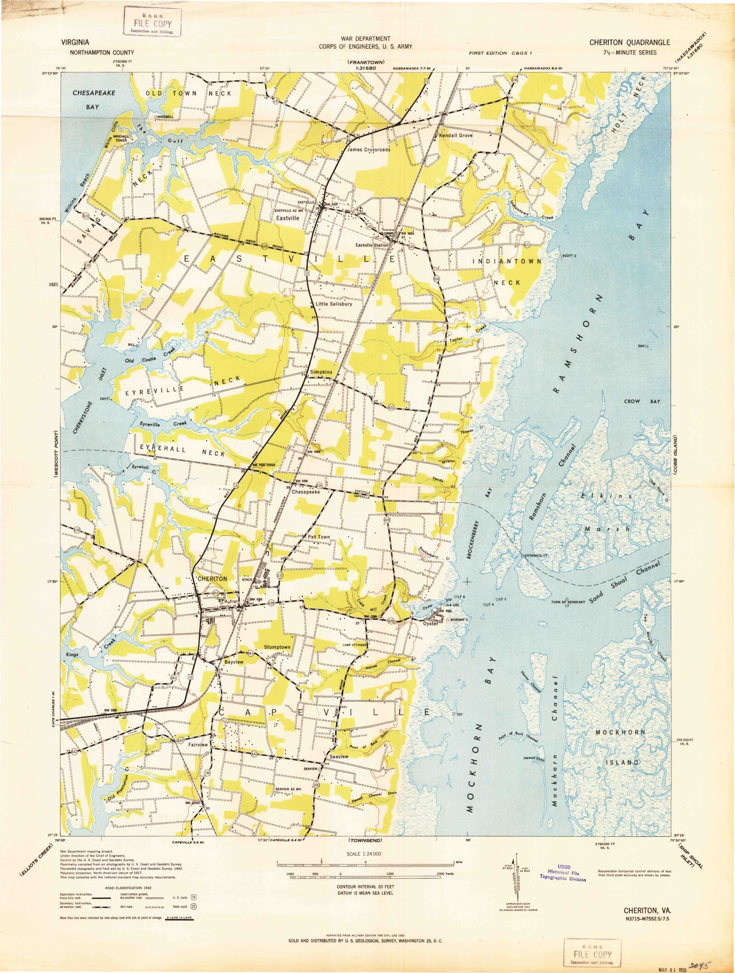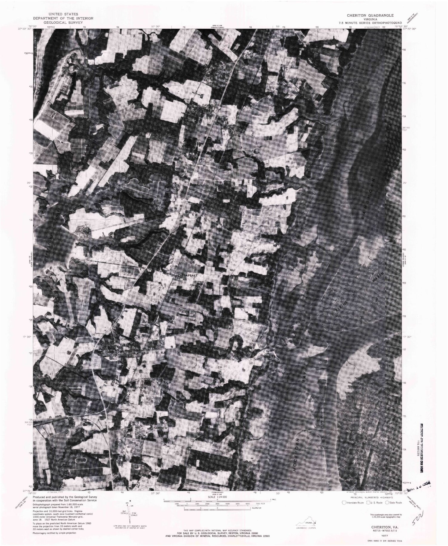
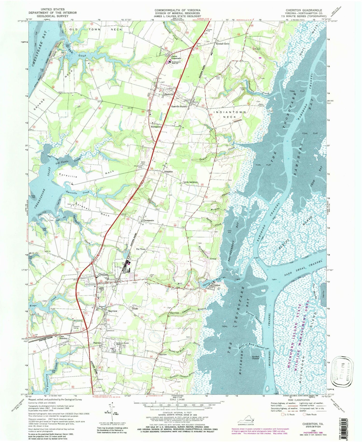
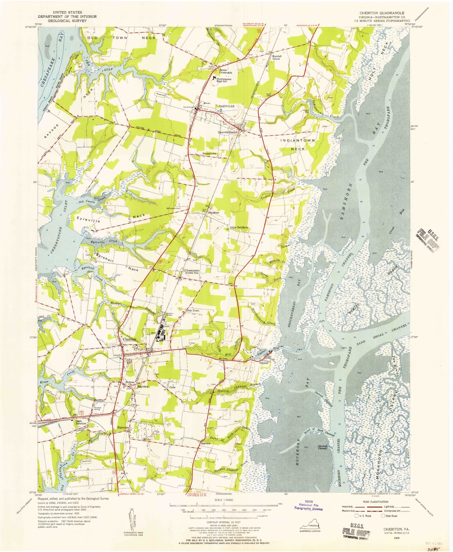

MyTopo
Classic USGS Cheriton Virginia 7.5'x7.5' Topo Map
Couldn't load pickup availability
Historical USGS topographic quad map of Cheriton in the state of Virginia. Map scale may vary for some years, but is generally around 1:24,000. Print size is approximately 24" x 27"
This quadrangle is in the following counties: Northampton.
The map contains contour lines, roads, rivers, towns, and lakes. Printed on high-quality waterproof paper with UV fade-resistant inks, and shipped rolled.
Contains the following named places: Allen Cemetery, Bayview, Bethlehem Temple Mission, Beverly, Brockenberry Bay, Brockenberry Creek, Cape Charles Cemetery, Cape Charles Rescue Service, Cape Junction, Cheriton, Cheriton Baptist Church, Cheriton Elementary School, Cheriton Methodist Church, Cheriton Post Office, Cheriton Volunteer Fire Department, Cherrystone Airport, Chesapeake, Chesapeake Post Office, Christ Episcopal Church, Cobb Mill Creek, Crow Bay, Culls, Eagles Nest Airport, Eastern Shore Lutheran Church, Eastern Shore Regional Jail, Eastville, Eastville Baptist Church, Eastville Post Office, Eastville Station, Eastville Volunteer Fire Company Station 17, Eyrehall Creek, Eyrehall Neck, Eyreville Creek, Eyreville Neck, Fairview, Faith Church, Holland Cemetery, Holmes Church, Holt Neck, Indiantown Creek, Indiantown Neck, Indiantown Recreation Park, James Crossroads, Jones Dam Number One, Jones Dam Number Two, Kellam Dam, Kellam Pond, Kendall Grove, Kendall Grove Estates, Kings Creek Landing, Kiptopeke Elementary School, Little Salisbury, Mears Field, Mears Pond, Mockhorn Bay, Mockhorn Island State Wildlife Management Area, Narrow Channel, Narrow Channel Branch, Newhall Channel, Newhall Channel Drain, Northampton County, Northampton County Courthouse, Northampton County Courthouse Historic District, Northampton County Landfill, Northampton County Sheriff's Office, Northampton High School, Nottingham, Old Castle Creek, Old Town Neck, Oyster, Oyster Post Office, Oyster Slip, Parsons Siding, Pat Town, Point of Rock Channel, Point of Rock Drain, Ramshorn Bay, Ramshorn Channel, Seaview, Seaview Post Office, Simpkins, Smith Beach, Smith Dam, Smith Pond, Spady Creek, Stumptown, Taylor Creek, The Gulf, The Meadows, Thomas Creek, Town of Cheriton, Town of Eastville, Twin Cedars Farms, Union Church, White Cliffs, Whitehead Cemetery, Wilkins Beach, Wilkins Creek, ZIP Codes: 23310, 23316, 23347