MyTopo
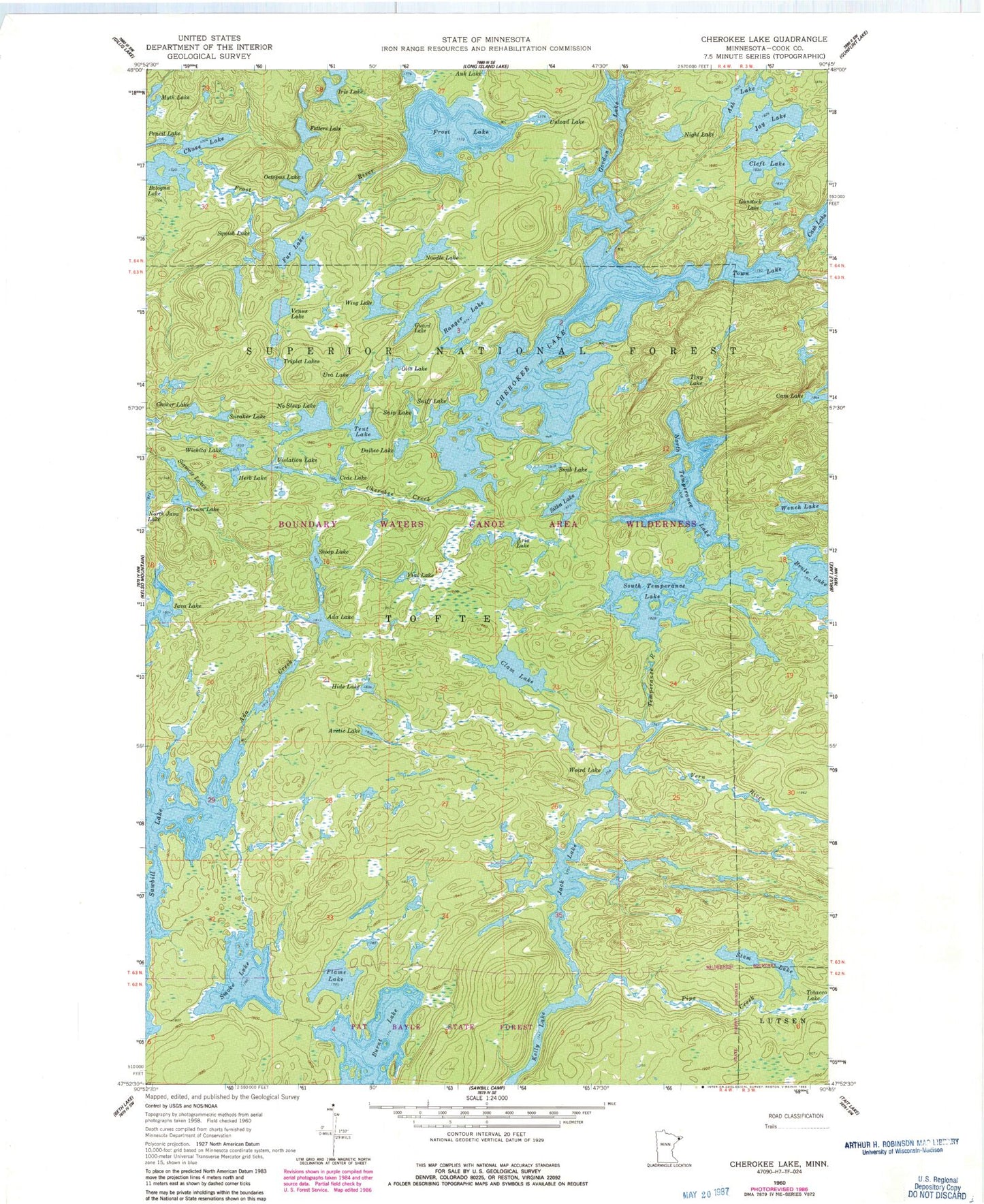
Classic USGS Cherokee Lake Minnesota 7.5'x7.5' Topo Map
Couldn't load pickup availability
Historical USGS topographic quad map of Cherokee Lake in the state of Minnesota. Typical map scale is 1:24,000, but may vary for certain years, if available. Print size: 24" x 27"
This quadrangle is in the following counties: Cook.
The map contains contour lines, roads, rivers, towns, and lakes. Printed on high-quality waterproof paper with UV fade-resistant inks, and shipped rolled.
Contains the following named places: Ada Creek, Ada Lake, Arctic Lake, Aria Lake, Ash Lake, Bologna Lake, Burnt Lake, Cede Lake, Chase Lake, Cherokee Creek, Cherokee Lake, Choker Lake, Clam Lake, Cleft Lake, Cream Lake, Dalbec Lake, Fetters Lake, Flame Lake, Frost Lake, Fur Lake, Gordon Lake, Guard Lake, Gunstock Lake, Herb Lake, Hide Lake, Iris Lake, Jack Lake, Java Lake, Jay Lake, Myth Lake, Night Lake, No Sleep Lake, Noodle Lake, North Temperance Lake, Octopus Lake, Olio Lake, Pipe Creek, Ranger Lake, Siamese Lakes, Sitka Lake, Smoke Lake, Sneaker Lake, Sniff Lake, Snip Lake, Snub Lake, South Temperance Lake, Squish Lake, Stem Lake, Tent Lake, Tiny Lake, Town Lake, Triplet Lakes, Unload Lake, Uva Lake, Venus Lake, Vern River, Vigl Lake, Violation Lake, Weird Lake, Wench Lake, Wichita Lake, Wing Lake, Skoop Lake