MyTopo
Classic USGS Cherokee Point Arizona 7.5'x7.5' Topo Map
Regular price
$16.95
Regular price
Sale price
$16.95
Unit price
per
Couldn't load pickup availability
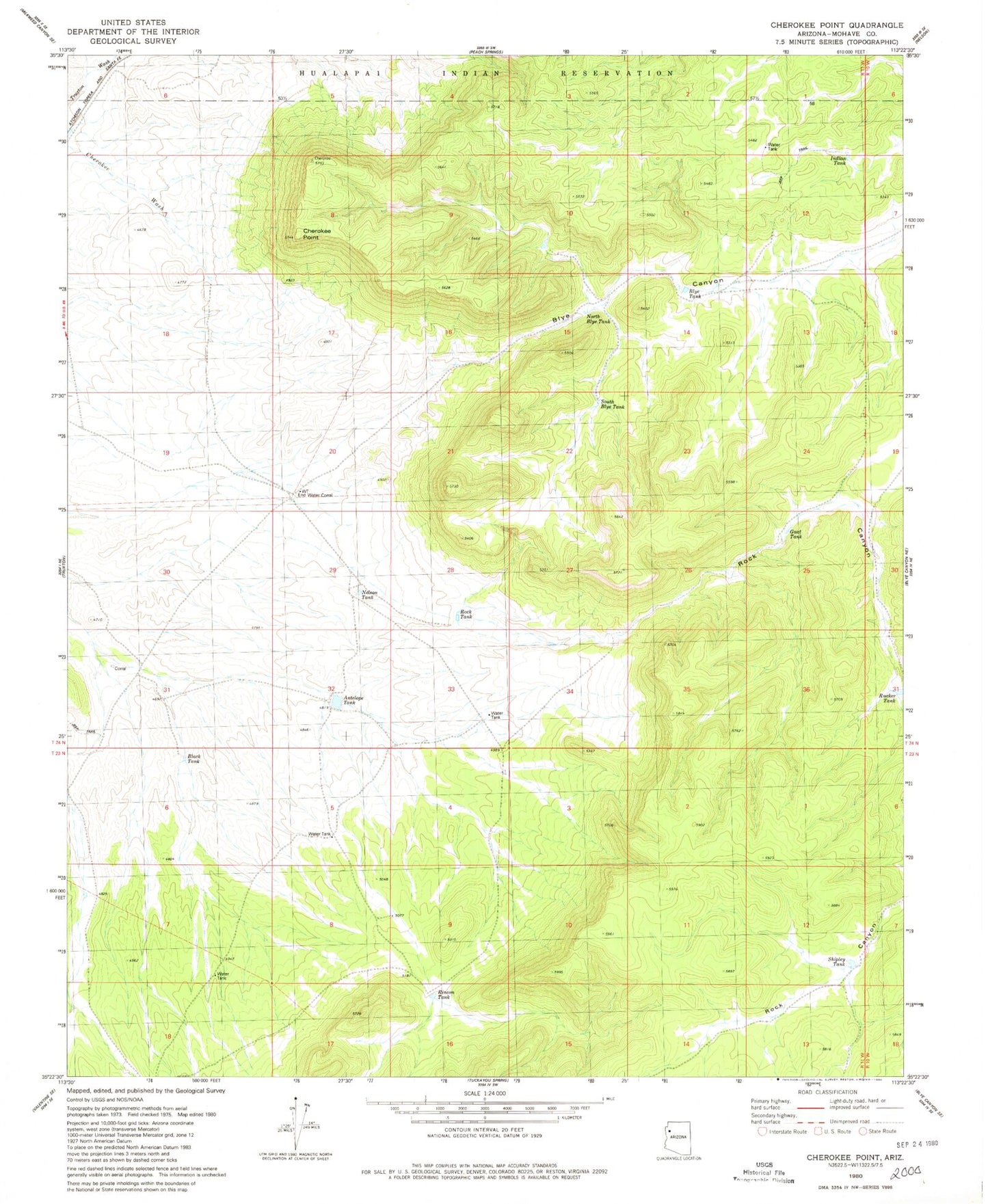
Historical USGS topographic quad map of Cherokee Point in the state of Arizona. Map scale may vary for some years, but is generally around 1:24,000. Print size is approximately 24" x 27"
This quadrangle is in the following counties: Mohave.
The map contains contour lines, roads, rivers, towns, and lakes. Printed on high-quality waterproof paper with UV fade-resistant inks, and shipped rolled.
Contains the following named places: Antelope Tank, Black Tank, Blye Canyon, Blye Tank, Cherokee Point, End Water Corral, Gnat Tank, Indian Tank, Nelson Tank, North Blye Tank, Rincon Tank, Rock Canyon, Rock Tank, Rucker Tank, Shipley Tank, South Blye Tank, Yampai Canyon