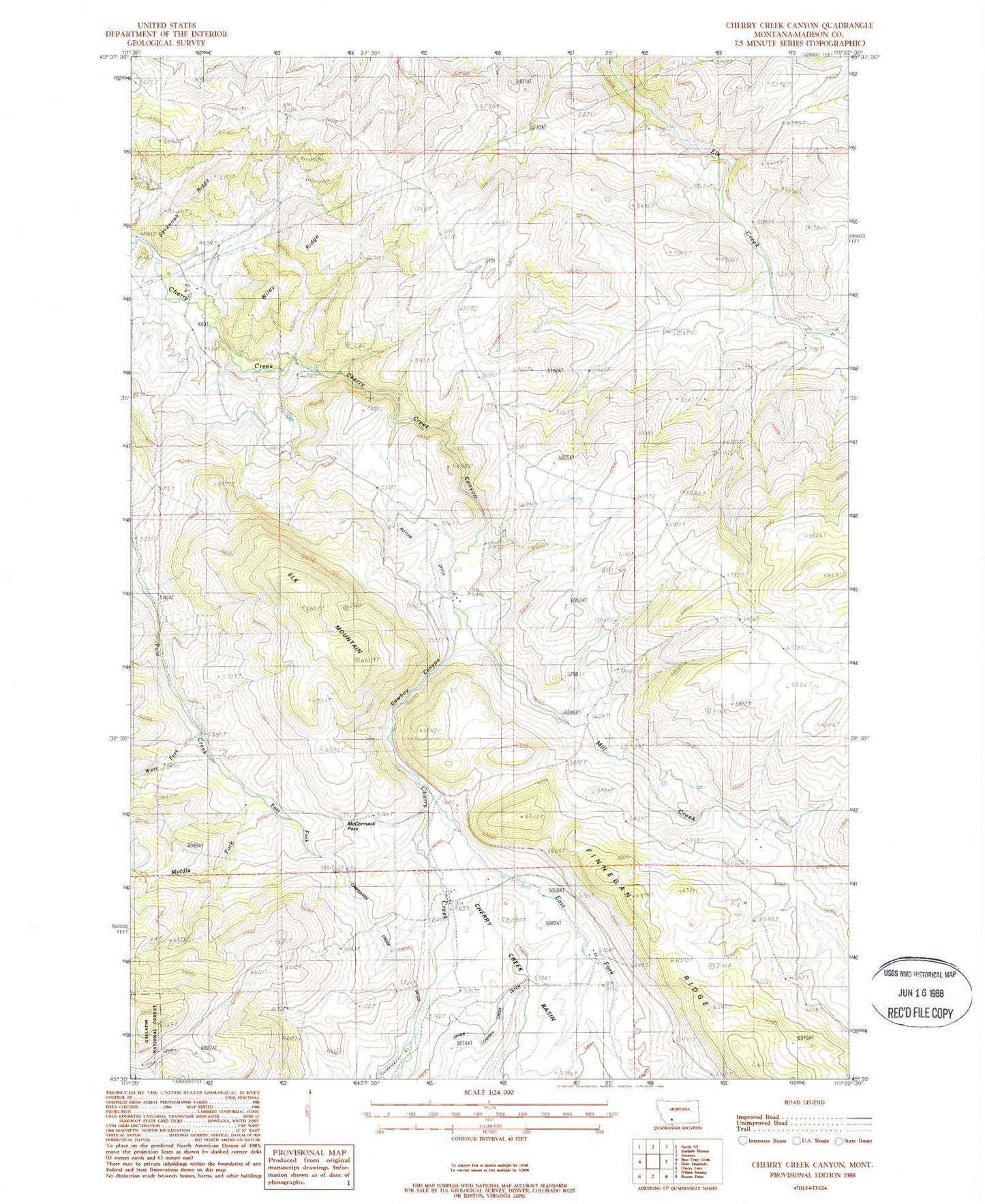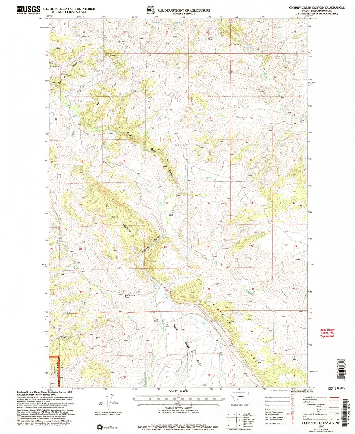

MyTopo
Classic USGS Cherry Creek Canyon Montana 7.5'x7.5' Topo Map
Couldn't load pickup availability
Historical USGS topographic quad map of Cherry Creek Canyon in the state of Montana. Map scale may vary for some years, but is generally around 1:24,000. Print size is approximately 24" x 27"
This quadrangle is in the following counties: Madison.
The map contains contour lines, roads, rivers, towns, and lakes. Printed on high-quality waterproof paper with UV fade-resistant inks, and shipped rolled.
Contains the following named places: Butler Ditch, Butler Ranch, Carpenter Creek, Carpenter Creek Ditch, Cherry Creek Basin, Cherry Creek Canyon, Cooper Mine, Cow Camp, Cowboy Canyon, East Fork Cherry Creek, East Fork Pole Creek, Elk Mountain, Finnegan Ridge, Havana, Havana Post Office, Home Ranch, Lower Ditch, McCormack Pass, Middle Fork Pole Creek, Mill Creek, Nome Ranch, Savannah Ridge, Turner Ranch Mine, Upper Cherry Creek Ditch, Upper Ditch, West Fork Pole Creek, Wiley Ridge