MyTopo
Classic USGS Cherry Creek New York 7.5'x7.5' Topo Map
Couldn't load pickup availability
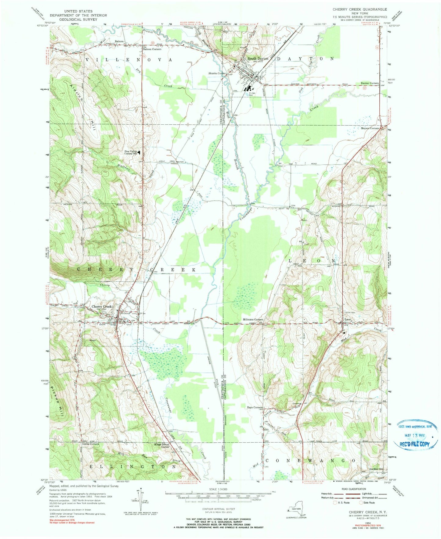
Historical USGS topographic quad map of Cherry Creek in the state of New York. Map scale may vary for some years, but is generally around 1:24,000. Print size is approximately 24" x 27"
This quadrangle is in the following counties: Cattaraugus, Chautauqua.
The map contains contour lines, roads, rivers, towns, and lakes. Printed on high-quality waterproof paper with UV fade-resistant inks, and shipped rolled.
Contains the following named places: Aldrich Hill, Balcom, Balcom Corners, Blaisdell Creek, Cherry Creek, Cherry Creek Assembly of God, Cherry Creek Census Designated Place, Cherry Creek Fire Department, Cherry Creek Leon United Methodist Church, Cherry Creek Mobile Home Park, Cherry Creek Post Office, Dexter Corners, Dry Creek, Free Methodist Church, Gardner School, Gates Corners, Highland Cemetery, Kings School Corner, Leon, Leon Fire Company 1 and Ambulance, Meyers Corners, Mill Run Brook, Millmans Corners, Nobles Farms, North Branch Conewango Creek, Pine Top Plantation, Pine Valley Central School, Rays Corners, Skunks Corner, Slab City Creek, South Dayton, South Dayton Airport, South Dayton Post Office, South Dayton Volunteer Fire Company 1, Town of Cherry Creek, Town of Leon, Union Cemetery, Village of Cherry Creek, Village of South Dayton, West Branch Conewango Creek, ZIP Code: 14726