
MyTopo
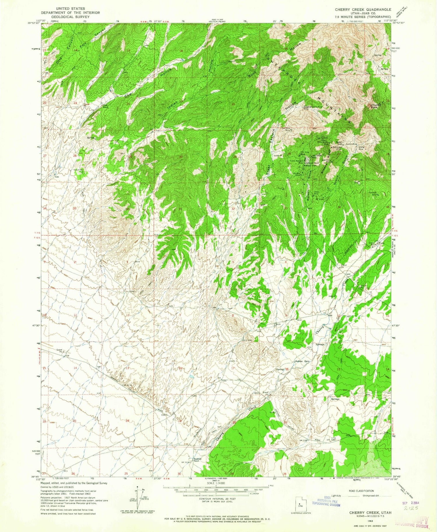
Classic USGS Cherry Creek Utah 7.5'x7.5' Topo Map
Couldn't load pickup availability
Historical USGS topographic quad map of Cherry Creek in the state of Utah. Map scale may vary for some years, but is generally around 1:24,000. Print size is approximately 24" x 27"
This quadrangle is in the following counties: Juab.
The map contains contour lines, roads, rivers, towns, and lakes. Printed on high-quality waterproof paper with UV fade-resistant inks, and shipped rolled.
Contains the following named places: Allah Mine, Bates Gulch, Bates Shaft, Bonanza Mine, Browns Ridge, Buck Hollow, Cherry Creek, Chicken Rock, Clyde Ranch, Cow Hollow, Eighty-eight Shaft, Great Eastern Hollow, Great Western King Mine, Indian Hollow, Indian Springs, Iron King Mine, Jones Mine, Lead King Mine, Murphy Mine, Orient Mine, Oro Plata Mine, Otts Canyon, Pole Canyon, Pyramid Mine, Resurrection Mine, Rockwell Ranch, Scotia Gulch, Scotia Mine, Sullivan Shaft, Tintic Western Mine, Walker Shaft, War Eagle Mine


