MyTopo
Classic USGS Cherry Point North Carolina 7.5'x7.5' Topo Map
Couldn't load pickup availability
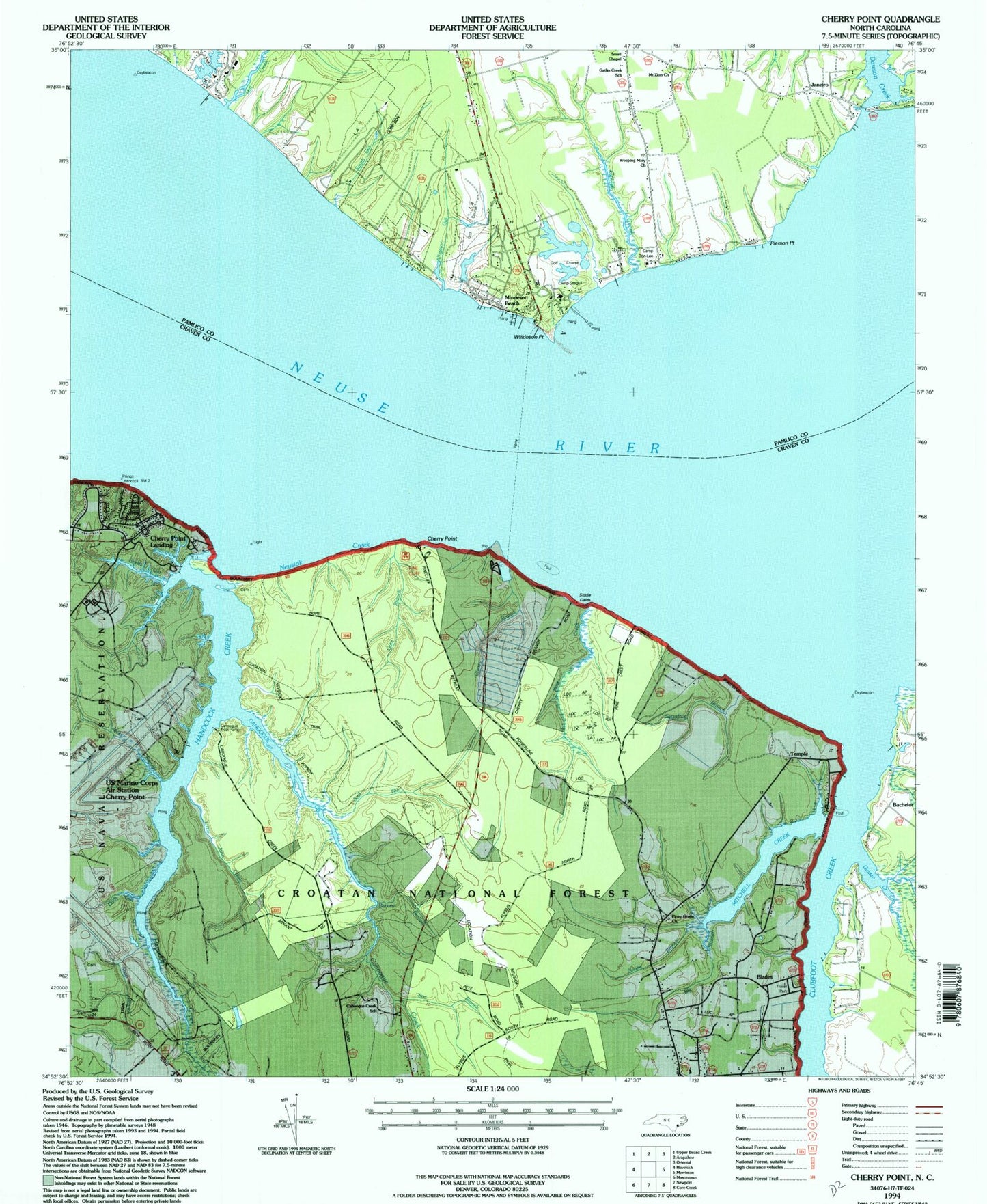
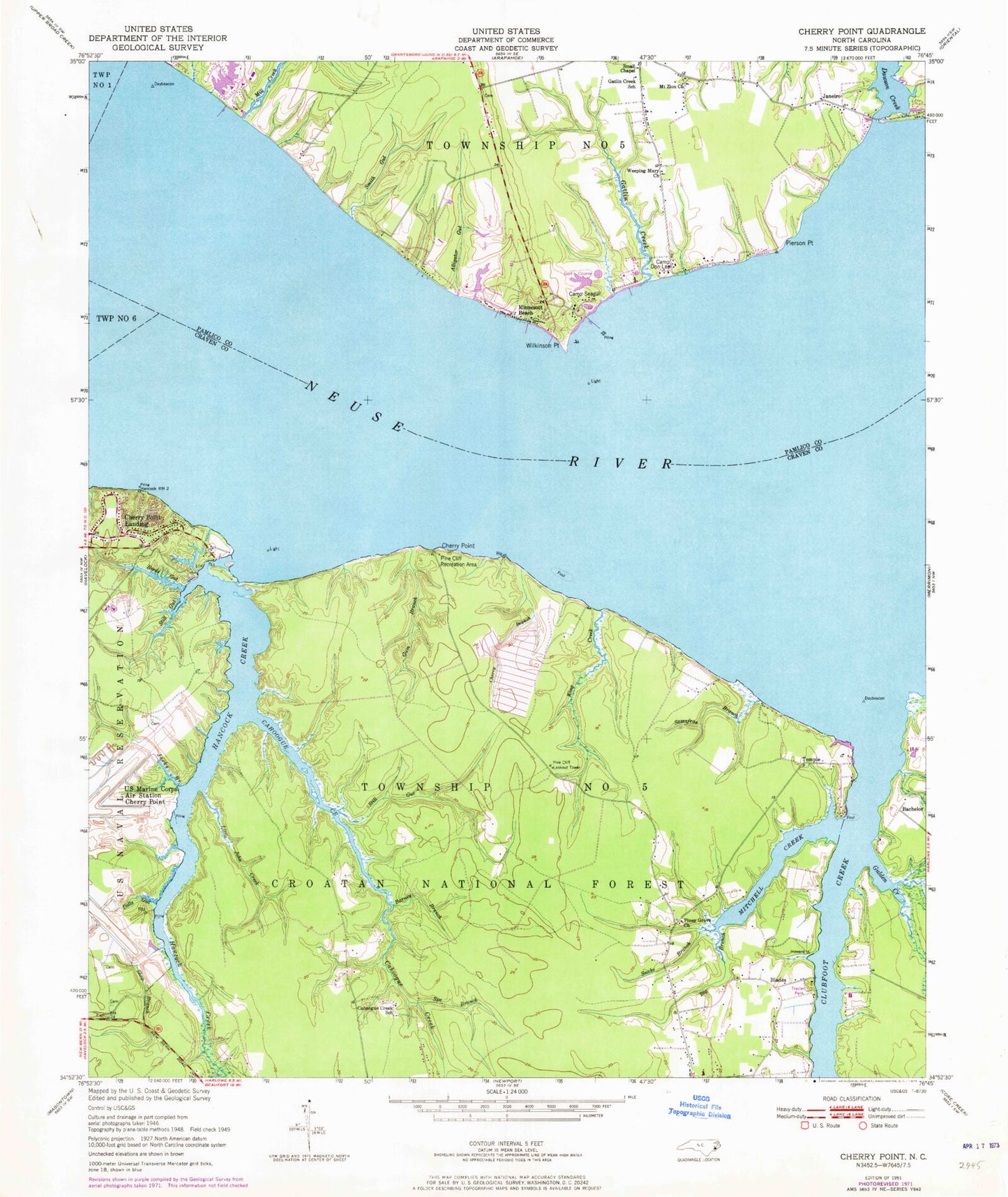
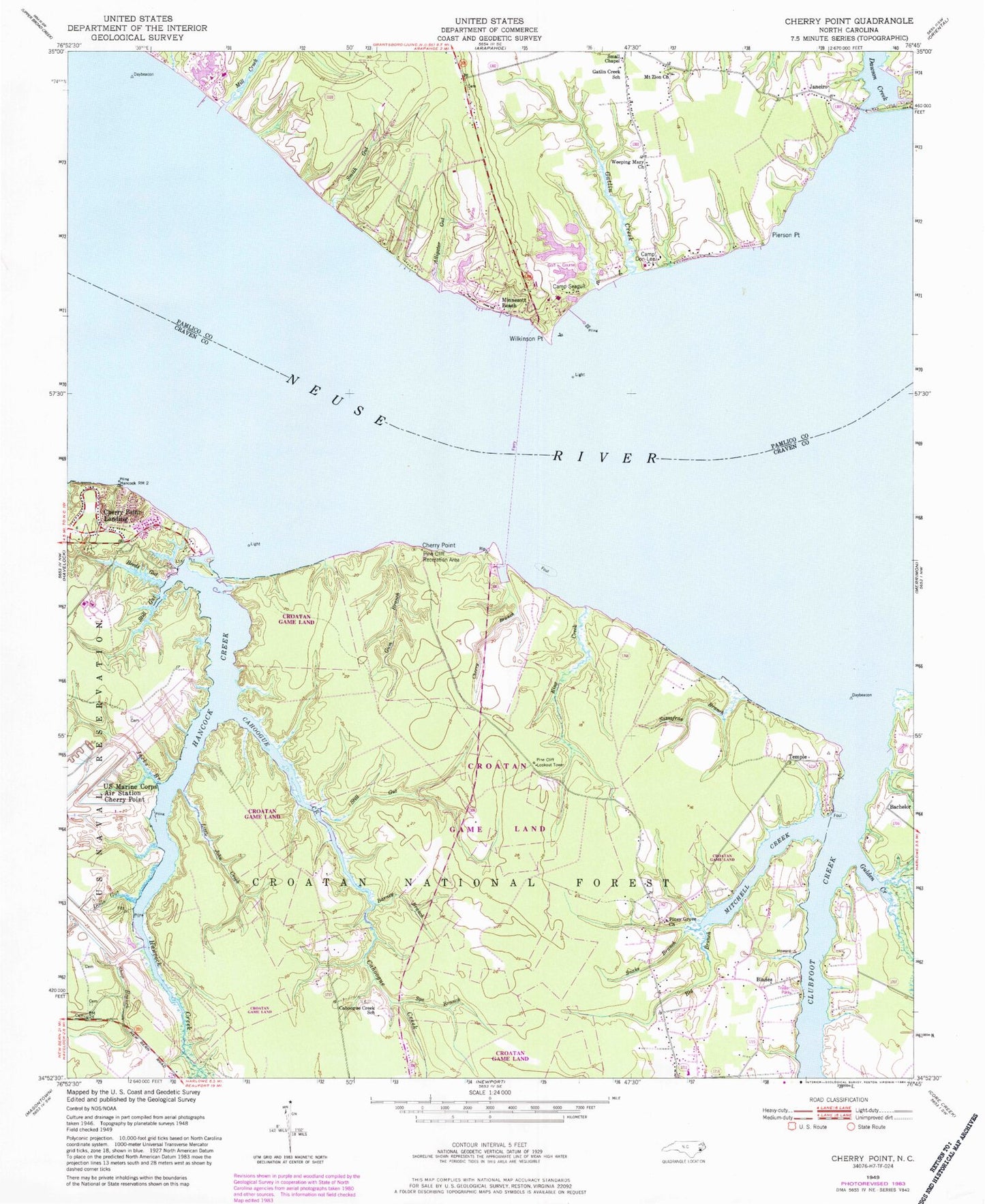
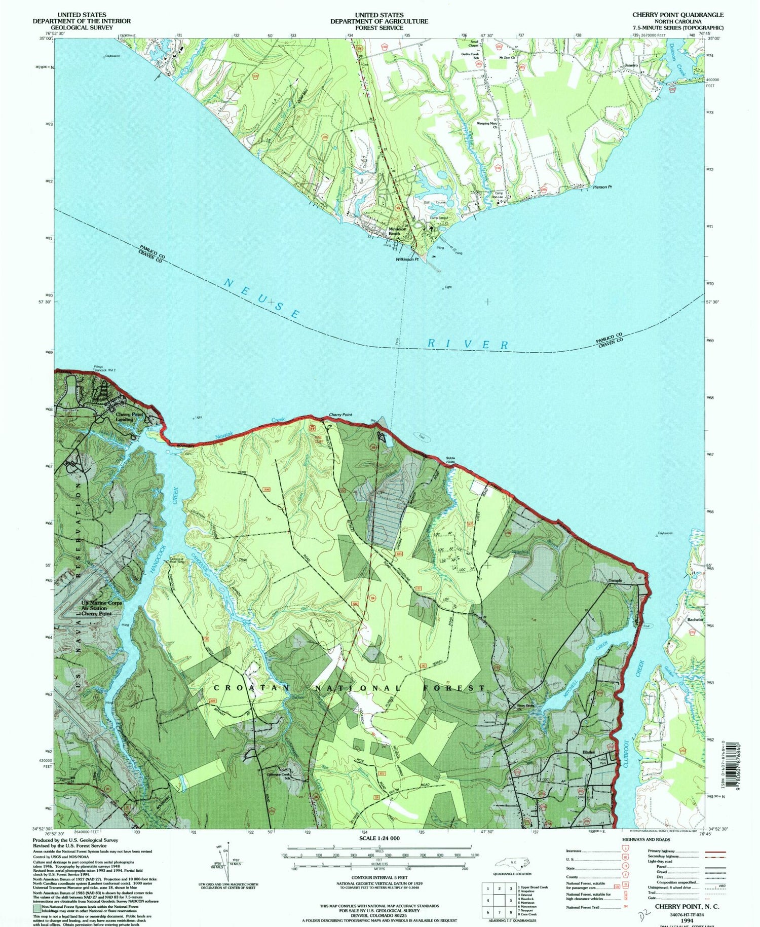
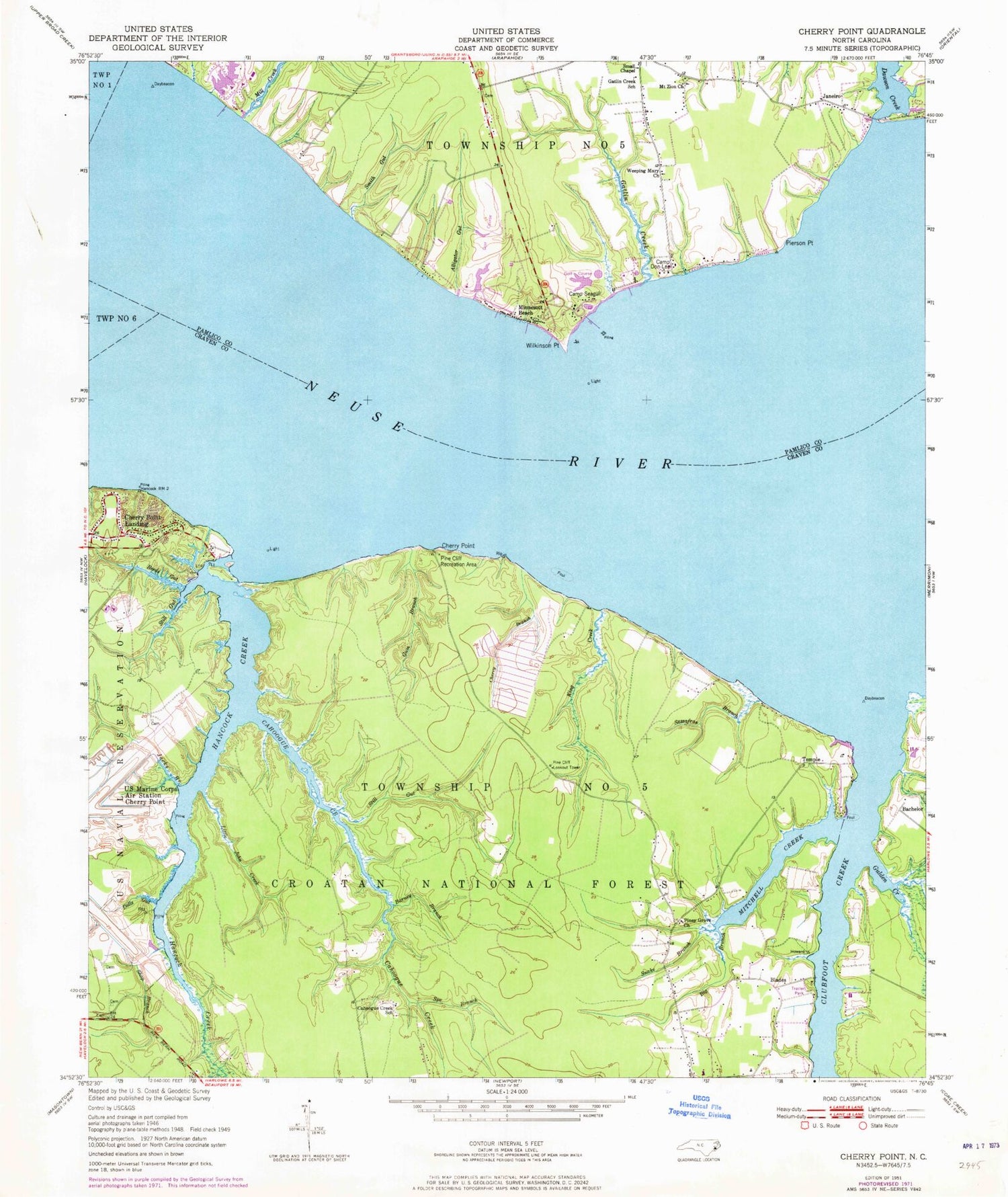
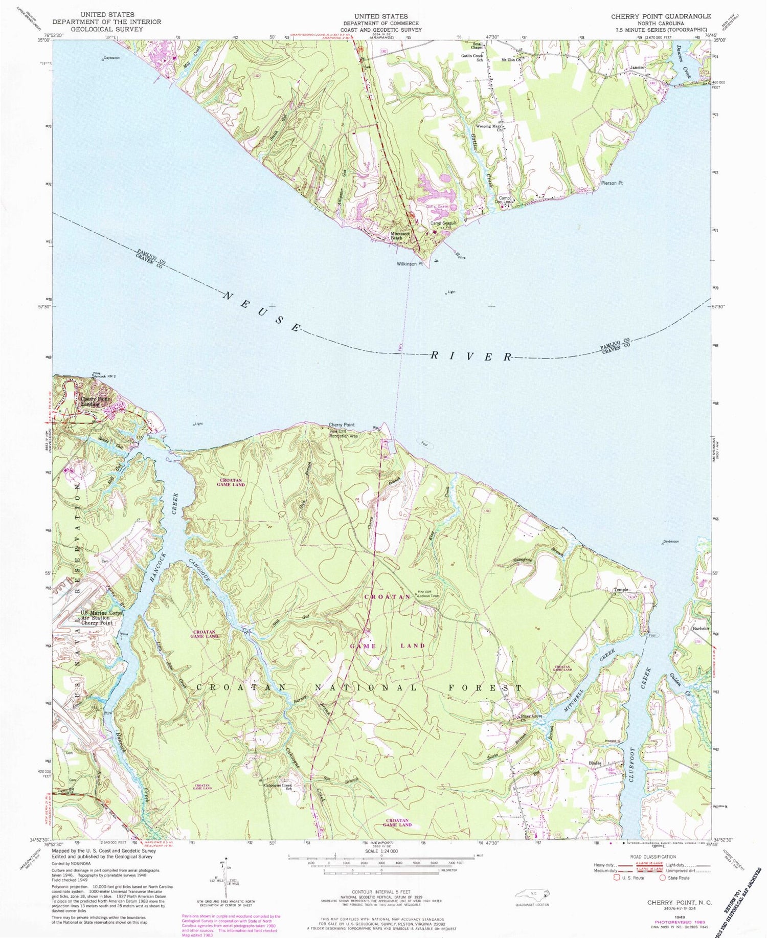
Historical USGS topographic quad map of Cherry Point in the state of North Carolina. Typical map scale is 1:24,000, but may vary for certain years, if available. Print size: 24" x 27"
This quadrangle is in the following counties: Craven, Pamlico.
The map contains contour lines, roads, rivers, towns, and lakes. Printed on high-quality waterproof paper with UV fade-resistant inks, and shipped rolled.
Contains the following named places: Still Gut, Cahooque Creek Recreation Site, Alligator Gut, Barney Branch, Big Branch, Cahoogue Creek, Cahoogue Creek School, Cherry Branch, Cherry Point, Clubfoot Creek, Dawson Creek, Deep Branch, Dolls Gut, Gatlin Creek, Gatlin Creek School, Gulden Creek, Gum Branch, Hancock Creek, Jacks Branch, King Creek, Little John Creek, Mill Creek, Mitchell Creek, Mount Zion Church, Pierson Point, Pine Cliff Recreation Area, Piney Grove Church, Reeds Gut, Sassafras Branch, Shop Branch, Small Chapel, Smith Gut, Snake Branch, Spe Branch, Still Gut, Temple, Weeping Mary Church, Wilkinson Point, Cahooque Creek Recreation Site, Bachelor, Blades, Camp Don-Lee, Camp Seagull, Janeiro, Minnesott Beach, Pine Cliff Lookout Tower, Township 5, Cherry Point Landing (historical), Cherry Point (historical), Cherry Point Landing (historical), Town of Minnesott Beach, Club Creek Mobile Home Park, Harlowe Volunteer Fire Department Station 3, Cherry Branch Census Designated Place, Still Gut, Cahooque Creek Recreation Site, Alligator Gut, Barney Branch, Big Branch, Cahoogue Creek, Cahoogue Creek School, Cherry Branch, Cherry Point, Clubfoot Creek, Dawson Creek, Deep Branch, Dolls Gut, Gatlin Creek, Gatlin Creek School, Gulden Creek, Gum Branch, Hancock Creek, Jacks Branch, King Creek, Little John Creek, Mill Creek, Mitchell Creek, Mount Zion Church, Pierson Point, Pine Cliff Recreation Area, Piney Grove Church, Reeds Gut, Sassafras Branch, Shop Branch, Small Chapel, Smith Gut, Snake Branch, Spe Branch, Still Gut, Temple, Weeping Mary Church, Wilkinson Point, Cahooque Creek Recreation Site, Bachelor, Blades, Camp Don-Lee, Camp Seagull, Janeiro, Minnesott Beach, Pine Cliff Lookout Tower, Township 5, Cherry Point Landing (historical), Cherry Point (historical), Cherry Point Landing (historical), Town of Minnesott Beach, Club Creek Mobile Home Park, Harlowe Volunteer Fire Department Station 3, Cherry Branch Census Designated Place
