
MyTopo
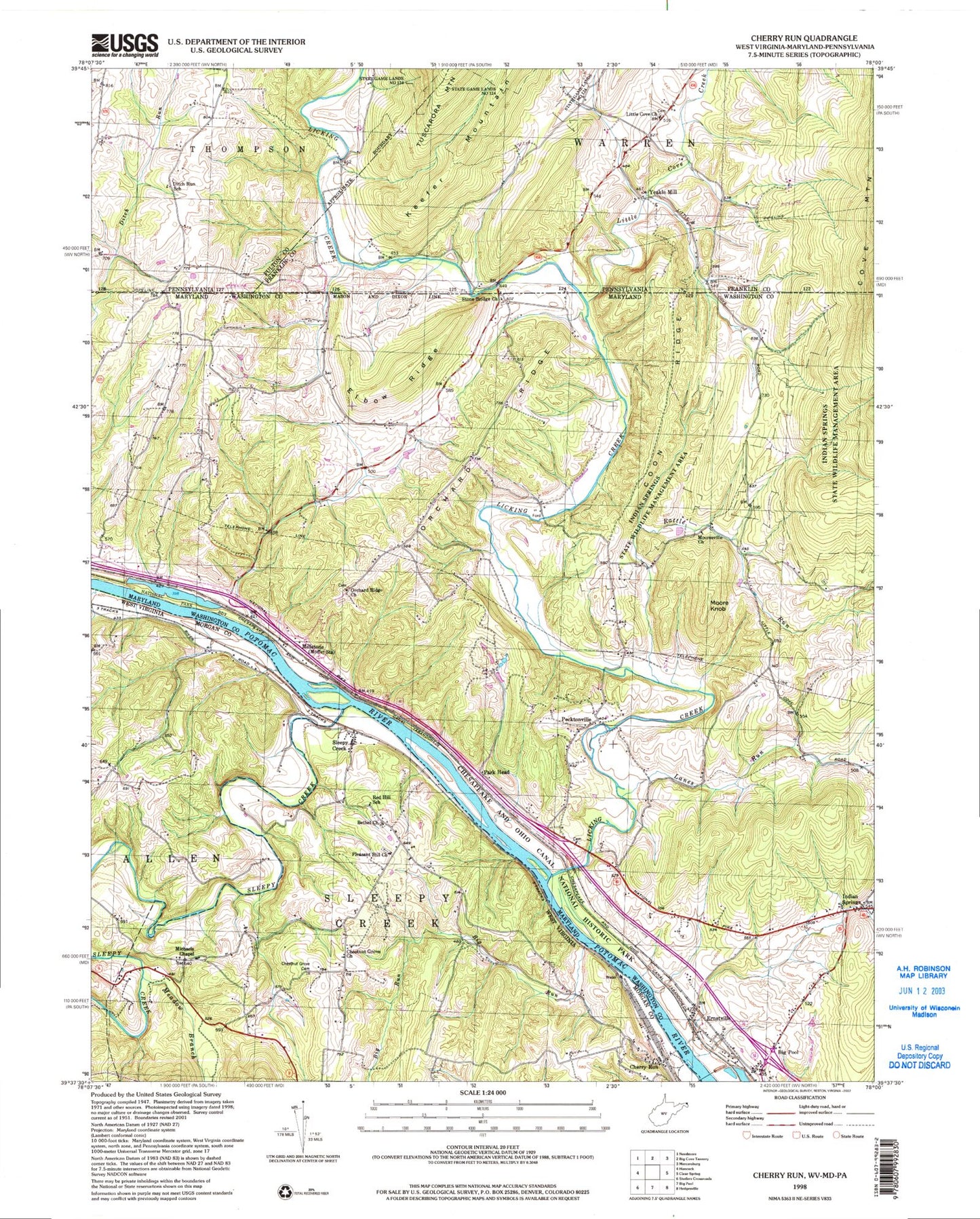
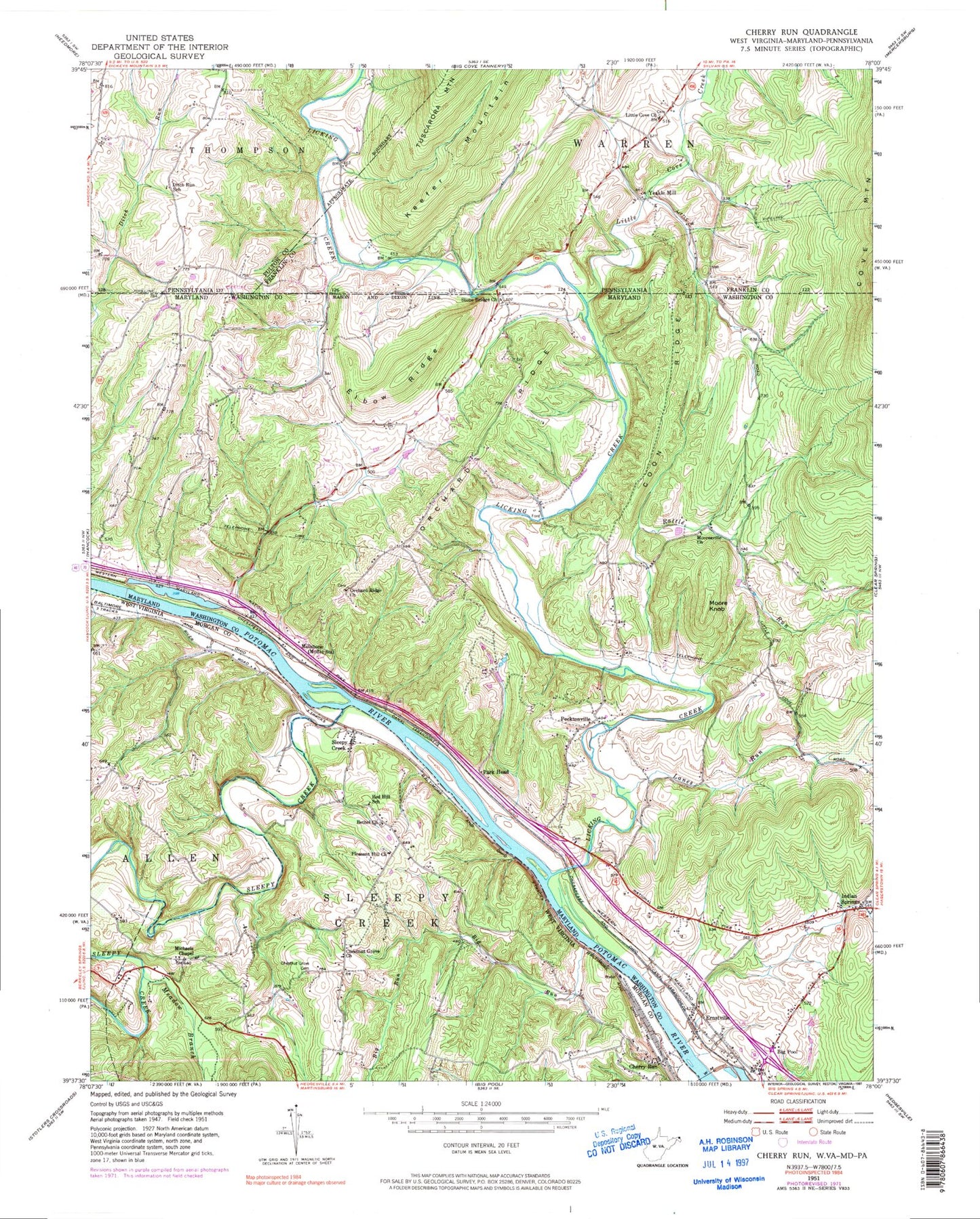
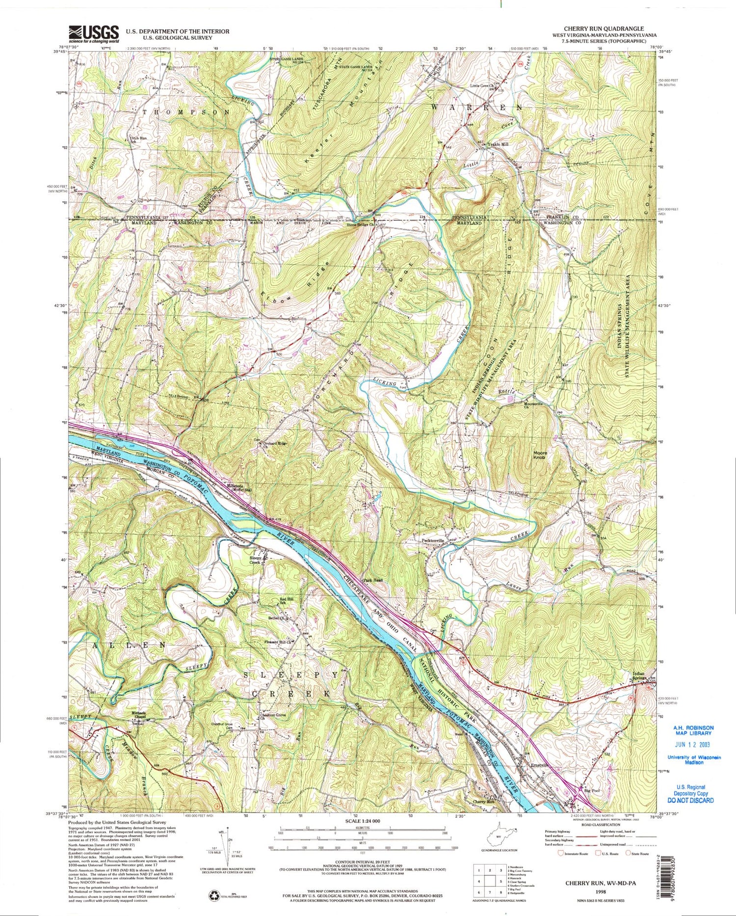
Classic USGS Cherry Run West Virginia 7.5'x7.5' Topo Map
Couldn't load pickup availability
Historical USGS topographic quad map of Cherry Run in the states of West Virginia, Pennsylvania, Maryland. Typical map scale is 1:24,000, but may vary for certain years, if available. Print size: 24" x 27"
This quadrangle is in the following counties: Franklin, Fulton, Morgan, Washington.
The map contains contour lines, roads, rivers, towns, and lakes. Printed on high-quality waterproof paper with UV fade-resistant inks, and shipped rolled.
Contains the following named places: Sleepy Creek, Bethel Church, Big Run, Chestnut Grove Cemetery, Chestnut Grove Church, Dugan Hollow, Meadow Branch, Michaels Chapel United Methodist Church, Pleasant Hill Church, Red Hill School (historical), Cherry Run, Sleepy Creek, Cherry Run School (historical), First United Brethren Church, Michael Farm Spring, Mount Trimble, Mount Trimble School (historical), Bethel Cemetery, Pleasant Hill Cemetery, Sleepy Creek Post Office, Spohr's Crossroads Bridge, Coon Ridge, Ditch Run School, Little Cove Church, Yeakle Mill, Warrens Point, Rabble Run, Elbow Ridge, Indian Springs, Lanes Run, Licking Creek, Millstone, Mooresville Church, Orchard Ridge, Orchard Ridge Methodist Church, Pecktonville, Stone Bridge Church, Ernstville, Moore Knob, Park Head, Little Cove Creek, Camp Harding, Golden Fleece Estates, Indian Springs Wildlife Management Area, Licking Creek Aqueduct, Little Pool, Little Pool Campground, Marvania Heights, Mountain Vistas, Orchard Ridge Cemetery, Park Head Cemetery, Parkhead Station (historical), Parkhead United Methodist Church, Saint Paul United Methodist Church, Stone Bridge Cemetery, District 15 Indian Spring, Big Pool Census Designated Place, Ernstville Census Designated Place, Indian Springs Census Designated Place, Pecktonville Census Designated Place