
MyTopo
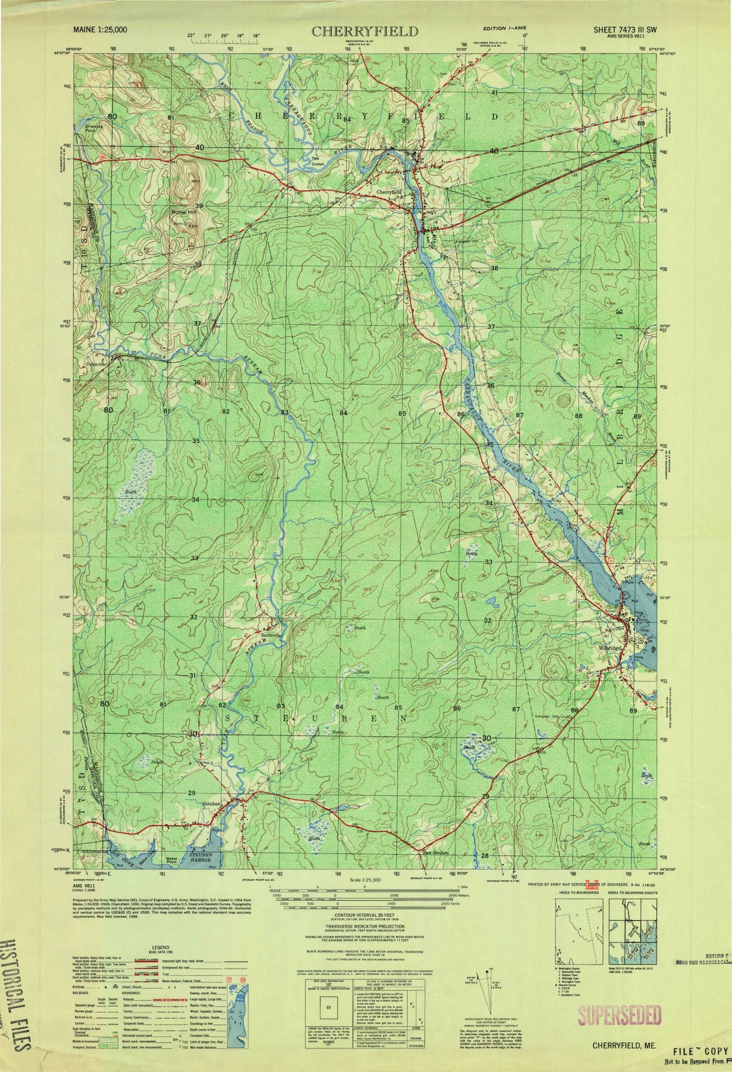
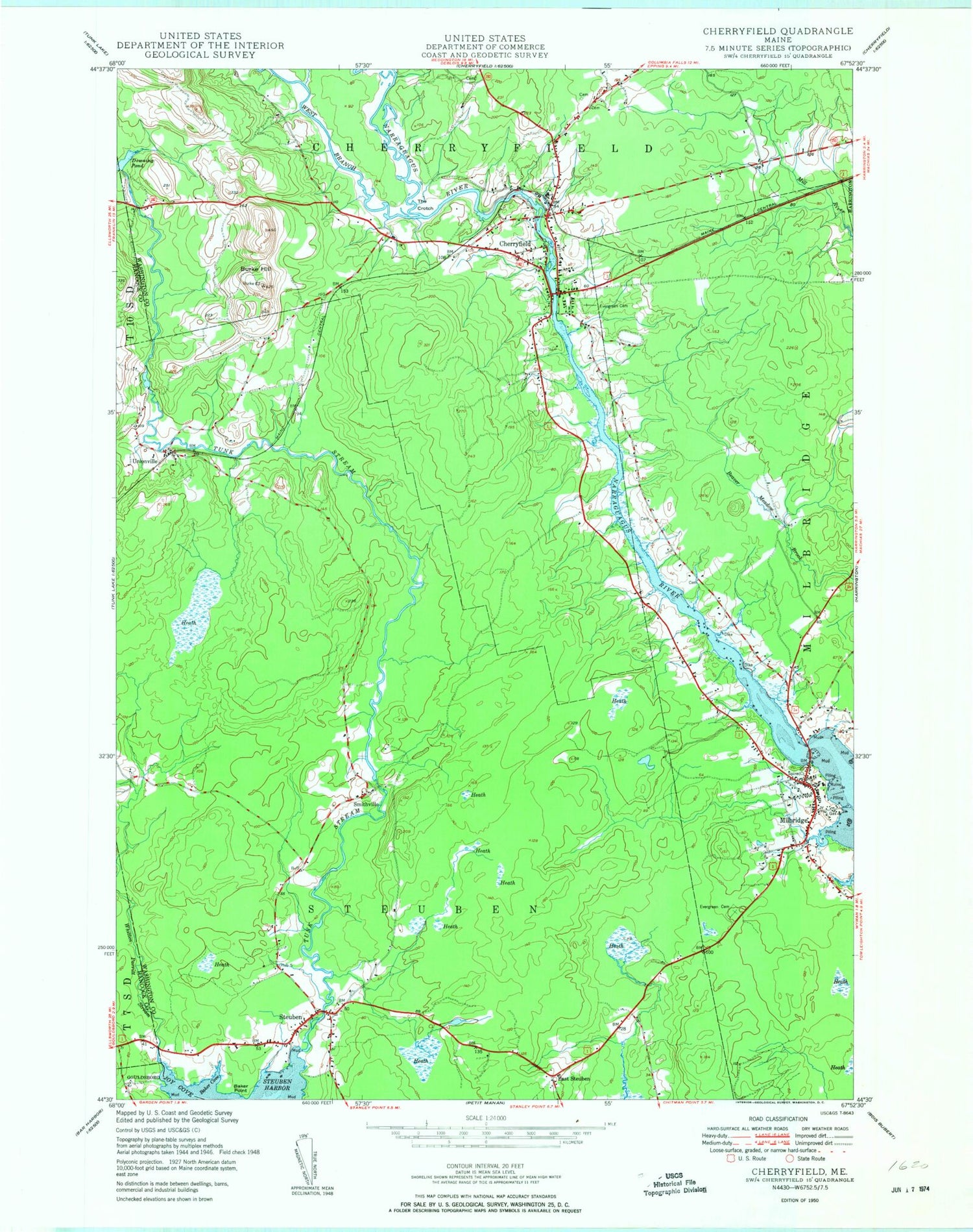
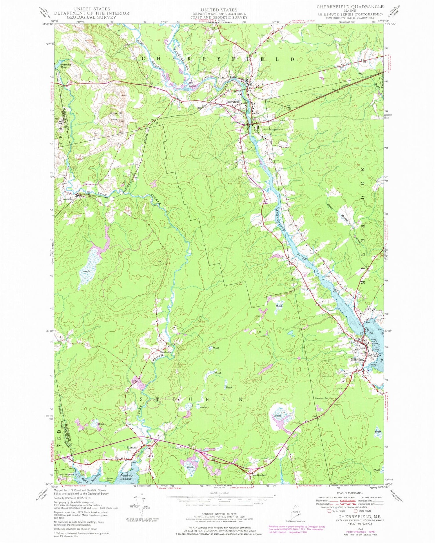
Classic USGS Cherryfield Maine 7.5'x7.5' Topo Map
Couldn't load pickup availability
Historical USGS topographic quad map of Cherryfield in the state of Maine. Map scale may vary for some years, but is generally around 1:24,000. Print size is approximately 24" x 27"
This quadrangle is in the following counties: Hancock, Washington.
The map contains contour lines, roads, rivers, towns, and lakes. Printed on high-quality waterproof paper with UV fade-resistant inks, and shipped rolled.
Contains the following named places: Baker Cove, Baker Point, Burke Hill, Cherryfield, Cherryfield Academy, Cherryfield Ambulance Service, Cherryfield Dam, Cherryfield Elementary School, Cherryfield Historic District, Cherryfield Post Office, Cherryfield Public Library, Cherryfield Volunteer Fire Department, Cherryfield-Narraguagus Historical Society, Downing Pond, East Steuben, East Steuben Dam, East Steuben Pond, Ella Lewis School, Evergreen Cemetery, Henry D Moore Library, Mahanon Branch, Mainayr Campground, Milbridge, Milbridge Census Designated Place, Milbridge Elementary School, Milbridge Heliport, Milbridge Police Department, Milbridge Post Office, Milbridge Public Library, Milbridge Volunteer Fire Department, Milbridge Volunteer Rescue, Narraguagus Airport, Narraguagus River Reservoir, Petit Manan Ambulance Milbridge, Smithville, Steuben, Steuben Harbor, Steuben Post Office, Steuben Volunteer Fire Department, The Crotch, Tunk Stream, Unionville, West Branch Narraguagus River, Whitten Parritt Stream, WRMO-FM (Milbridge), ZIP Code: 04658


