MyTopo
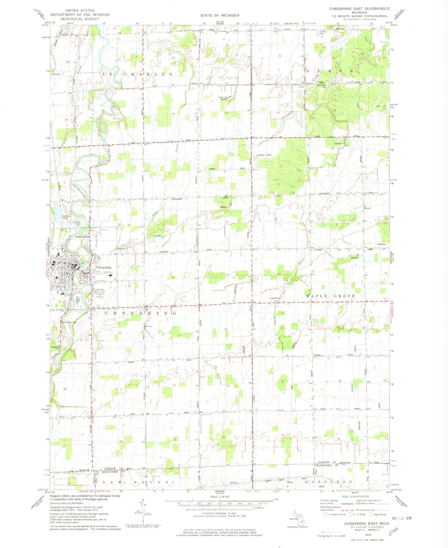
Classic USGS Chesaning East Michigan 7.5'x7.5' Topo Map
Couldn't load pickup availability
Historical USGS topographic quad map of Chesaning East in the state of Michigan. Map scale may vary for some years, but is generally around 1:24,000. Print size is approximately 24" x 27"
This quadrangle is in the following counties: Saginaw, Shiawassee.
The map contains contour lines, roads, rivers, towns, and lakes. Printed on high-quality waterproof paper with UV fade-resistant inks, and shipped rolled.
Contains the following named places: Adams Drain, Albert Drain, Big Rock Elementary School, Chesaning, Chesaning Area Historical Museum, Chesaning Church of Christ, Chesaning Family Medicine, Chesaning Nursing Care Center, Chesaning Police Department, Chesaning Post Office, Chesaning Public Library, Chesaning Station, Church of the Nazarene, Cole Park, George Nason House Historical Marker, Leamington Stewart House Historical Marker, Luce, Luce Post Office, Maple Grove Airpark, Mobile Medical Response Chesaning, Mount Calvary Cemetery, New Wine Full Gospel Church, North Ridge Cemetery, Orser Drain, Our Lady of Perpetual Help Church, Our Lady of Perpetual Help School, Richter Drain, Saint Mary Cemetery, Saint Mary's Clinic, Seventh Day Adventist Church, Showboat Park, Township of Chesaning, Village Baptist Church, Village of Chesaning, WAQP-TV (Saginaw), West Albee Cemetery, Wickham Drain, WJRT-TV (Flint), Woodside Airport, WSMH-TV (Flint), Zion Evangelical School, ZIP Code: 48616