
MyTopo
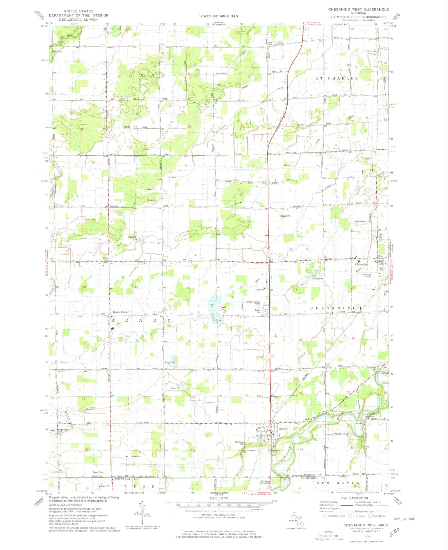
Classic USGS Chesaning West Michigan 7.5'x7.5' Topo Map
Couldn't load pickup availability
Historical USGS topographic quad map of Chesaning West in the state of Michigan. Map scale may vary for some years, but is generally around 1:24,000. Print size is approximately 24" x 27"
This quadrangle is in the following counties: Saginaw, Shiawassee.
The map contains contour lines, roads, rivers, towns, and lakes. Printed on high-quality waterproof paper with UV fade-resistant inks, and shipped rolled.
Contains the following named places: Brady Center, Brady Center Wesleyan Church, Brady Elementary School, Brady Post Office, Brown Fickies Drain, Chesaning Brady Fire Department Station 1, Chesaning Middle School, Chesaning Union High School, Christ Church, Dygert Drain, Francis Drain, Greens Drain, Griffus Cemetery, Groveton, Howard Nixon Memorial Airport, Kingdom Hall, Leutz Post Office, Mickles Creek, Oak Grove Cemetery, Oakley, Oakley Community Church, Oakley Post Office, Oakley Station, Oakley Village Hall, Parshallburg, Pine Grove County Park, Ridge Road Cemetery, Saginaw County Fairgrounds, Saint John's Lutheran Cemetery, Saint Michael Church, Saint Michael's Catholic Cemetery, Stoddard Mobile Court, Township of Brady, Trinity United Methodist Church, Twin Brook Golf Course, Village of Oakley, Wildwood Cemetery, ZIP Code: 48649


