MyTopo
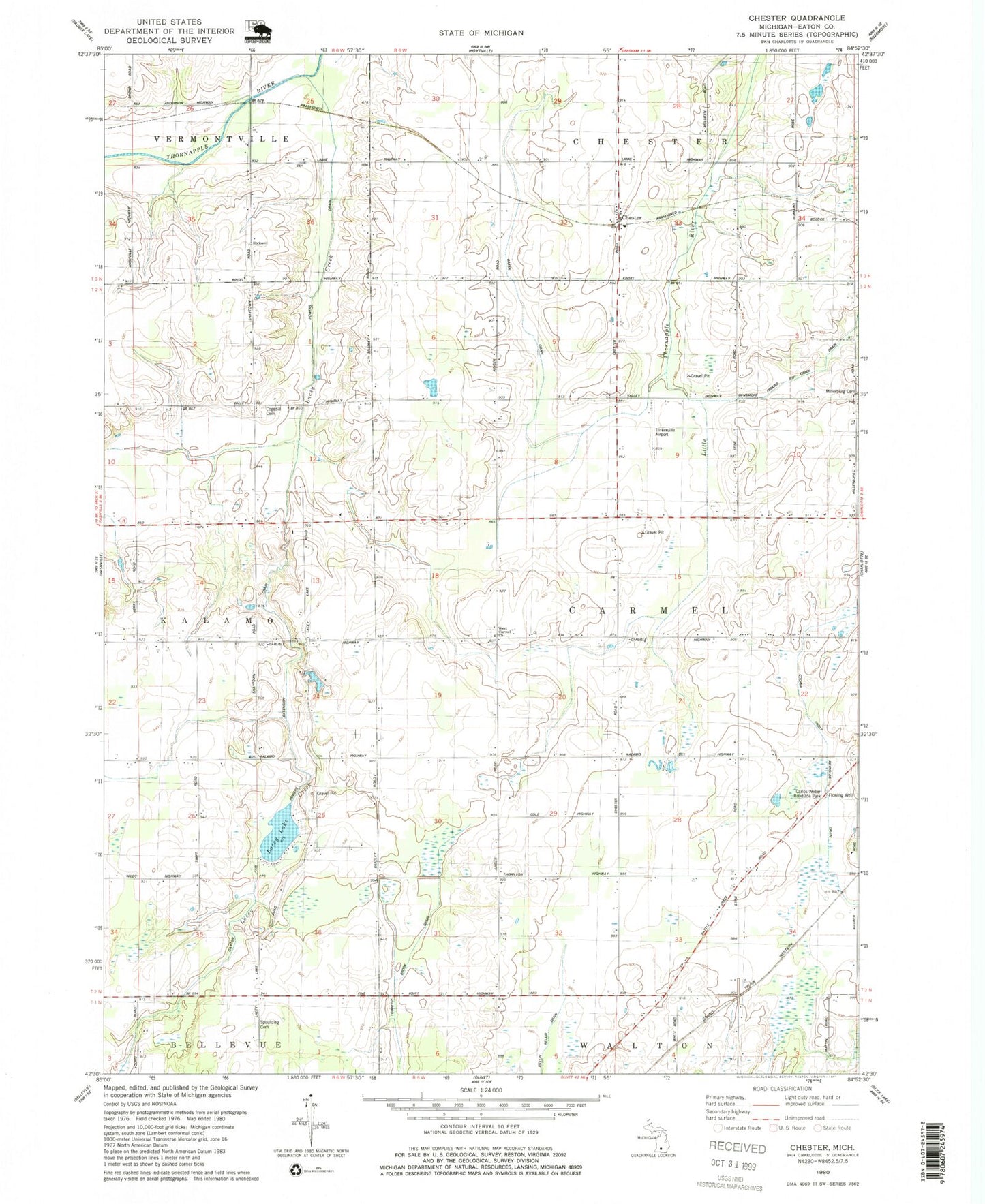
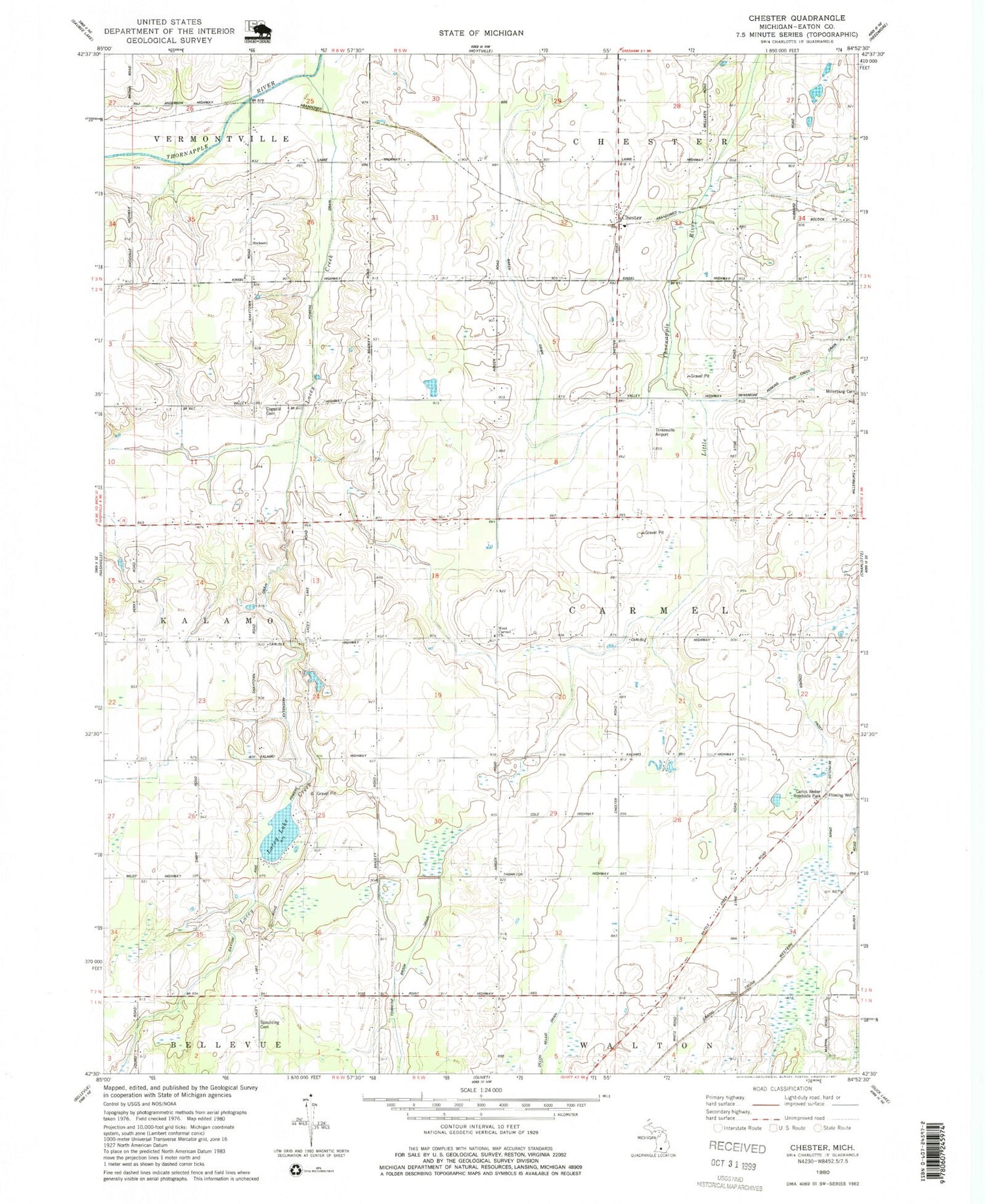
Classic USGS Chester Michigan 7.5'x7.5' Topo Map
Couldn't load pickup availability
Historical USGS topographic quad map of Chester in the state of Michigan. Map scale may vary for some years, but is generally around 1:24,000. Print size is approximately 24" x 27"
This quadrangle is in the following counties: Eaton.
The map contains contour lines, roads, rivers, towns, and lakes. Printed on high-quality waterproof paper with UV fade-resistant inks, and shipped rolled.
Contains the following named places: Carlisle, Carlisle Post Office, Carlos Weber Roadside Park, Chester, Chester Post Office, Chester Station, Cogsdil Cemetery, Cogsdill School, Ells School, Fish Creek, Gayton and Powers Extension Drain, Hill Drain, Hubbard School, Lacey Creek, Lacey Lake, Lamie School, McLaughlin School, Millerburg School, Nye and Eaton Drainage, Pleasantview Elementary School, Powers Ditch, Spaulding Cemetery, Spaulding School, Swift School, Thornton School, Township of Carmel, Valley School, Wade School, Wells School, Wend Valley Airport, West Carmel Cemetery, West Carmel Church, Wyble School