MyTopo
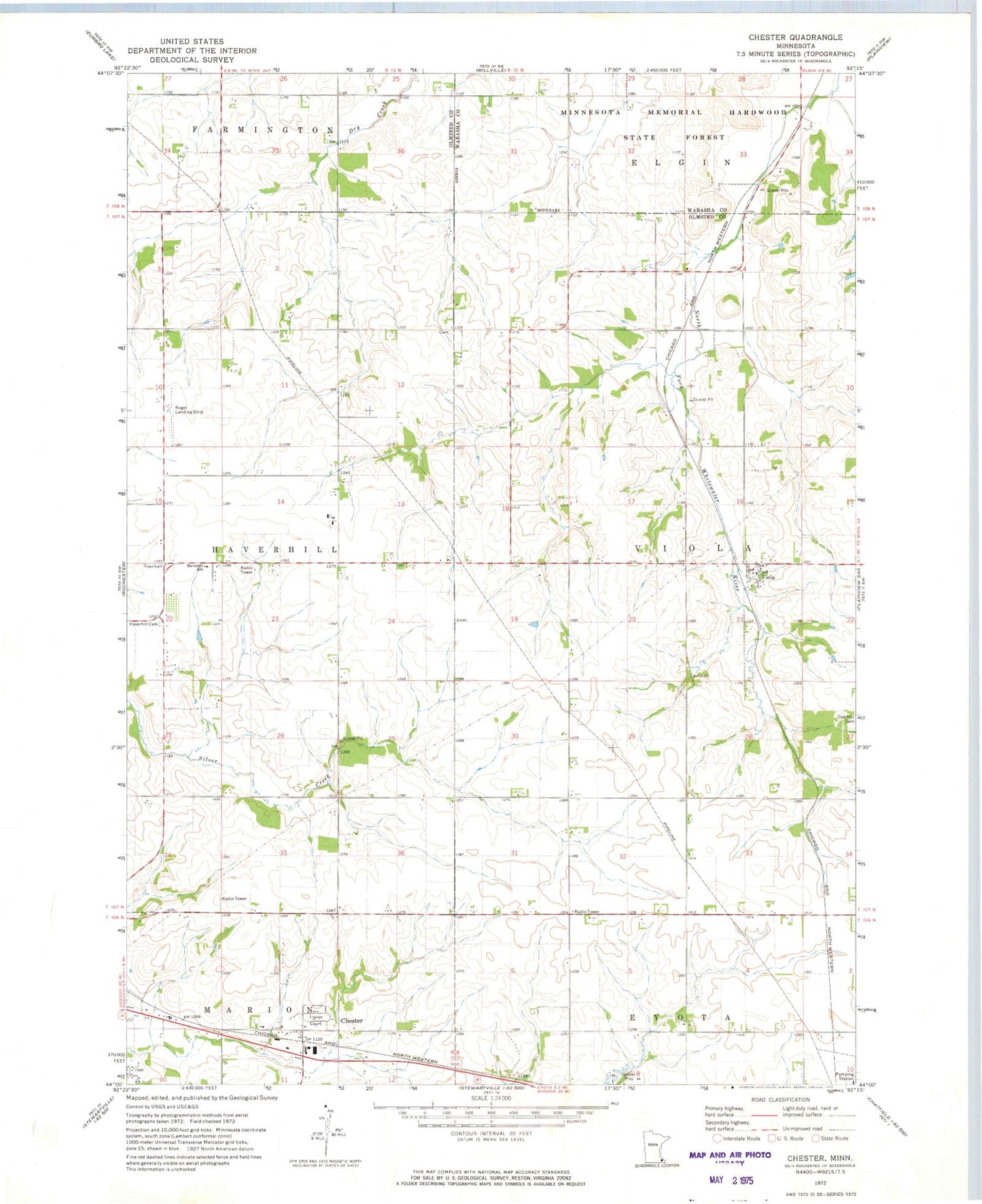
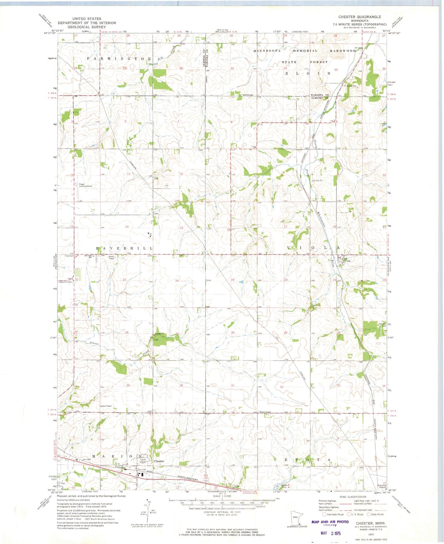
Classic USGS Chester Minnesota 7.5'x7.5' Topo Map
Couldn't load pickup availability
Historical USGS topographic quad map of Chester in the state of Minnesota. Map scale may vary for some years, but is generally around 1:24,000. Print size is approximately 24" x 27"
This quadrangle is in the following counties: Olmsted, Wabasha.
The map contains contour lines, roads, rivers, towns, and lakes. Printed on high-quality waterproof paper with UV fade-resistant inks, and shipped rolled.
Contains the following named places: Allen Hog Farms, Chester, Chester Cemetery, Chester Post Office, Dresser Valley Watershed Dam, Haverhill Cemetery, Haverhill School, KLSE-FM (Rochester), KNXR-FM (Rochester), KRCH-FM (Rochester), KRPR-FM (Rochester), KWWK-FM (Rochester), KZSE-FM (Rochester), Our Lady of the Rosary Church, Randall Fork Cemetery, Rochester - Viola Bible Church, Rochester Air Force Station, Rogers Landing Field, Saint John's Lutheran Cemetery, Township of Haverhill, Township of Viola, Viola, Viola Post Office, ZIP Code: 55934