MyTopo
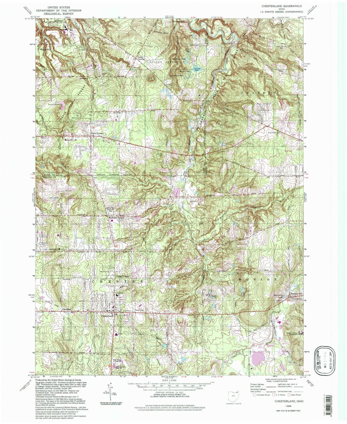
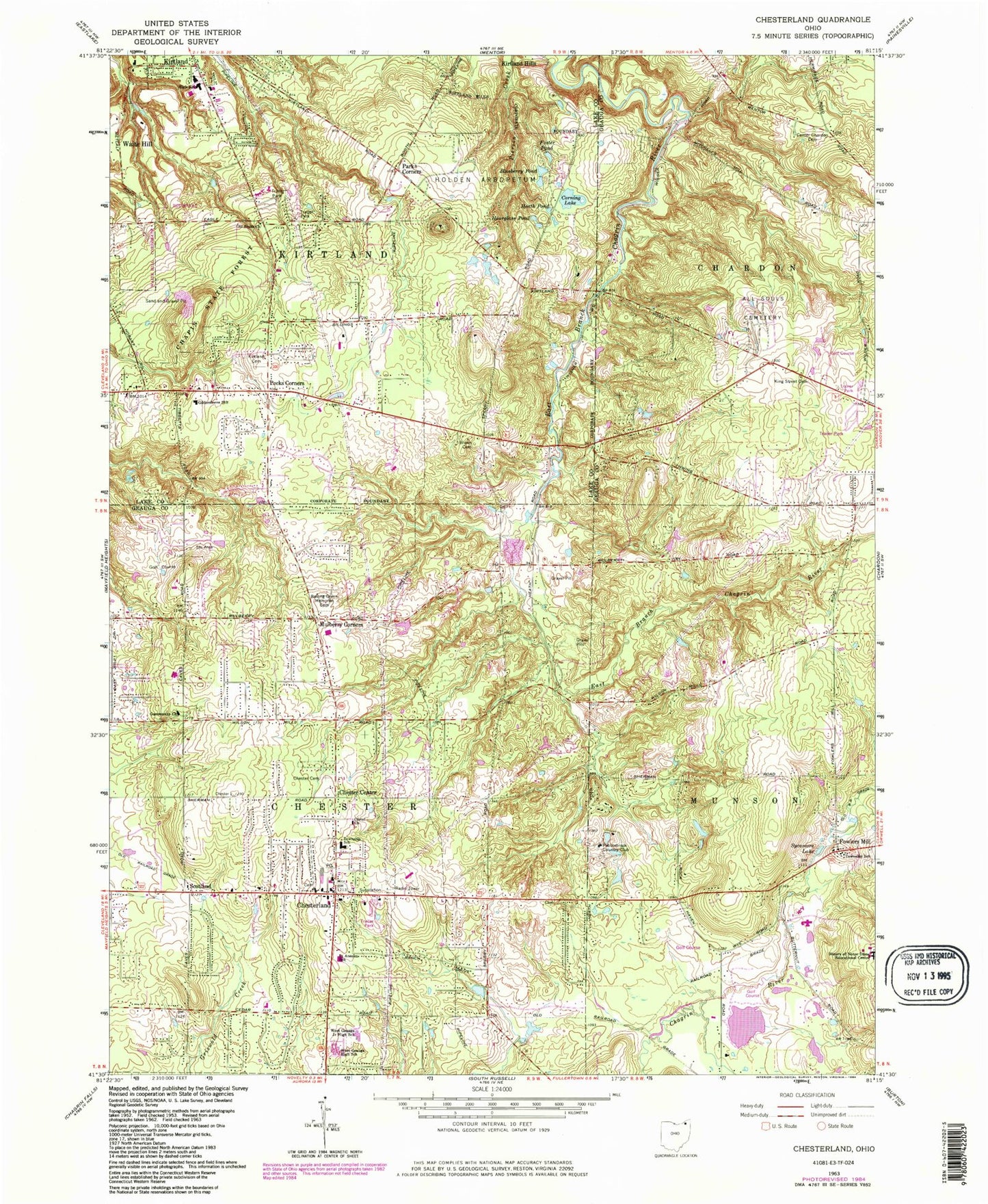
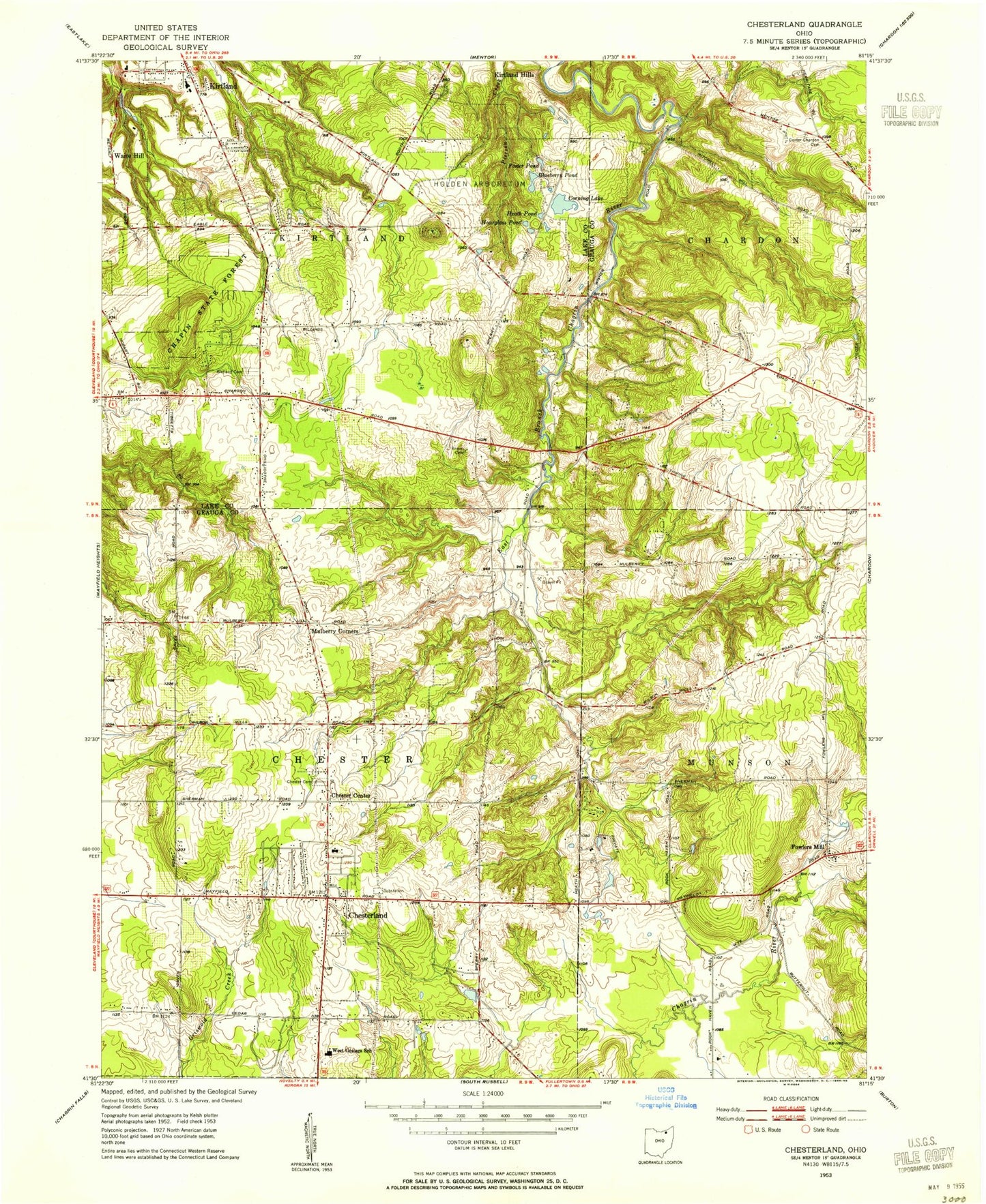
Classic USGS Chesterland Ohio 7.5'x7.5' Topo Map
Couldn't load pickup availability
Historical USGS topographic quad map of Chesterland in the state of Ohio. Typical map scale is 1:24,000, but may vary for certain years, if available. Print size: 24" x 27"
This quadrangle is in the following counties: Geauga, Lake.
The map contains contour lines, roads, rivers, towns, and lakes. Printed on high-quality waterproof paper with UV fade-resistant inks, and shipped rolled.
Contains the following named places: All Souls Cemetery, Blueberry Pond, Brown Cemetery, Center Chardon Cemetery, Chaplin State Forest, Chester Township Cemetery, Christ Presbyterian Church, Corning Lake, Foster Pond, Heath Pond, Holden Arboretum, Hourglass Pond, King Street Cemetery, Old South Church, Pebblebrook Country Club, Rolling Green Memorial Cemetery, Saint Anselm School, Scotland, Sycamore Lake, West Geauga High School, Mulberry Corners, Kirtland Elementary School, Kirtland High School, Kirtland Middle School, Gildersleeve Mountain, West Geauga Plaza Shopping Center, Robert C Lindsey Elementary School, Fullertown Station (historical), West Geauga Middle School, Chester Center, Chesterland, Pecks Corners, South Church, Parks Corner, Kirtland Hills, Sand Hill, Fowlers Mill, North Munson, Piersons Knob, Kirtland South Cemetery, Mitchells Mill (historical), Gildersleeve Elementary School, Chesterland Post Office, Township of Chester, City of Kirtland, Chester Elementary School, Chester Town Hall, Chesterland Baptist Church, Community Church, Orchard Hills Golf Course, Saint Anselm Church, Trinity United Methodist Church, Chester Center Cemetery, Fowlers Mills Cemetery, Old Settlers Cemetery, Lake Farmpark, Fowlers Mill Post Office (historical), Chesterland Census Designated Place, Lost Fen, Wilder Senior Citizen Mobile Home Park North, Wilder Senior Citizen Mobile Home Park South, Kirtland Mobile Home Park, Eagle Trailer Park, Eddy Fruit Farm, Patterson Fruit Farm, Roberts Fruit Farm, Schupp Orchard, Durkalski Industrial Park, Kirtland Fire Department Station 1, Kirtland Fire Department Station 2, Chesterland Fire and Emergency Medical Services Station 2, Chester Township Fire Rescue, Chester Township Police Department, Kirtland Police Department, Chester Township Police Department, All Souls Cemetery, Blueberry Pond, Brown Cemetery, Center Chardon Cemetery, Chaplin State Forest, Chester Township Cemetery, Christ Presbyterian Church, Corning Lake, Foster Pond, Heath Pond, Holden Arboretum, Hourglass Pond, King Street Cemetery, Old South Church, Pebblebrook Country Club, Rolling Green Memorial Cemetery, Saint Anselm School, Scotland, Sycamore Lake, West Geauga High School, Mulberry Corners, Kirtland Elementary School, Kirtland High School, Kirtland Middle School, Gildersleeve Mountain, West Geauga Plaza Shopping Center, Robert C Lindsey Elementary School, Fullertown Station (historical), West Geauga Middle School, Chester Center, Chesterland, Pecks Corners, South Church, Parks Corner, Kirtland Hills, Sand Hill, Fowlers Mill, North Munson, Piersons Knob, Kirtland South Cemetery, Mitchells Mill (historical), Gildersleeve Elementary School, Chesterland Post Office, Township of Chester, City of Kirtland, Chester Elementary School, Chester Town Hall, Chesterland Baptist Church, Community Church, Orchard Hills Golf Course, Saint Anselm Church, Trinity United Methodist Church, Chester Center Cemetery, Fowlers Mills Cemetery, Old Settlers Cemetery, Lake Farmpark, Fowlers Mill Post Office (historical), Chesterland Census Designated Place, Lost Fen, Wilder Senior Citizen Mobile Home Park North, Wilder Senior Citizen Mobile Home Park South, Kirtland Mobile Home Park, Eagle Trailer Park, Eddy Fruit Farm, Patterson Fruit Farm, Roberts Fruit Farm, Schupp Orchard, Durkalski Industrial Park, Kirtland Fire Department Station 1, Kirtland Fire Department Station 2, Chesterland Fire and Emergency Medical Services Station 2, Chester Township Fire Rescue, Chester Township Police Department, Kirtland Police Department, Chester Township Police Department


