MyTopo
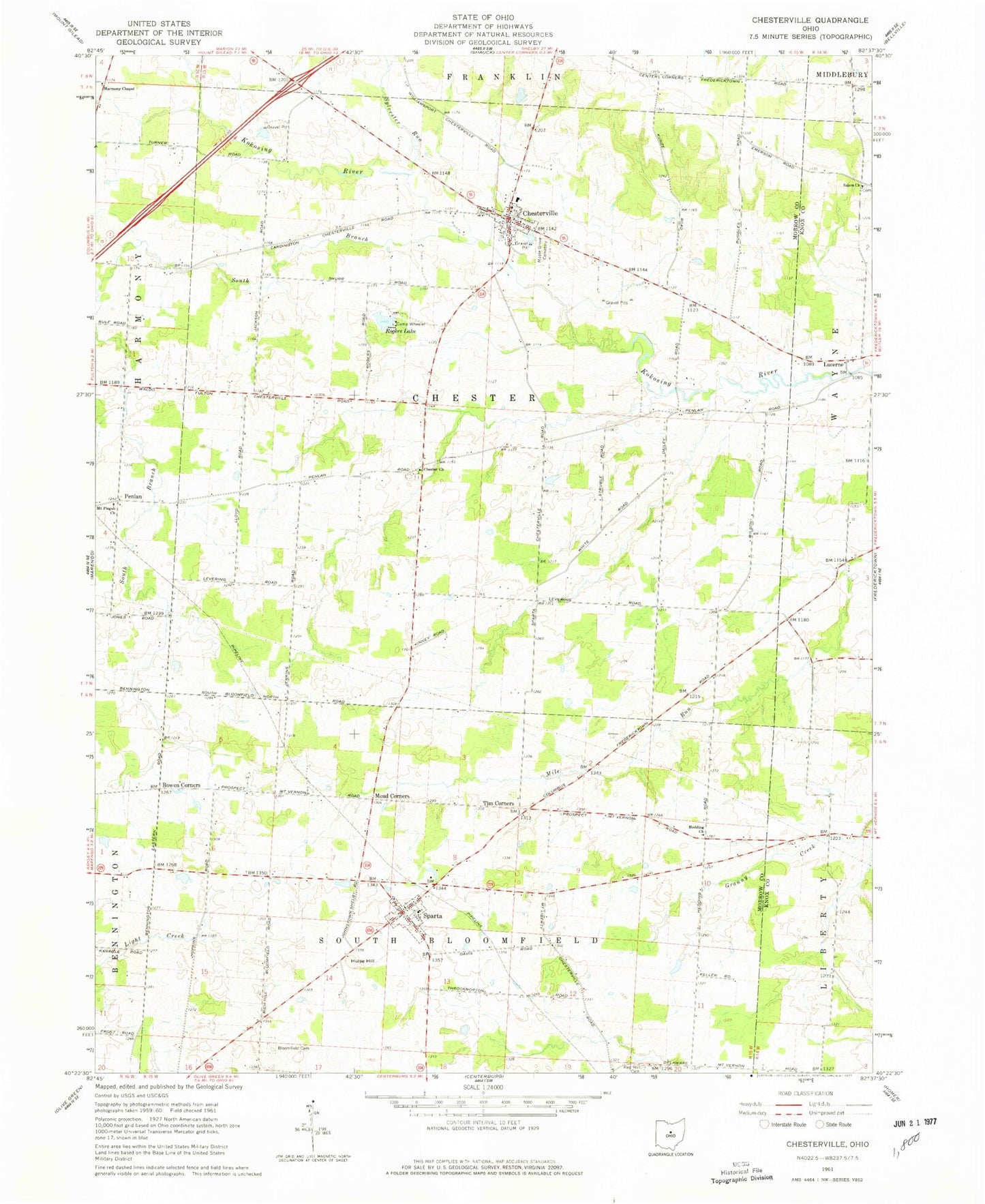
Classic USGS Chesterville Ohio 7.5'x7.5' Topo Map
Couldn't load pickup availability
Historical USGS topographic quad map of Chesterville in the state of Ohio. Map scale may vary for some years, but is generally around 1:24,000. Print size is approximately 24" x 27"
This quadrangle is in the following counties: Knox, Morrow.
The map contains contour lines, roads, rivers, towns, and lakes. Printed on high-quality waterproof paper with UV fade-resistant inks, and shipped rolled.
Contains the following named places: Aaronsburg, Anthony Mining Company Dam, Anthony Mining Company Pond, Bethel Cemetery, Bethel School, Big Walnut Joint Fire District Station 2, Bloomfield Cemetery, Bowen Corners, Camp Wheeler, Chester Baptist Cemetery, Chester Baptist Church, Chester School, Chesterville, Chesterville Methodist Church, Chesterville Post Office, Chesterville Village Post Office, Fairfield School, Fairview School, Gardner School, Gordon School, Harmony Chapel, Harmony Chapel Cemetery, Hedding Church, Highland High School, Highland North Elementary School, Hulse Hill, Jackson School, Lake Peniel, Lake Peniel Dam, Life Line Medical Ambulance, Lucerne, Lucerne Post Office, Maple Grove Cemetery, Mead Corners, Moore Corners, Mount Pisgah Church, Ohio State Highway Patrol - Mount Gilead Patrol Post, Penlan, Red Hill Cemetery, Red Hill School, Rogers Lake, Salem Church, Salem Methodist Episcopal Cemetery, Shaw School, South Branch Kokosing River, Sparta, Sparta Post Office, State of Ohio, Sylvester Run, Tim Corners, Township of Chester, Township of South Bloomfield, Vail School, Village of Chesterville, Village of Sparta, Washington School, ZIP Code: 43317