MyTopo
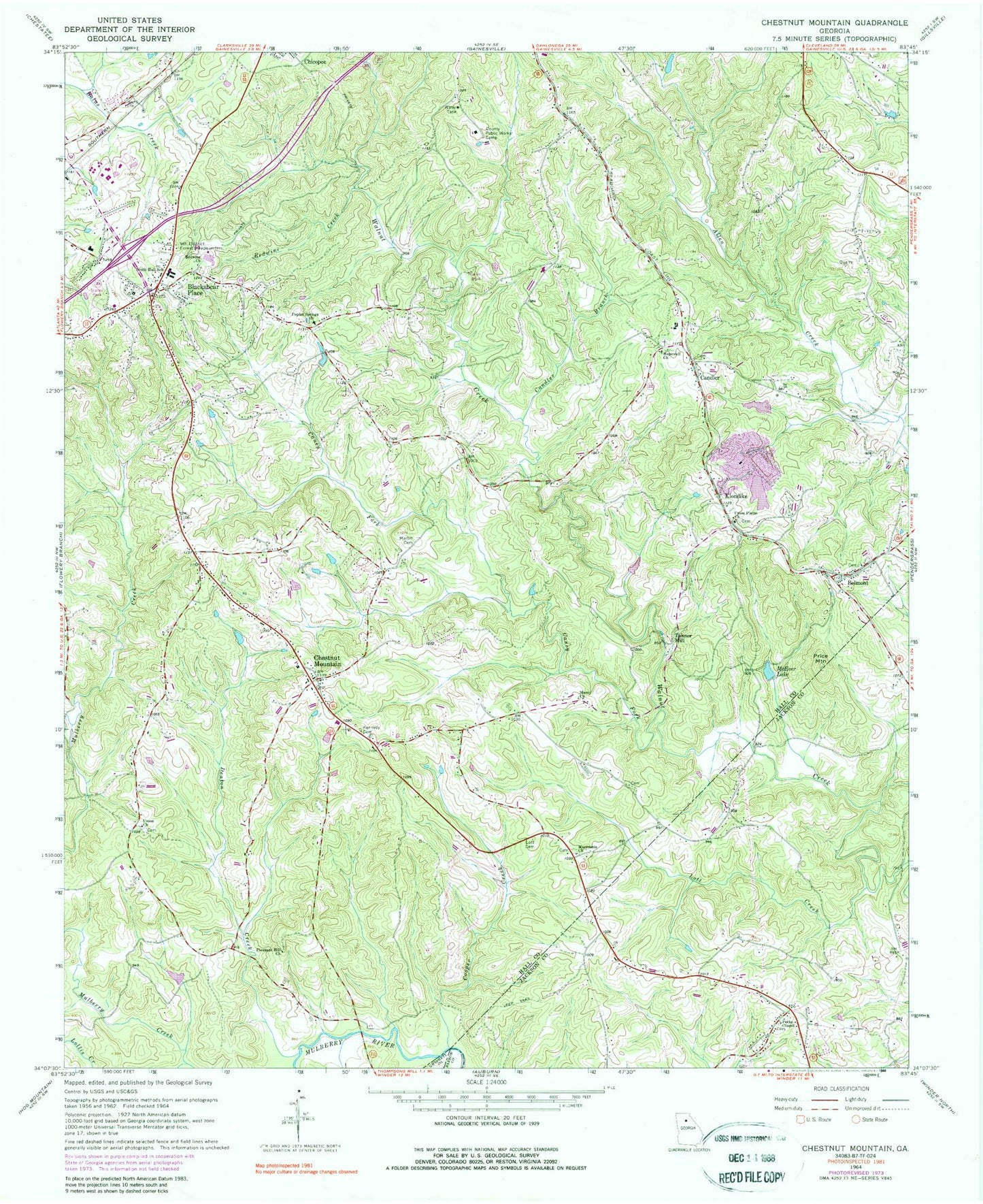
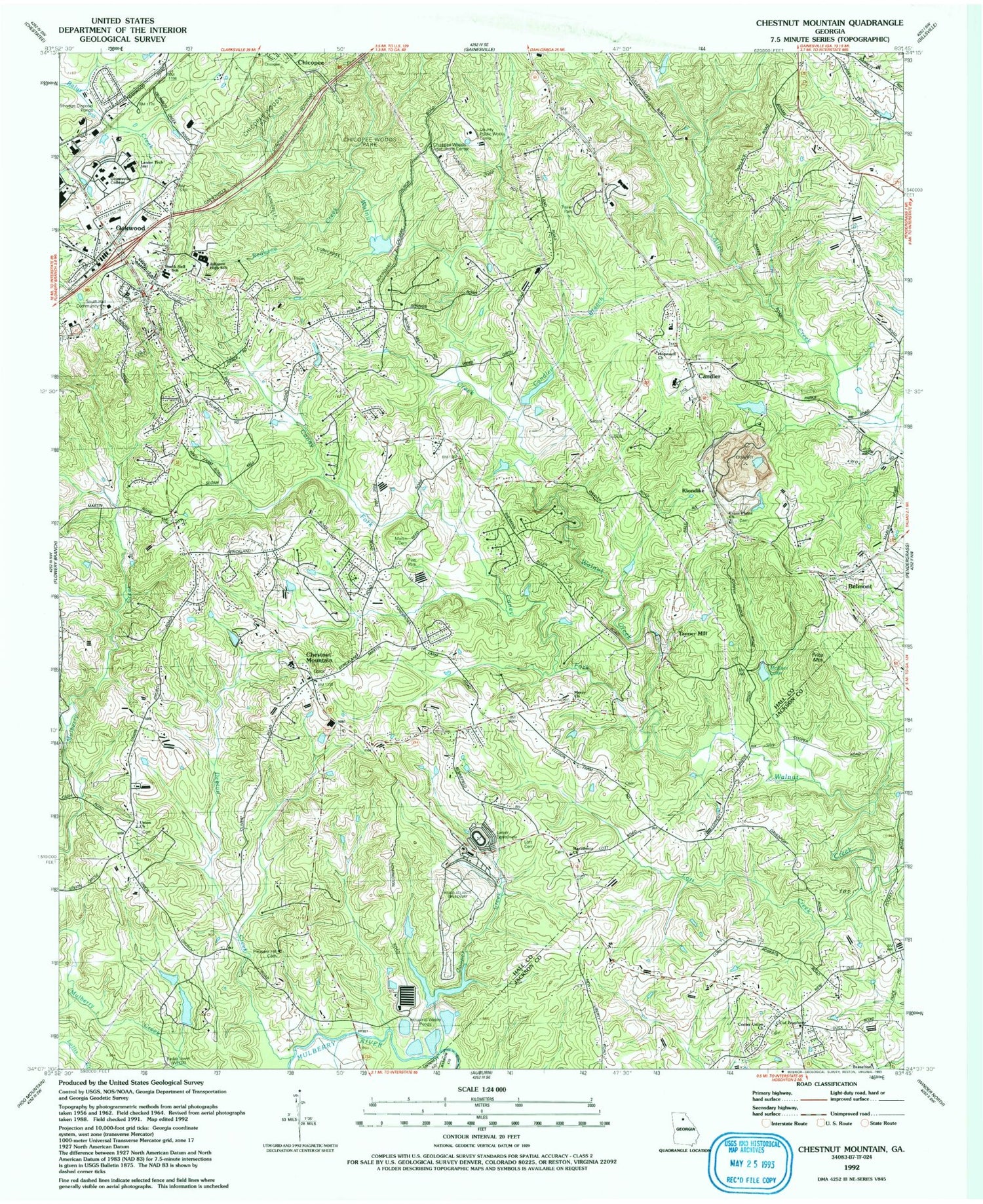
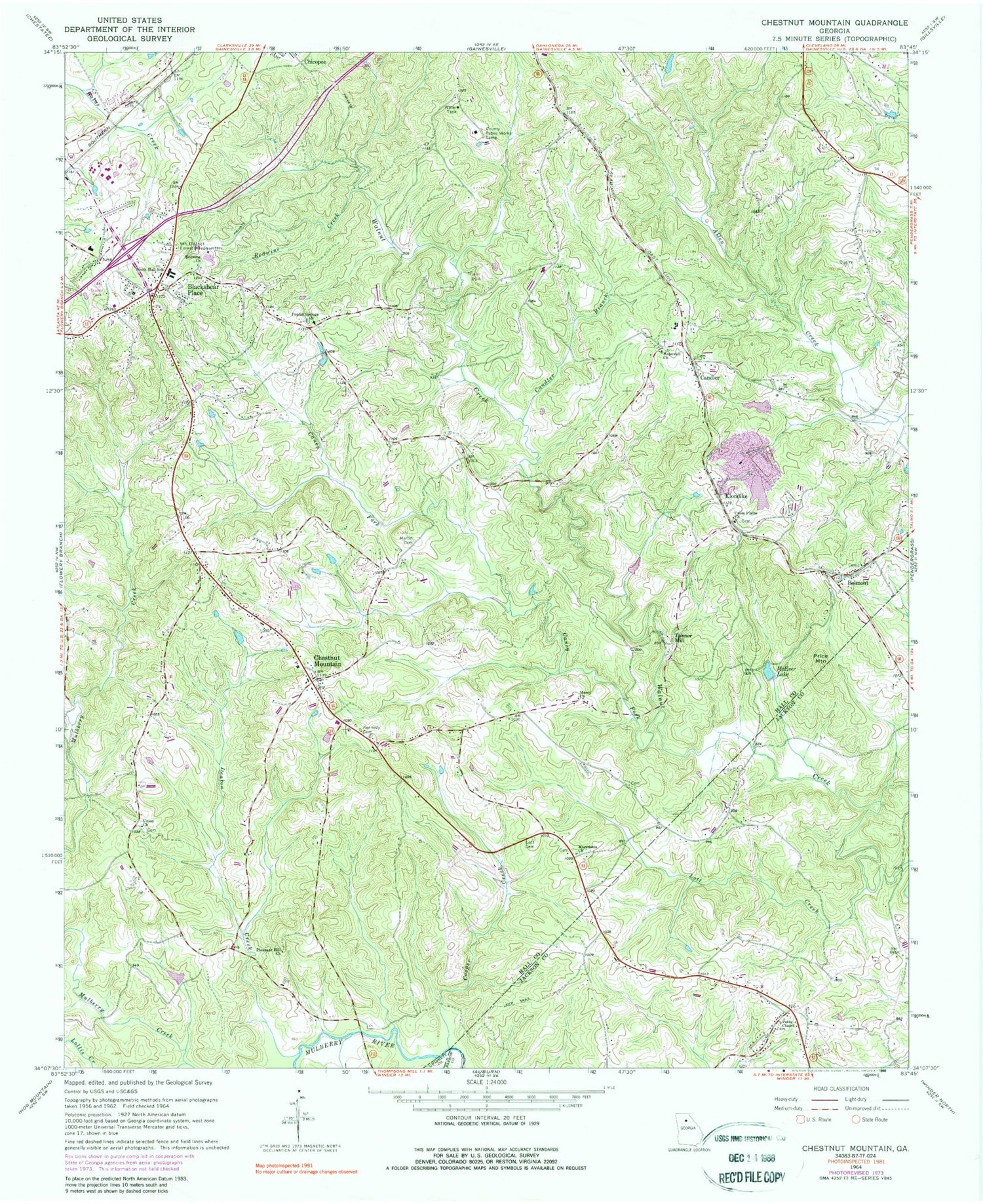
Classic USGS Chestnut Mountain Georgia 7.5'x7.5' Topo Map
Couldn't load pickup availability
Historical USGS topographic quad map of Chestnut Mountain in the state of Georgia. Map scale may vary for some years, but is generally around 1:24,000. Print size is approximately 24" x 27"
This quadrangle is in the following counties: Barrow, Gwinnett, Hall, Jackson.
The map contains contour lines, roads, rivers, towns, and lakes. Printed on high-quality waterproof paper with UV fade-resistant inks, and shipped rolled.
Contains the following named places: Alandale, Belmont, Belmont Baptist Church, Belmont Cemetery, Blackshear Place, Bolman Estates, Bretton Woods, Briarwood, Candler, Candler Branch, Candler Methodist Cemetery, Candler Methodist Church, Caney Fork, Carvers Mill, Center Union Church, Center Union School, Chestnut Hill, Chestnut Mountain, Chestnut Mountain Baptist Church, Chestnut Mountain Church Cemetery, Chestnut Mountain Elementary School, Chestnut Mountain Post Office, Chestnut Mountain Presbyterian Church, Chicopee Woods Agricultural Center, Chicopee Woods Elementary School, Chicopee Woods Park, Church of Prophecy, College Square Shopping Center, Colony South, Cooper Creek, Cross Plains Church, Deaton Creek, Eagle Ranch Christian School, Eaglewood, Ednaville, Evergreen Heights, Frazier, Gainesville State College, Gainesville Stone Lake, Gainesville Stone Lake Dam, Gilleland, Goochville, Hall County Fire Station 12, Hall County Fire Station 9, Hall County Jail, Hillcroft Heights, Hopewell Baptist Cemetery, Hopewell Church, Johnson High School, Kennedy Cemetery, Kennedy Mountain, Klondike, Lanier Career Academy, Lanier Speedway, Lanier Technical College, Lanier Technical College Oakwood Campus, Liberty Church, Lott Cemetery, Lott Creek, Macedonia Baptist Cemetery, Macedonia Church, Marlette Heights, Martin Cemetery, McEver Lake, Meadowood, Merchants Crossing Shopping Center, Merchants Walk Shopping Center, Mercy Church, Middle Oconee Structure Number One Dam, Mulberry, Mulberry Creek, Myers Elementary School, Peeks Chapel, Platt Park, Pleasant Brook, Pleasant Hill Cemetery, Pleasant Hill Church, Poplar Springs Baptist Cemetery, Poplar Springs Church, Price Mountain, Redwine Church, Redwine Creek, Redwine Methodist Cemetery, Reservoir One, Road Atlanta Speedway, Sherwood Creek, South Hall Community Center, South Hall Middle School, Springfield Downs, Strickland Heights, Tanner Mill, Trinity Day School, Union Baptist Cemetery, Union Church, WFOX-FM (Gainesville), World Language Academy, WYAY-FM (Gainesville), ZIP Codes: 30507, 30517