
MyTopo
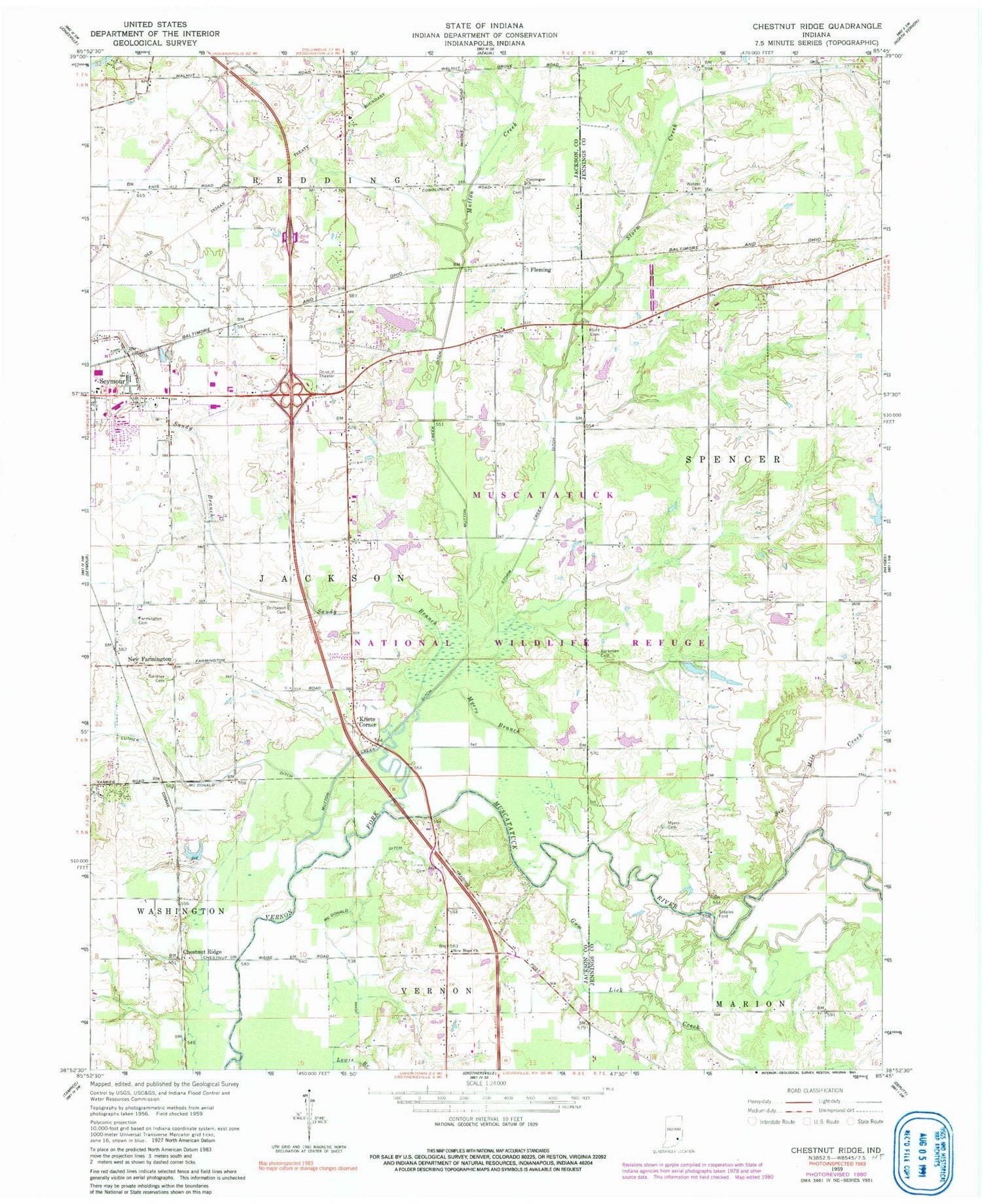
Classic USGS Chestnut Ridge Indiana 7.5'x7.5' Topo Map
Couldn't load pickup availability
Historical USGS topographic quad map of Chestnut Ridge in the state of Indiana. Map scale may vary for some years, but is generally around 1:24,000. Print size is approximately 24" x 27"
This quadrangle is in the following counties: Jackson, Jennings.
The map contains contour lines, roads, rivers, towns, and lakes. Printed on high-quality waterproof paper with UV fade-resistant inks, and shipped rolled.
Contains the following named places: Banks Hog Farm, Barkman Cemetery, Chestnut Ridge, Conologue, Conologue Church, Conologue Post Office, Driftwood Cemetery, Farmington Cemetery, Fleming, Gardner Cemetery, Gum Lick Creek, Hunt Cemetery, John McDonald Ditch, Kriete Corner, Lewis Branch, Luther McDonald Ditch, Muscatatuck National Wildlife Refuge, Mutton Creek, Mutton Creek Ditch, Myers Branch, Myers Cemetery, New Farmington, New Hope Church, Newry, Sandy Branch, Seymour Fire Department Station 3, Sixmile Creek, Staples Ford, Stewart Field, Storm Creek, Storm Creek Ditch, Wohrer Cemetery


