MyTopo
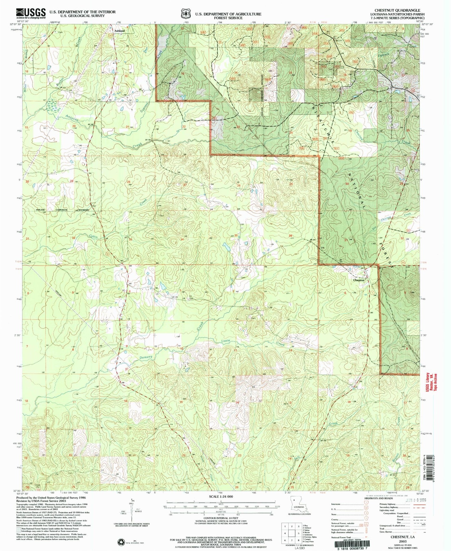
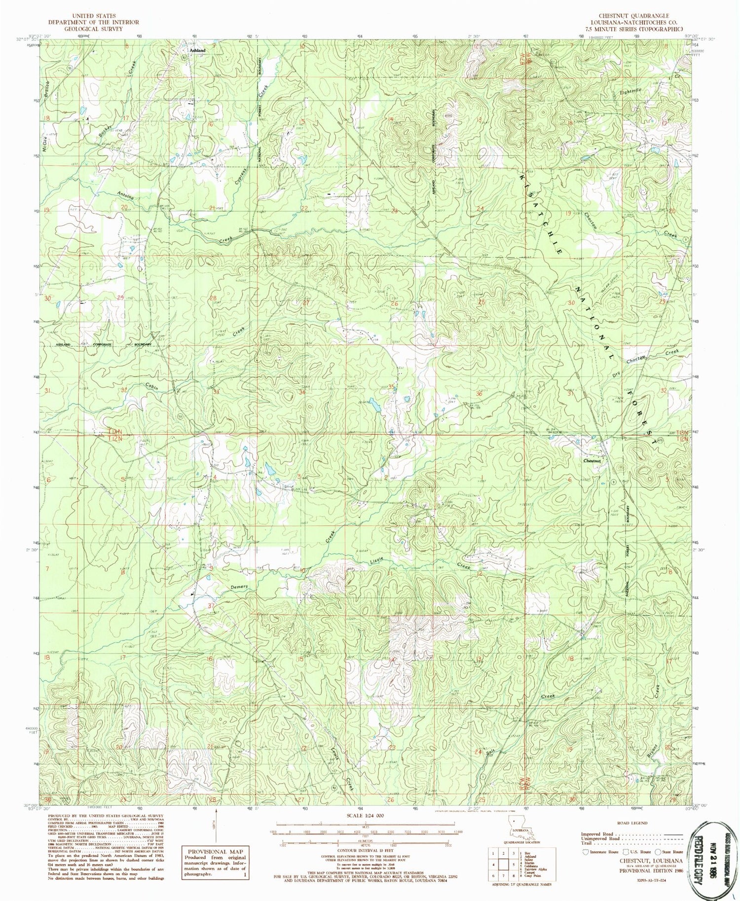
Classic USGS Chestnut Louisiana 7.5'x7.5' Topo Map
Couldn't load pickup availability
Historical USGS topographic quad map of Chestnut in the state of Louisiana. Map scale may vary for some years, but is generally around 1:24,000. Print size is approximately 24" x 27"
This quadrangle is in the following counties: Natchitoches.
The map contains contour lines, roads, rivers, towns, and lakes. Printed on high-quality waterproof paper with UV fade-resistant inks, and shipped rolled.
Contains the following named places: Bucket Creek, Chestnut, Chestnut Post Office, Creston Gas Field, Cypress Creek, Demery Creek Gas Field, Hathorn Cemetery, Hickory Hill Lookout Tower, Lizzie Creek, McGee Branch, Mount Olive Church, Oak Grove Church, Oak Grove School, Pilgrim Grove Church, Piney Branch, Pleasant Hill Church, Saint Johns Church, Saint Johns School, Saint Mathews Church, Skidder, Stewart Cemetery, Village of Ashland, Weaver Cemetery, ZIP Code: 71070