MyTopo
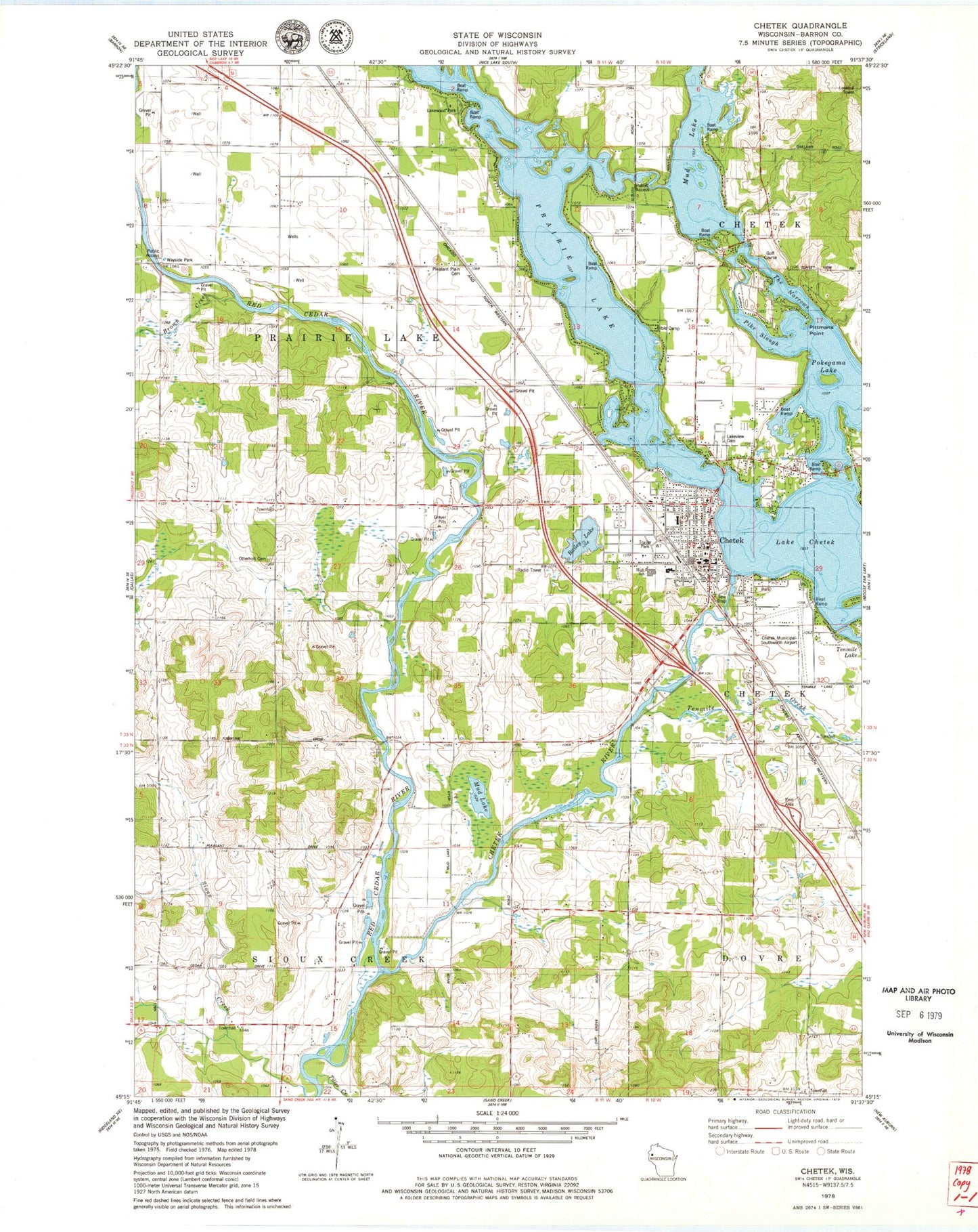
Classic USGS Chetek Wisconsin 7.5'x7.5' Topo Map
Couldn't load pickup availability
Historical USGS topographic quad map of Chetek in the state of Wisconsin. Map scale may vary for some years, but is generally around 1:24,000. Print size is approximately 24" x 27"
This quadrangle is in the following counties: Barron.
The map contains contour lines, roads, rivers, towns, and lakes. Printed on high-quality waterproof paper with UV fade-resistant inks, and shipped rolled.
Contains the following named places: Advent Christian Church, Bailey Lake, Brown Creek, Chetek, Chetek Flowage 135, Chetek Full Gospel Tabernacle, Chetek Lutheran Church, Chetek Middle School, Chetek Municipal-Southworth Airport, Chetek Police Department, Chetek Post Office, Chetek River, Chetek United Methodist Church, Chetek Volunteer Fire Department, Chetek Wastewater Treatment Plant, Chetek Weyerhaeuser Middle - High School, Chetek WP277 Dam, City of Chetek, City View School, Dovre Townhall, Gregarson School, Hunt School, Lake Chetek, Lakeview Cemetery, Lakewood Park, Mud Lake, Oak Grove School, Otterholt Cemetery, Otterholt School, Pike Slough, Pittmans Point, Pleasant Hill School, Pleasant Plain Cemetery, Pleasant Plain School, Pokegama Lake, Prairie Lake, Prairie Lake Townhall, Riverview School, Roselawn Elementary School, Saint Boniface Catholic Church, Sioux Creek Townhall, Stardust Drive-In Theatre, Sunset View Country Club, Tenmile Creek, The Narrows, Tiller Creek, Town of Prairie Lake, Town of Sioux Creek, ZIP Code: 54728