
MyTopo
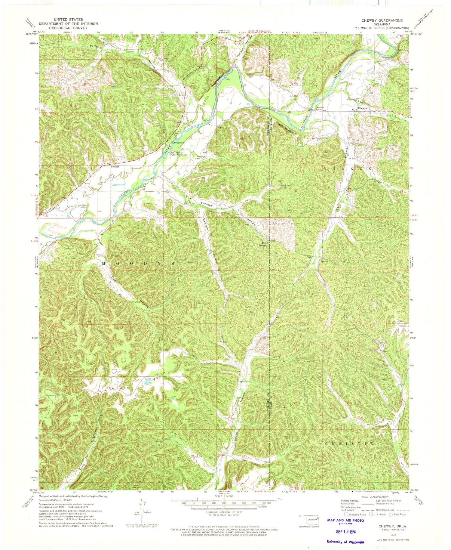
Classic USGS Chewey Oklahoma 7.5'x7.5' Topo Map
Couldn't load pickup availability
Historical USGS topographic quad map of Chewey in the state of Oklahoma. Map scale may vary for some years, but is generally around 1:24,000. Print size is approximately 24" x 27"
This quadrangle is in the following counties: Adair, Cherokee.
The map contains contour lines, roads, rivers, towns, and lakes. Printed on high-quality waterproof paper with UV fade-resistant inks, and shipped rolled.
Contains the following named places: Black Fox Hollow, Chewey, Chewey Cemetery, Dog Hollow, Fall Branch, Falls Branch, Hampton Bridge, Hogshooter Bluff, Illinois River Association Fire Station, Kirk Springs, Kirk Springs Hollow, Luna Branch, Pine Bluff, Proctor, Pumpkin Flats, Pumpkin Hollow Census Designated Place, Round Hollow Public Access Area, Sawmill Hollow, Scraper, Skelly Public School, Thompson Cemetery, Winset Hollow, ZIP Code: 74457


