MyTopo
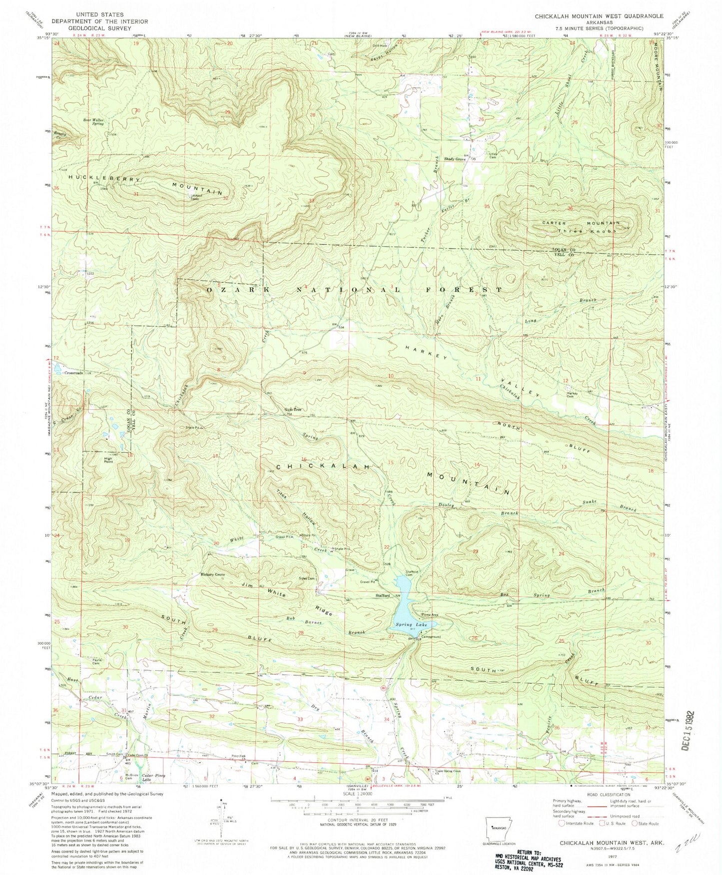
Classic USGS Chickalah Mountain West Arkansas 7.5'x7.5' Topo Map
Couldn't load pickup availability
Historical USGS topographic quad map of Chickalah Mountain West in the state of Arkansas. Map scale may vary for some years, but is generally around 1:24,000. Print size is approximately 24" x 27"
This quadrangle is in the following counties: Logan, Yell.
The map contains contour lines, roads, rivers, towns, and lakes. Printed on high-quality waterproof paper with UV fade-resistant inks, and shipped rolled.
Contains the following named places: Abbott Grave, Bear Waller Spring, Bob Barnes Branch, Box Spring Branch, Box Springs School, Buzzards Rock, Carter Mountain, Cedar Creek Church, Chickalah Mountain, Crossroads, Dooley Branch, Earles Branch, Gum Tree, Harkey's Valley Cemetery, Hickory Grove, Hickory Grove School, High Point, Horn Branch, Huckleberry Mountain, Jim White Ridge, Long Branch, Martin Creek, McBride Cemetery, Mount Pisgah Church, North Bluff, Payne Cemetery, Piney Fork Church, Shady Grove, Sides Cemetery, Sides Family Cemetery, Smith Family Cemetery, Snake Branch, South Bluff, Spring Lake, Spring Lake Bridge, Spring Lake Campground, Spring Lake Dam, Spring Lake Picnic Area, Spring Lake Recreation Area, Spring Lake Trail, Stafford, Stafford Cemetery, Three Knobs, Titus Hollow, Township of Chickalah, Township of Mountain, Tucker Branch, Upper Spring Creek Cemetery, Upper Spring Creek Church, Upper Spring Creek School, Utley Cemetery, White Creek, ZIP Code: 72824