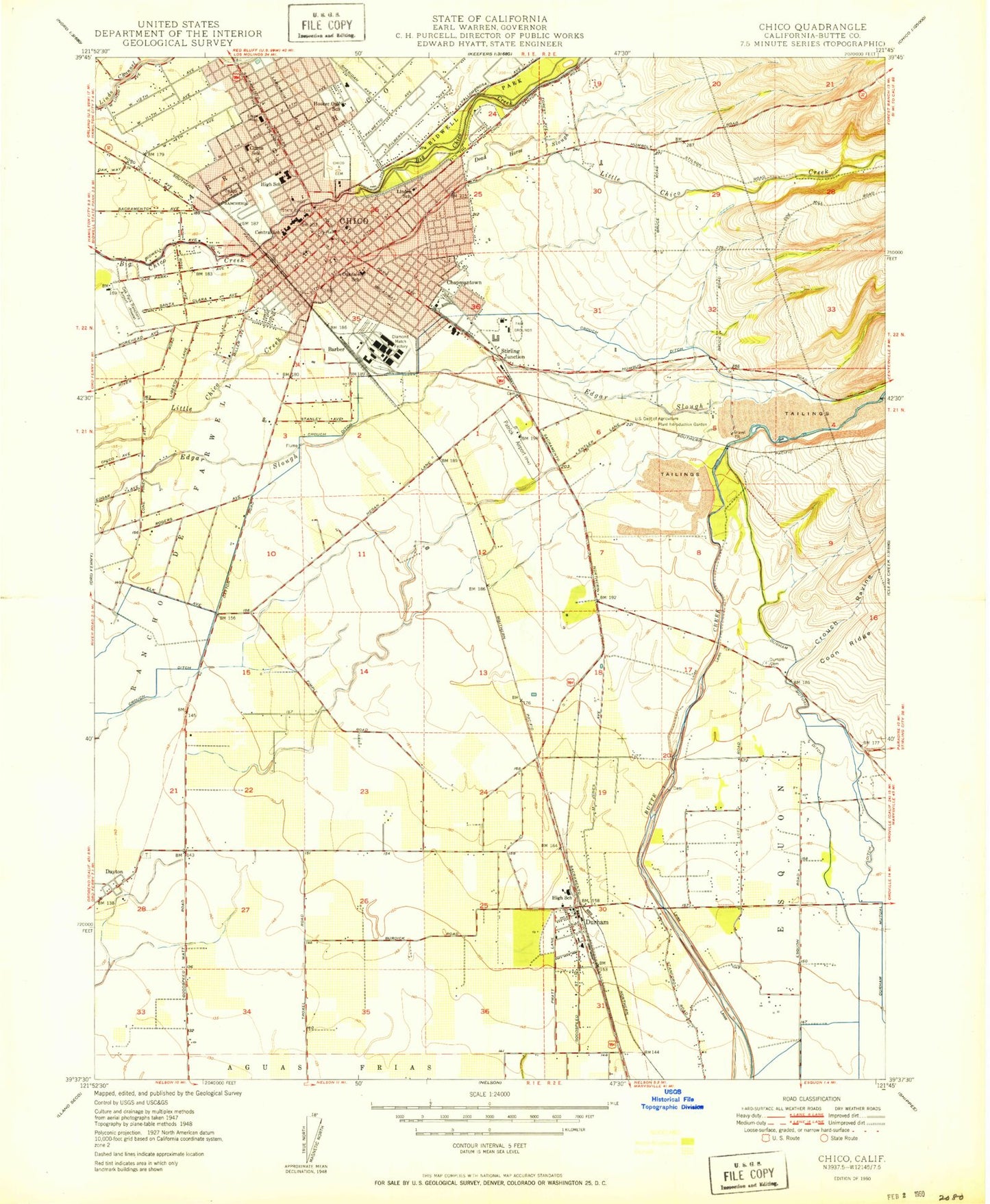
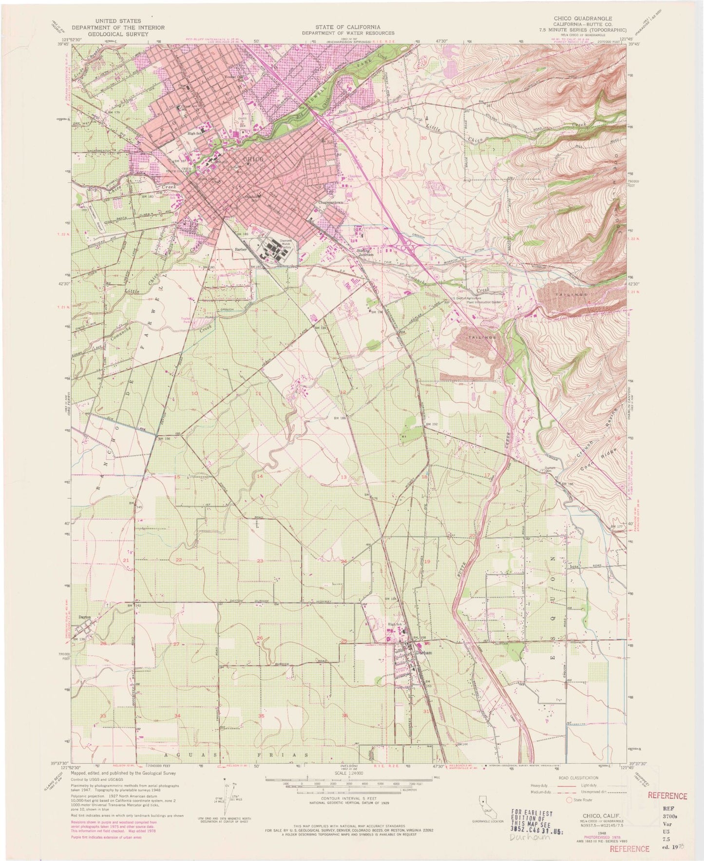
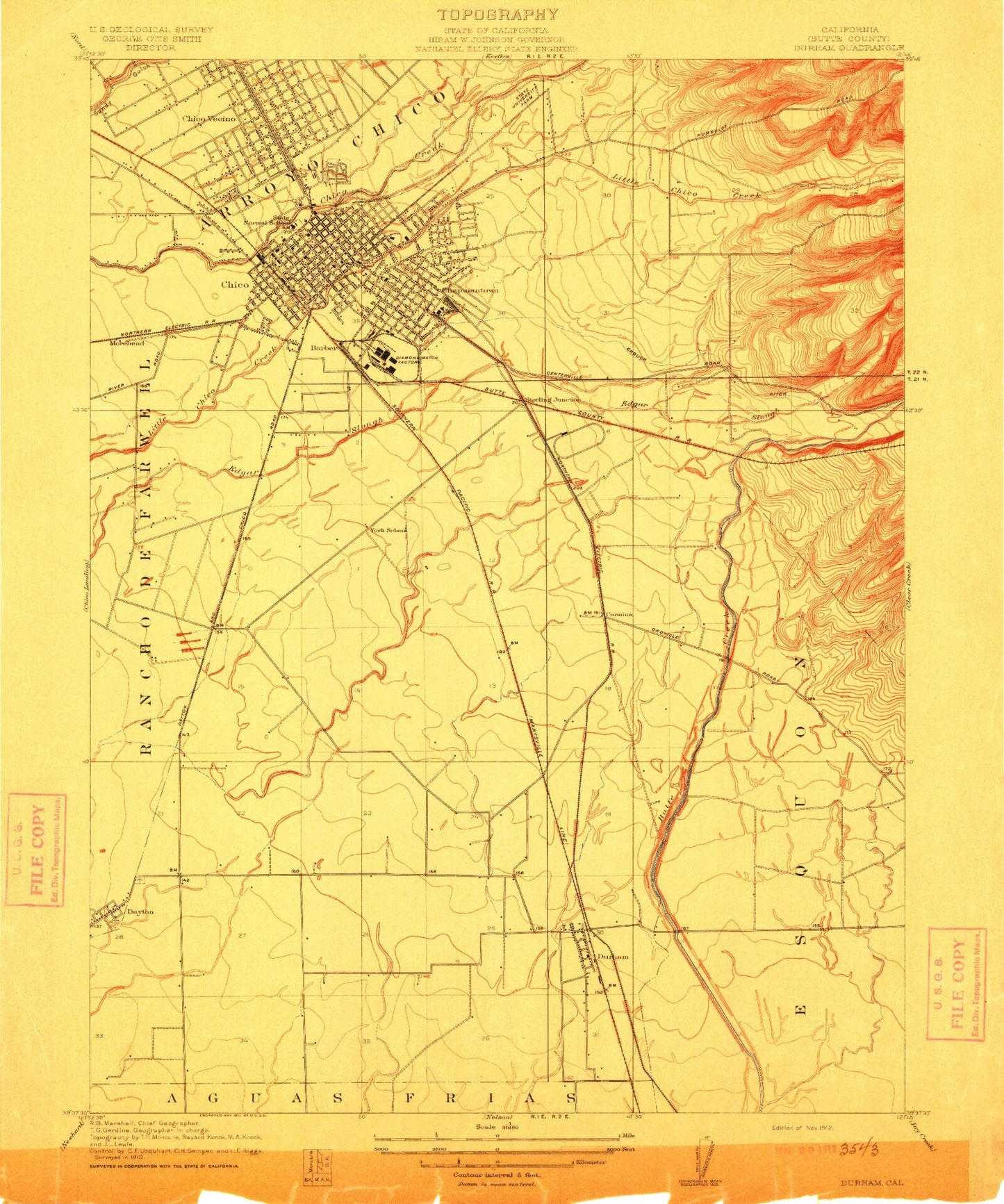
MyTopo
Classic USGS Chico California 7.5'x7.5' Topo Map
Couldn't load pickup availability
Historical USGS topographic quad map of Chico in the state of California. Map scale may vary for some years, but is generally around 1:24,000. Print size is approximately 24" x 27"
This quadrangle is in the following counties: Butte.
The map contains contour lines, roads, rivers, towns, and lakes. Printed on high-quality waterproof paper with UV fade-resistant inks, and shipped rolled.
Contains the following named places: Apostolic Gospel Temple, Aymer Jay Hamilton Elementary School, Barber, Bidwell Mansion, Bidwell Mansion State Historic Park, Bidwell Memorial Presbyterian Church, Bidwell Park, Butte County Fire Department Station 44, Butte County Fire Department Station 45, Butte Creek Country Club, Butte Creek Diversion Channel, Butte Creek Hog Ranch Airport, California Highway Patrol Valley Division - Chico, California State University - Chico, California State University - Chico Police Department, Calvary Southern Baptist Church, Chapman Elementary School, Chapman Neighborhood Center, Chapmantown, Chico, Chico Branch Butte County Library, Chico Cemetery, Chico Fire Department Station 1, Chico Fire Department Station 2, Chico Fire Department Station 4, Chico Fire Department Training Center, Chico Gospel Hall, Chico Junior High School, Chico Municipal Center, Chico Museum, Chico Police Department, Chico Post Office, Chico Senior High School, Church of Christ, Church of God, Church of the Brethren, Citrus Avenue Elementary School, Craig Hall, Crouch Ravine, Crough Ditch, Dayton, Dayton Cemetery, Dead Horse Slough, Depot Park, Diamond Match Factory, Durham, Durham Branch Butte County Library, Durham Cemetery, Durham High School, Durham Intermediate School, Durham Mutual Ditch, Durham Post Office, Enloe Hospital Heliport, Enloe Medical Center, Eskini, Fair View High School, First Assembly of God Church, First Responder Emergency Medical Service Station 33, Four Square Church, Free Methodist Church, Glen Oaks Memorial Park, Grace Brethren Church, Hooker Oak Elementary School, Kingdom Hall of Jehovahs Witnesses, KPAY-AM (Chico), Linden Public School, Mechoopda Indian Rancheria, Mechoopda Tribal Cemetery, Mechoopda Tribal Designated Statistical Area, Meriam Library, Michopdo, Midtown Chico Post Office, Neal Dow Elementary School, Notre Dame School, Oak Way Park, Park Village Shopping Center, Parkview Elementary School, Patrick Cemetery, Pentecostal Church of God, Pentecostal Church of God Faith Tabernacle, Ranchaero Airport, Reorganized Church of Jesus Christ of Latter Day Saints, Roble, Rosedale Elementary School, Saint John the Baptist Roman Catholic Church, Saint Johns Episcopal Church, Seventh Day Adventist Church, Silver Dollar Fairgrounds, Southside Foursquare Church, Stirling Junction, The Church of Jesus Christ of Latter Day Saints, The Esplanade Baptist Church, The Neighborhood Church, Trinity Methodist Church, Twentieth Street Park, United States Department of Agriculture Plant Introduction Garden, Veterans Memorial Building, ZIP Codes: 95926, 95928