MyTopo
Classic USGS Chidester Arkansas 7.5'x7.5' Topo Map
Couldn't load pickup availability
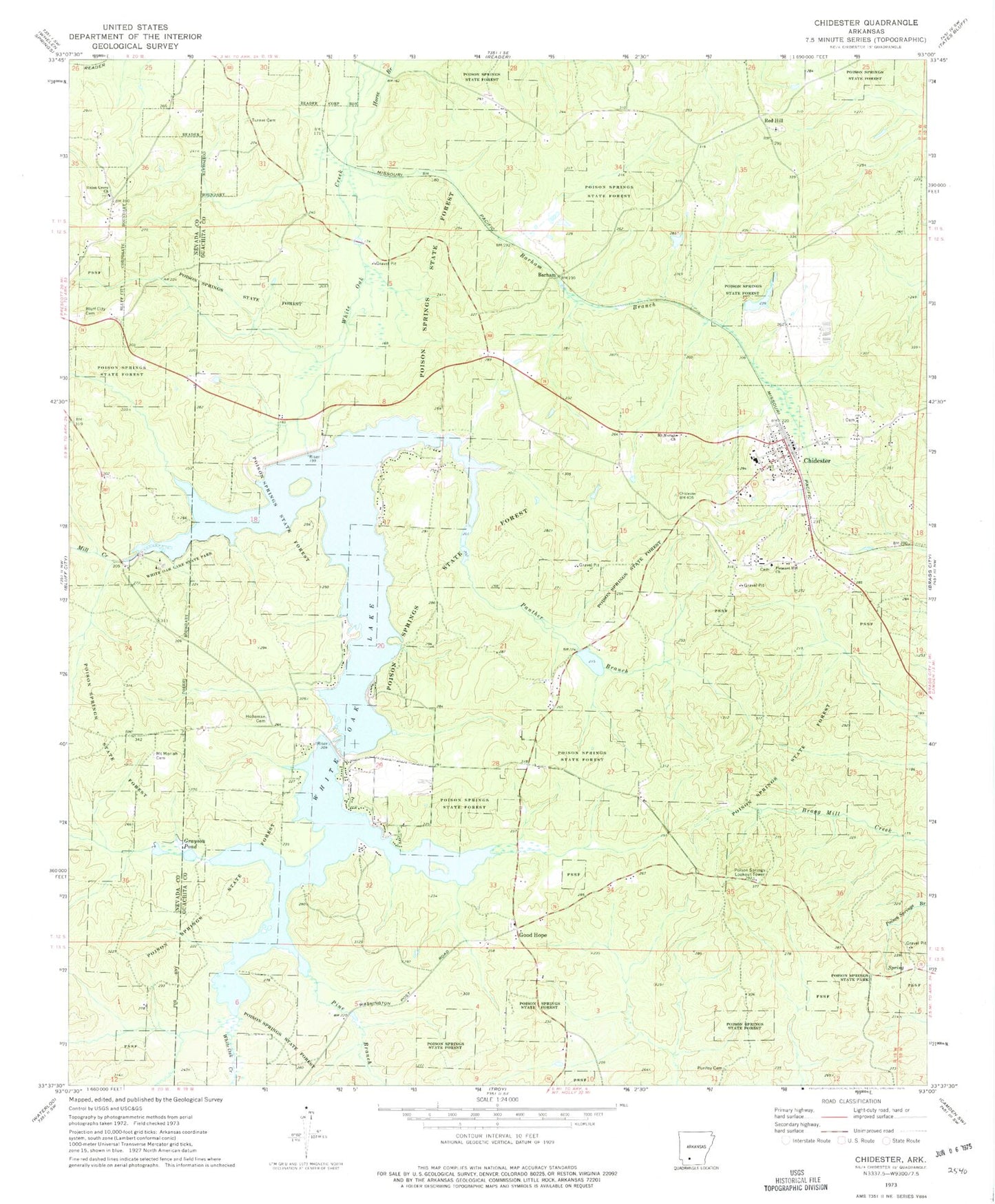
Historical USGS topographic quad map of Chidester in the state of Arkansas. Map scale may vary for some years, but is generally around 1:24,000. Print size is approximately 24" x 27"
This quadrangle is in the following counties: Nevada, Ouachita.
The map contains contour lines, roads, rivers, towns, and lakes. Printed on high-quality waterproof paper with UV fade-resistant inks, and shipped rolled.
Contains the following named places: Barham, Barham Branch, Beavers Lake, Beavers Lake Dam, Chidester, Chidester Elementary School, Chidester Police Department, Chidester Post Office, Chidester Volunteer Fire Department, City of Chidester, Good Hope, Grayson Pond, Harmony School, Holleman Cemetery, Lower White Oak Lake, Lower White Oak Lake Dam, Mill Creek, Mount Moriah Cemetery, Panther Branch, Pine Branch, Pleasant Hill Church, Poison Springs Lookout Tower, Poison Springs State Forest, Poison Springs State Park, Poison Springs Work Center, Purifoy Cemetery, Red Hill, Red Hill United Methodist Church, Township of Red Hill, Turner Cemetery, Union Grove Church, Union Grove Church Cemetery, Upper White Oak Lake, Upper White Oak Lake Dam, Upper White Oak Volunteer Fire Department Station, White Oak Lake, White Oak Lake State Park