MyTopo
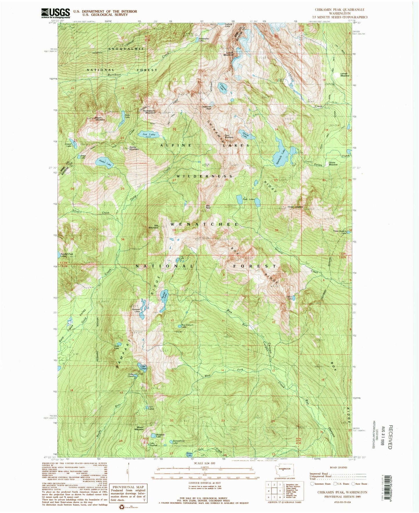
Classic USGS Chikamin Peak Washington 7.5'x7.5' Topo Map
Couldn't load pickup availability
Historical USGS topographic quad map of Chikamin Peak in the state of Washington. Typical map scale is 1:24,000, but may vary for certain years, if available. Print size: 24" x 27"
This quadrangle is in the following counties: King, Kittitas.
The map contains contour lines, roads, rivers, towns, and lakes. Printed on high-quality waterproof paper with UV fade-resistant inks, and shipped rolled.
Contains the following named places: Alaska Lake, Alaska Mountain, Alta Mountain, Alta Pass, Avalanche Lake, Box Canyon Lake, Box Ridge, Chikamin Lake, Chikamin Peak, Chikamin Ridge, Edds Lake, Glacier Lake, Gold Lake, Gravel Lake, Hibox Lake, Huckleberry Mountain, Joe Lake, Lake Laura, Lila Lake, Lake Lillian, Margaret Lake, Mount Margaret, Park Lakes, Rachel Lake, Rampart Lakes, Rampart Ridge, Ridge Lake, Silver Creek, Spectacle Lake, Stonesthrow Lake, Swan Lake, Three Queens, Three Queens Lake, Twin Lakes, West Fork Box Canyon Creek, Lake Yvonne, Mount Thomson, Four Brothers, Hibox Mountain, Lemah Mountain