MyTopo
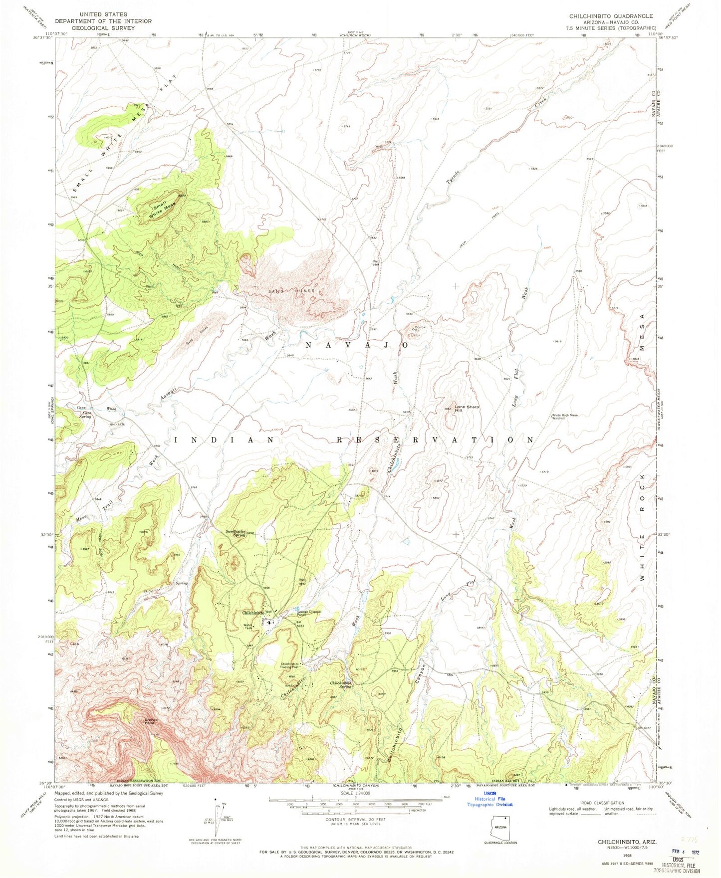
Classic USGS Chilchinbito Arizona 7.5'x7.5' Topo Map
Couldn't load pickup availability
Historical USGS topographic quad map of Chilchinbito in the state of Arizona. Map scale may vary for some years, but is generally around 1:24,000. Print size is approximately 24" x 27"
This quadrangle is in the following counties: Apache, Navajo.
The map contains contour lines, roads, rivers, towns, and lakes. Printed on high-quality waterproof paper with UV fade-resistant inks, and shipped rolled.
Contains the following named places: Aasayii Wash, Cane Spring, Cane Wash, Chilchinbeto Chapter, Chilchinbito, Chilchinbito Canyon, Chilchinbito Census Designated Place, Chilchinbito Creek, Chilchinbito Spring, Chilchinbito Trading Post, Chilchinbito Wash, Chilchinbito Well, Crevice Point, Lone Sharp Hill, Long Flat Wash, Mesa Trail Wash, Small White Mesa, Small White Mesa Flat, Sweetwater Spring, White Rock Mesa Windmill