MyTopo
Classic USGS Childers Oklahoma 7.5'x7.5' Topo Map
Couldn't load pickup availability
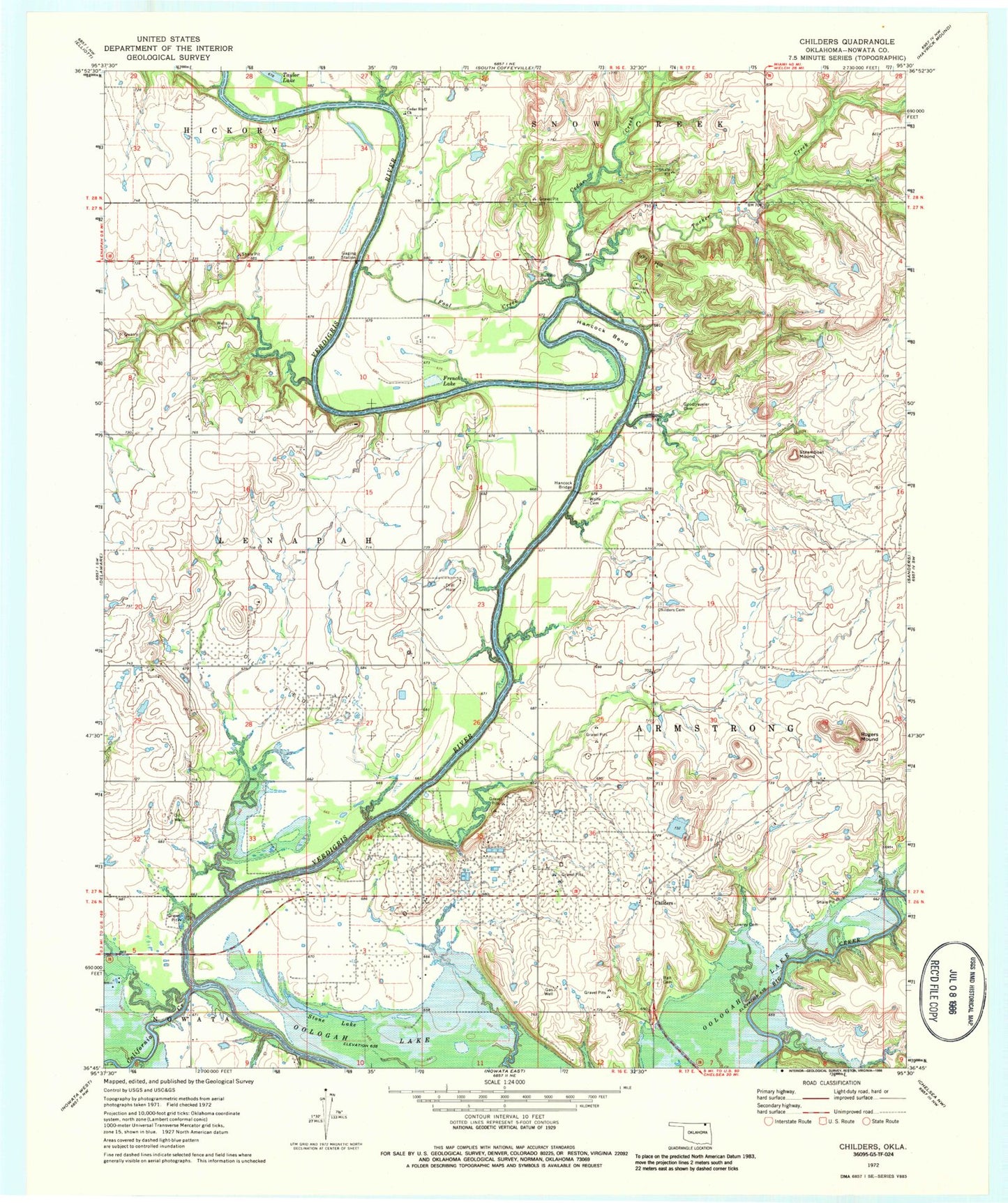
Historical USGS topographic quad map of Childers in the state of Oklahoma. Map scale may vary for some years, but is generally around 1:24,000. Print size is approximately 24" x 27"
This quadrangle is in the following counties: Nowata.
The map contains contour lines, roads, rivers, towns, and lakes. Printed on high-quality waterproof paper with UV fade-resistant inks, and shipped rolled.
Contains the following named places: Ball Cemetery, Buffalo Cemetery, California Creek, Cedar Bluff Church, Cedar Creek, Childers, Childers Chapel Cemetery, Fool Creek, French Lake, Goodtraveler Cemetery, Hancock Bend, Hancock Bridge, Lenapah-Delaware Division, Lowrey Cemetery, Nowata County, Nowata Non-Community, Rogers Mound, Steamboat Mound, Stone Lake, Tucker Creek, Tully Hill, Wells Cemetery, Wolfe Cemetery, ZIP Codes: 74027, 74042