MyTopo
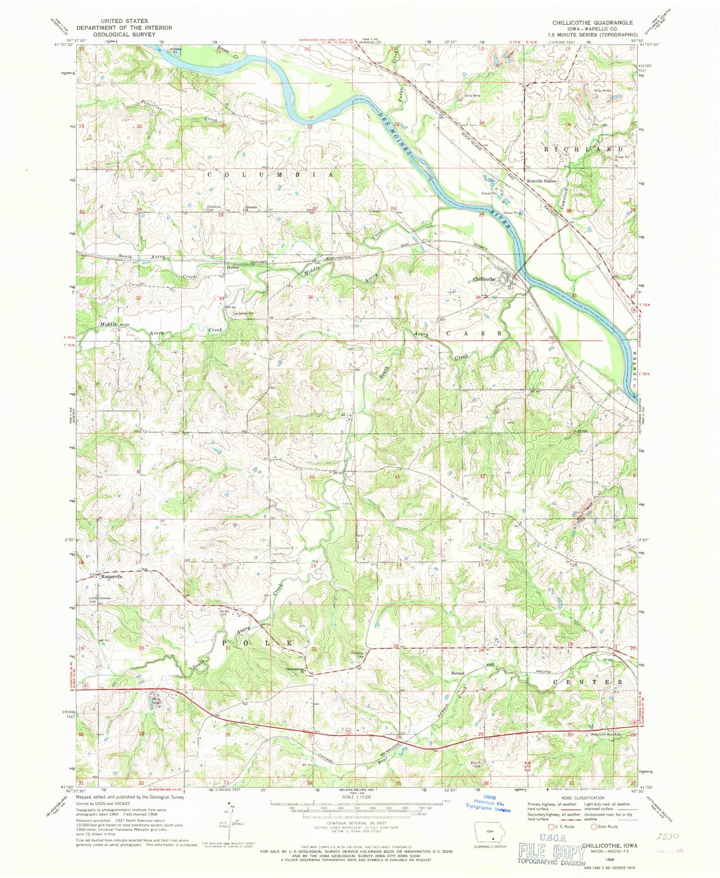
Classic USGS Chillicothe Iowa 7.5'x7.5' Topo Map
Couldn't load pickup availability
Historical USGS topographic quad map of Chillicothe in the state of Iowa. Map scale may vary for some years, but is generally around 1:24,000. Print size is approximately 24" x 27"
This quadrangle is in the following counties: Wapello.
The map contains contour lines, roads, rivers, towns, and lakes. Printed on high-quality waterproof paper with UV fade-resistant inks, and shipped rolled.
Contains the following named places: Bidwell, Bidwell Post Office, Bowen Cemetery, Brooks Cemetery, Brown Creek, Chillicothe, Chillicothe Cemetery, Chillicothe First Responders, Chillicothe Post Office, Chisman Cemetery, Christianburg Church, Christiansburgh Post Office, City of Chillicothe, Columbia Cemetery, Columbia Church, Comstock Cemetery, Comstock Creek, Comstock Post Office, Comstock Station, Dudley, Dudley Post Office, Folgman Cemetery, Fountain Springs Post Office, Fudge Creek, Griffith Cemetery, Happy Hollow, Happy Hollow Post Office, Kirkville Station, Little Chisman Cemetery, McNeese Wildlife Area, Middle Avery Creek, Munterville, Munterville Cemetery, Munterville Lutheran Church, Munterville Post Office, Myrick Cemetery, North Avery Creek, Palestine Creek, Sand Stone, Shocks Post Office, Shocks Station, Smith Cemetery, South Avery Creek, Township of Cass, Township of Columbia, Township of Polk, West Gate Rest Area, Willard, Willard Post Office, Williams Cemetery, ZIP Code: 52548