MyTopo
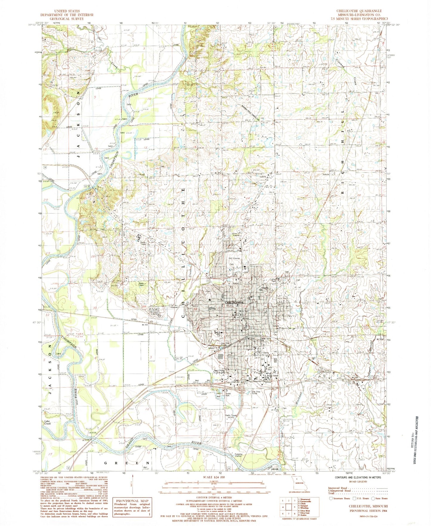
Classic USGS Chillicothe Missouri 7.5'x7.5' Topo Map
Couldn't load pickup availability
Historical USGS topographic quad map of Chillicothe in the state of Missouri. Map scale may vary for some years, but is generally around 1:24,000. Print size is approximately 24" x 27"
This quadrangle is in the following counties: Livingston.
The map contains contour lines, roads, rivers, towns, and lakes. Printed on high-quality waterproof paper with UV fade-resistant inks, and shipped rolled.
Contains the following named places: Adams School, Bishop Hogan Memorial School, Bliss School, Carlton Lake Dam, Central School, Chillicothe, Chillicothe Alternative Center for Education, Chillicothe Correctional Center, Chillicothe Fire Department, Chillicothe High School, Chillicothe Middle School, Chillicothe Police Department, Chillicothe Post Office, City of Chillicothe, Coon Creek, Copeland Lake Dam, Dewey School, Edgewood Cemetery, Field Elementary School, Garrison School, Girdner School, Graham Mill Bridge, Grand River Technical School, Green Grove School, Hamilton Lake East Dam, Hamilton Lake West Dam, Hedrick Medical Center, Jones School, KCHI-AM (Chillicothe), KCHI-FM (Chillicothe), Lake Creek, Linville School, Litton Lake North Dam, Litton Lake South Dam, Livingston County, Livingston County Sheriff's Office, Minor School, Number 56 Lake, Oak Grove School, Olenhouse Lake Dam, Owl Creek, Smith Lake Dam, Thistlethwait Lake Dam, Thompson River, Township of Chillicothe, Verelle Peniston State School, Willard School, Woodland School, ZIP Code: 64601