MyTopo
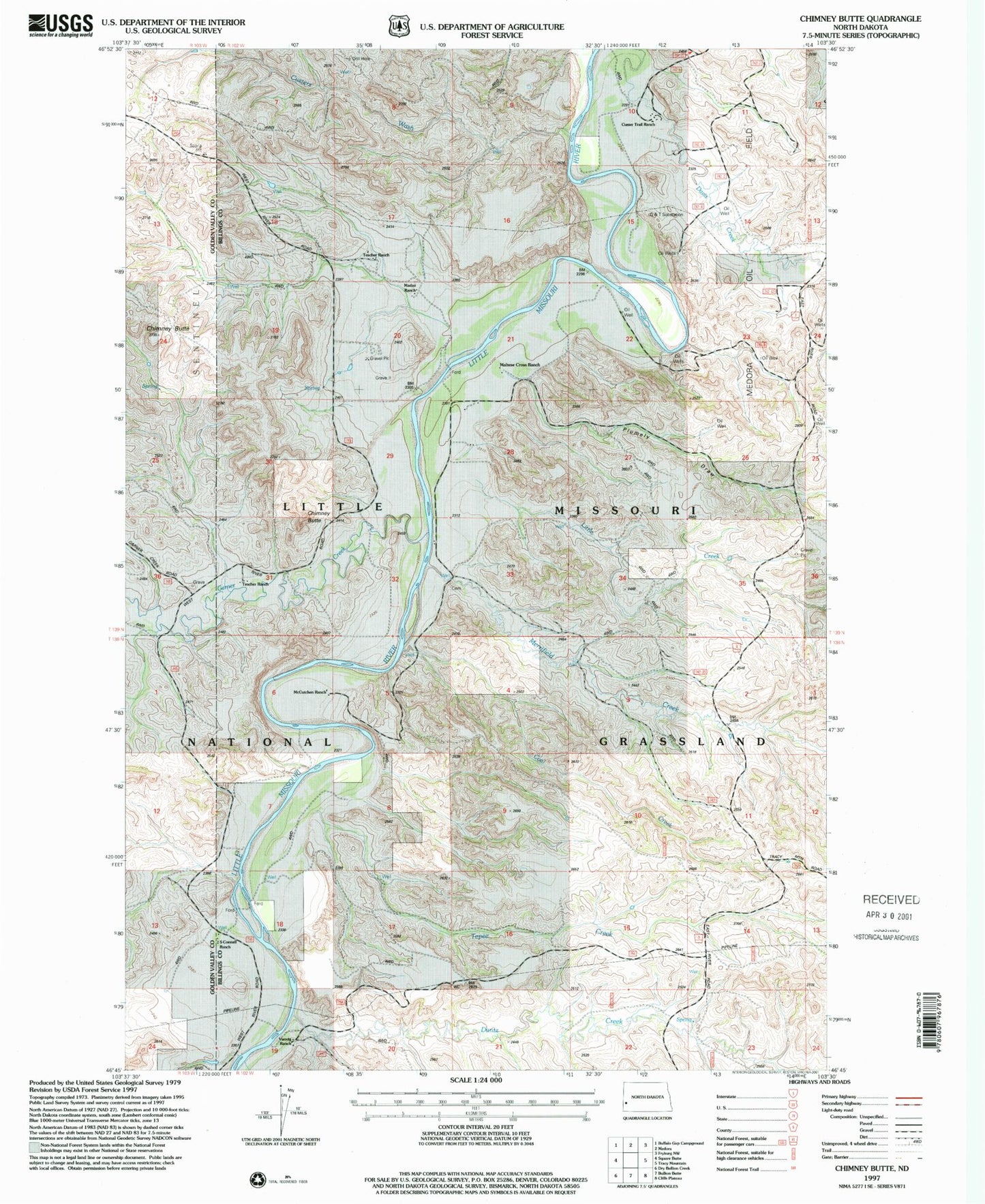
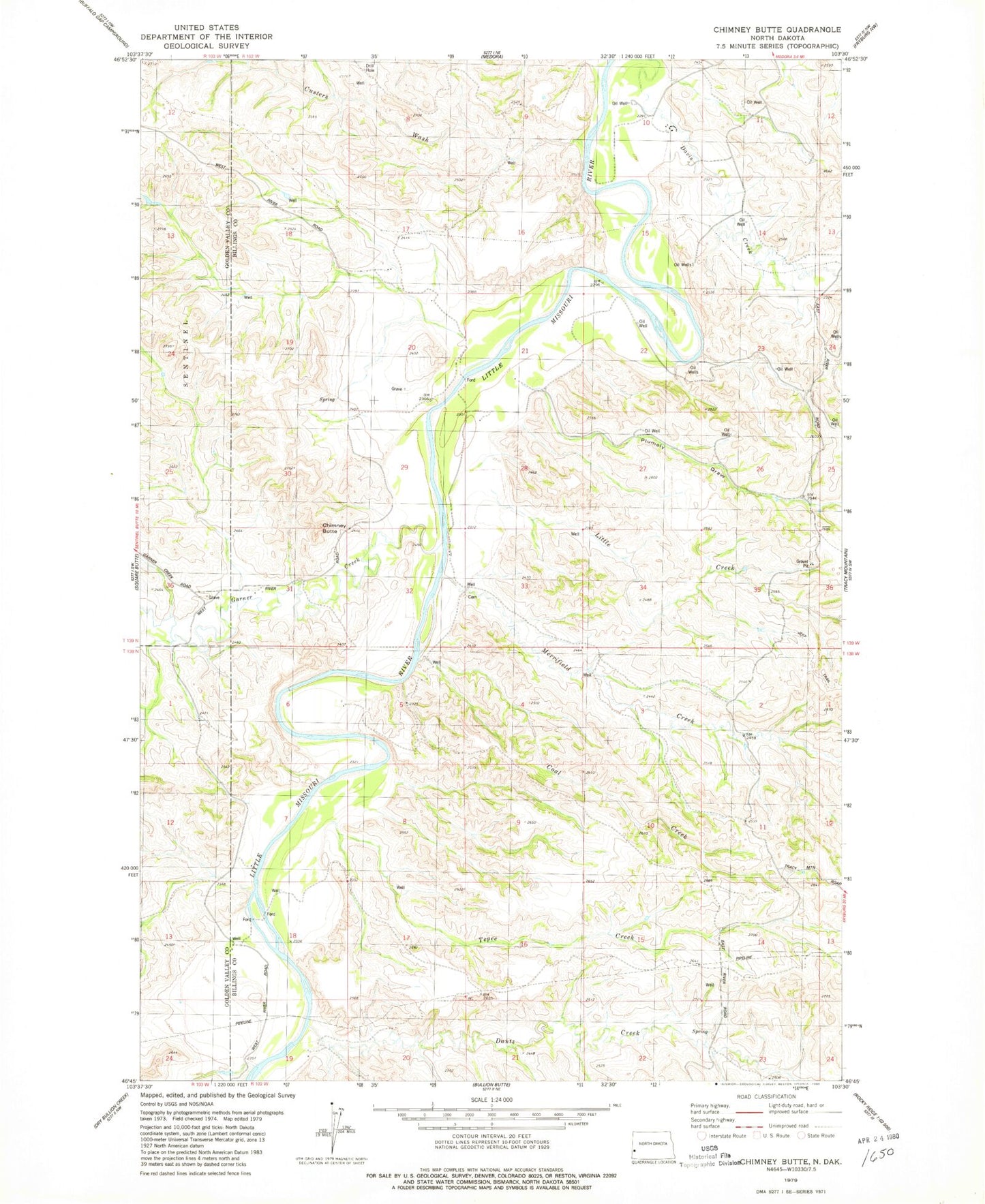
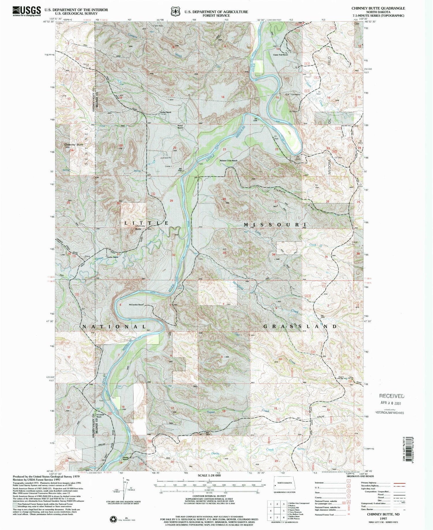
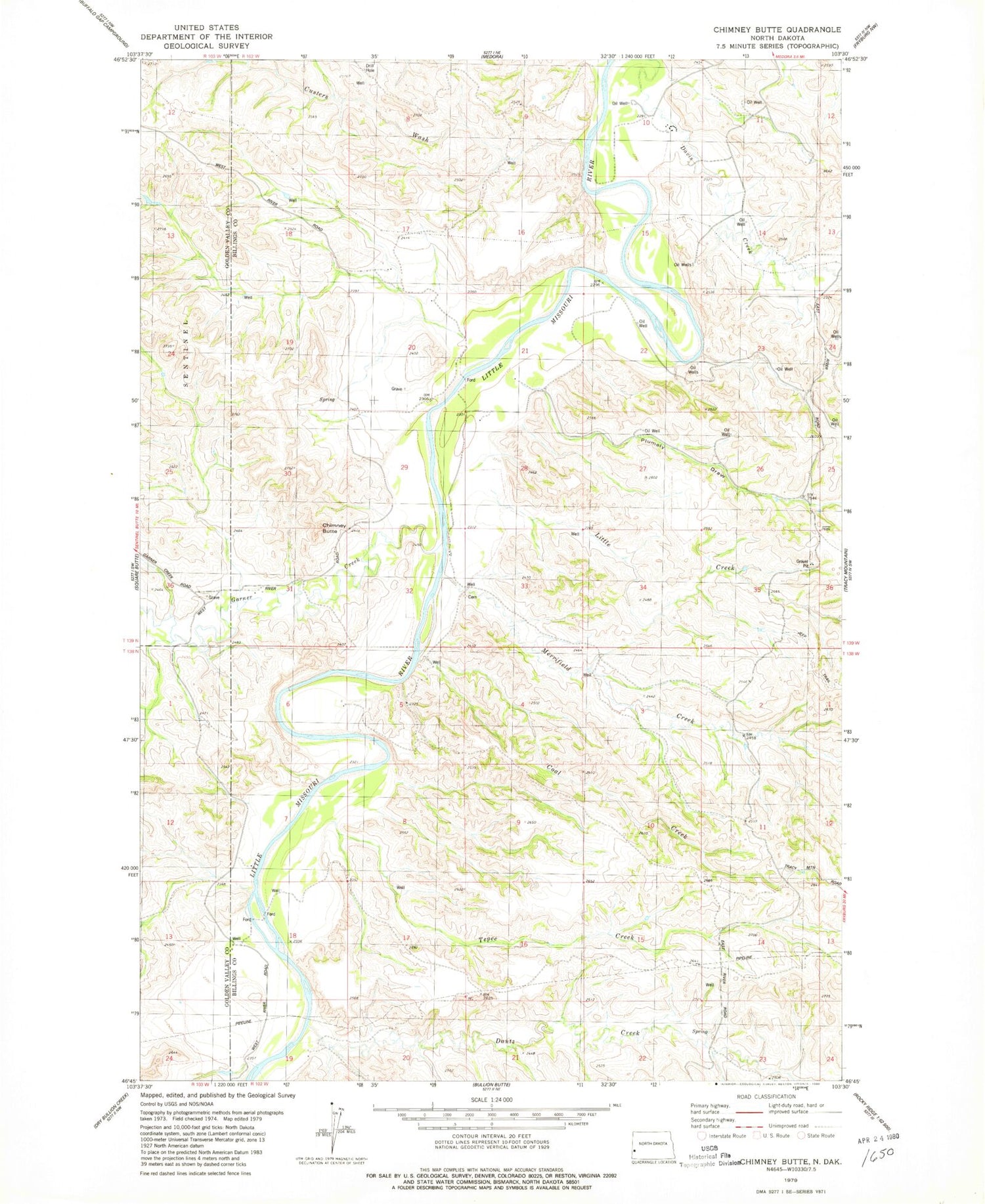
Classic USGS Chimney Butte North Dakota 7.5'x7.5' Topo Map
Couldn't load pickup availability
Historical USGS topographic quad map of Chimney Butte in the state of North Dakota. Map scale may vary for some years, but is generally around 1:24,000. Print size is approximately 24" x 27"
This quadrangle is in the following counties: Billings, Golden Valley.
The map contains contour lines, roads, rivers, towns, and lakes. Printed on high-quality waterproof paper with UV fade-resistant inks, and shipped rolled.
Contains the following named places: Bully Pulpit Golf Course, Burtkhart Ranch, Chimney Butte, Coal Creek, Custer Campground, Custer Trail Ranch, Custers Wash, Dantz Creek, Davis Creek, Garner Creek, Harmon - Tetly Cemetery, Little Creek, Madzo Ranch, Maltese Cross Ranch, McCutchen Ranch, Medora Oil Field, Merrifield Creek, Pellissier Ranch, Plumley Draw, S Connell Ranch, Tepee Creek, Transportation Museum, Vanvig Ranch