MyTopo
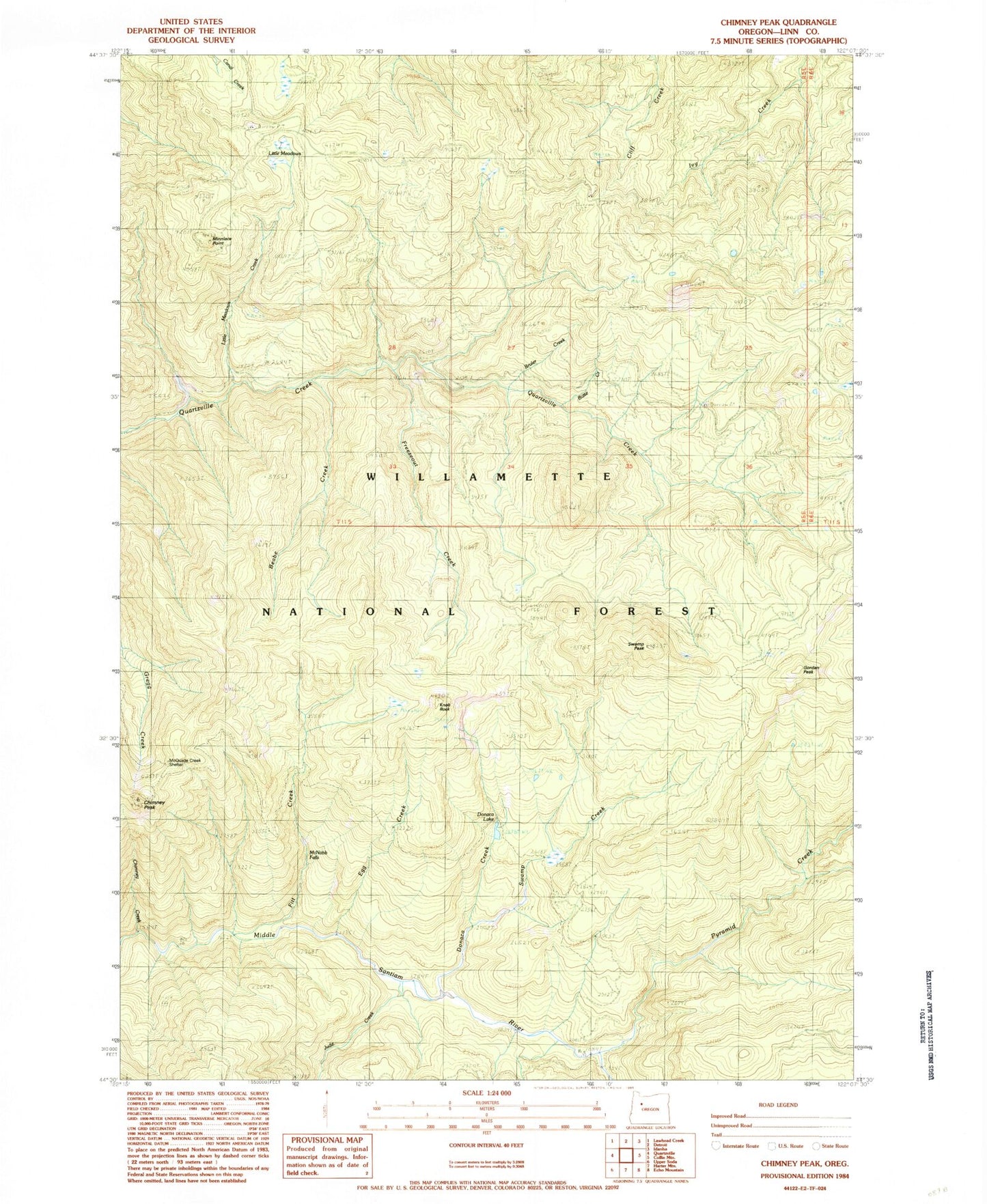
Classic USGS Chimney Peak Oregon 7.5'x7.5' Topo Map
Couldn't load pickup availability
Historical USGS topographic quad map of Chimney Peak in the state of Oregon. Typical map scale is 1:24,000, but may vary for certain years, if available. Print size: 24" x 27"
This quadrangle is in the following counties: Linn.
The map contains contour lines, roads, rivers, towns, and lakes. Printed on high-quality waterproof paper with UV fade-resistant inks, and shipped rolled.
Contains the following named places: McQuade Creek Shelter, McNabb Falls, Beabe Creek, Bruler Creek, Butte Creek, Chimney Creek, Chimney Peak, Chimney Peak Trail, Donaca Creek, Donaca Lake, Egg Creek, Fitt Creek, Freezeout Creek, Gordan Peak, Gordan Peak Trail, Jude Creek, Knob Rock, Little Meadows Creek, Little Meadows, Minniece Point, Pinnacle Peak, Pyramid Creek, Pyramid Trail, Scar Mountain Trail, Swamp Creek, Swamp Peak, Swamp Peak Trail, Minniece Creek, Johnny Creek, Knob Creek, No Man Creek, Hoover Recreation Site, Middle Santiam Wilderness, Detroit Ranger Station