MyTopo
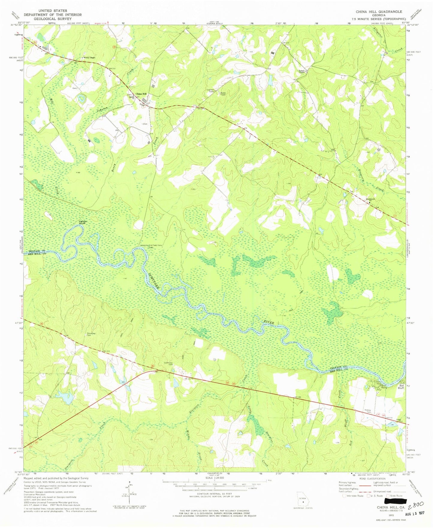
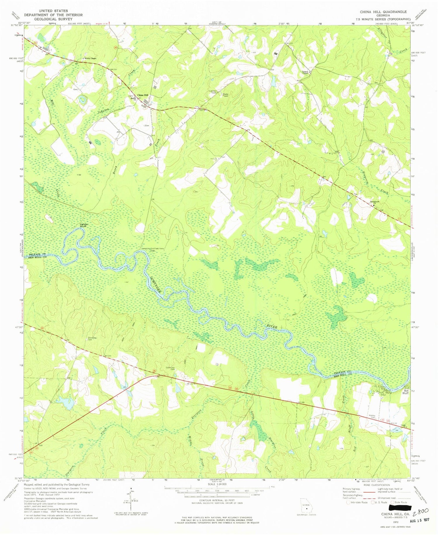
Classic USGS China Hill Georgia 7.5'x7.5' Topo Map
Couldn't load pickup availability
Historical USGS topographic quad map of China Hill in the state of Georgia. Map scale may vary for some years, but is generally around 1:24,000. Print size is approximately 24" x 27"
This quadrangle is in the following counties: Ben Hill, Telfair.
The map contains contour lines, roads, rivers, towns, and lakes. Printed on high-quality waterproof paper with UV fade-resistant inks, and shipped rolled.
Contains the following named places: Ben Hill County Park, Bethel Church, Bethel Church Cemetery, Blockhouse Church, Blockhouse Church Cemetery, Boney Creek, China Hill, Cowan Dam, Dorminey Cemetery, Dorminy Lake, Dorminy Lake Dam, Dorminy School, Fussel Store, Gilder Bluff, James Dormin Dam, Johnson Creek, Lampkins Old Field Ferry, Little Sturgeon Creek, Middle Prong Sturgeon Creek, Mill Creek, Mobley Bluff, Mobley Cemetery, Red Bluff, Red Bluff Creek, Sturgeon Creek, Temple Chapel, Union Church, Wesley Chapel, Yellow Bluff