MyTopo
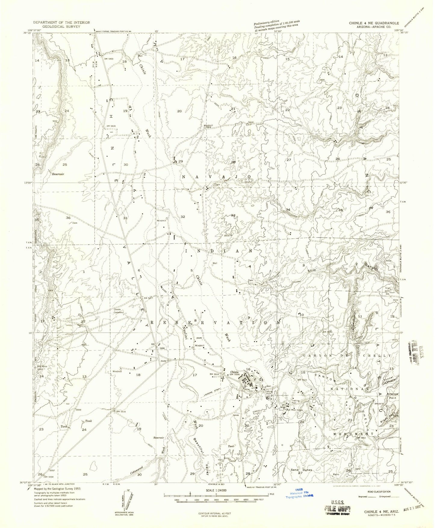
Classic USGS Chinle Arizona 7.5'x7.5' Topo Map
Couldn't load pickup availability
Historical USGS topographic quad map of Chinle in the state of Arizona. Map scale may vary for some years, but is generally around 1:24,000. Print size is approximately 24" x 27"
This quadrangle is in the following counties: Apache.
The map contains contour lines, roads, rivers, towns, and lakes. Printed on high-quality waterproof paper with UV fade-resistant inks, and shipped rolled.
Contains the following named places: Antelope Point, Beautiful Valley, Blade Rock, Canyon De Chelly Elementary School, Canyon de Chelly Trading Post, Canyon de Chelly Visitor Center, Chinle, Chinle Adventist School, Chinle Airport, Chinle Ambulance Services, Chinle Cemetery, Chinle Census Designated Place, Chinle Chapter, Chinle Chapter House, Chinle Community Center, Chinle Comprehensive Health Care Facility - Hospital, Chinle Division, Chinle Elementary School, Chinle Extended Care Center, Chinle High School, Chinle Junior High School, Chinle Post Office, Chinle Water Tank, Cottonwood Canyon, Cottonwood Wash, Mesa View Elementary School, Navajo Nation Department of Fire and Rescue Services Station 50 Chinle Fire Department, Navajo Police Department - Chinle, Navajo Tribal Utility, Nazlini Wash, Sleeping Duck, Slim Canyon, Trinity Presbyterian Church, Tsegi Overlook, Tsos Trading Post, Tunnel Canyon