MyTopo
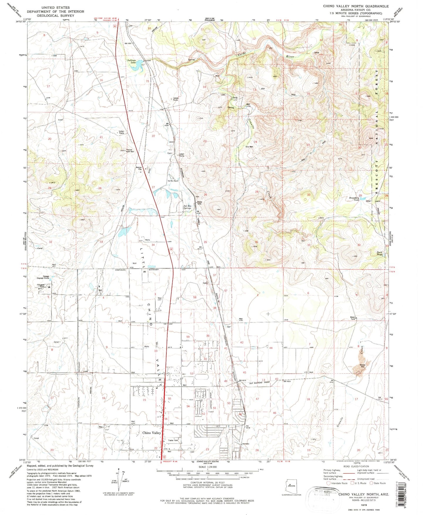
Classic USGS Chino Valley North Arizona 7.5'x7.5' Topo Map
Couldn't load pickup availability
Historical USGS topographic quad map of Chino Valley North in the state of Arizona. Map scale may vary for some years, but is generally around 1:24,000. Print size is approximately 24" x 27"
This quadrangle is in the following counties: Yavapai.
The map contains contour lines, roads, rivers, towns, and lakes. Printed on high-quality waterproof paper with UV fade-resistant inks, and shipped rolled.
Contains the following named places: Arizona Highway Maintenance Chino Valley Yard, Bible Baptist Church, Boundary Tank, Chino Valley, Chino Valley Community Church, Chino Valley District Ranger Office, Chino Valley Fire District Station 61, Chino Valley Police Department, Chino Valley Post Office, Chino Valley Public Library, Chino Valley Word of Life Assembly of God, Copper Railroad Station, Country West Mobile Home Park, Del Rio, Del Rio Dam, Del Rio Elementary School, Del Rio Railroad Station, Del Rio Ranch, Del Rio Springs, Duck Tank, Excel Education Centers - Chino Valley, First Southern Baptist Church of Chino Valley, Granite Creek, Heritage Middle School, Hope Evangelical Lutheran Church, Kingdom Hall of Jehovahs Witnesses, Little Chino Valley, Lonesome Valley, Mingus Springs Charter School, Morgan Ranch and Headquarters, Puro Railroad Station, Roadrunner Mobile Home Park, Saint Catherine Laboure Catholic, Sullivan Dam, Sullivan Lake, Territorial Early Childhood Center School, Town of Chino Valley, Yavapai College Agribusiness and Science Technology Center, ZIP Code: 86323