MyTopo
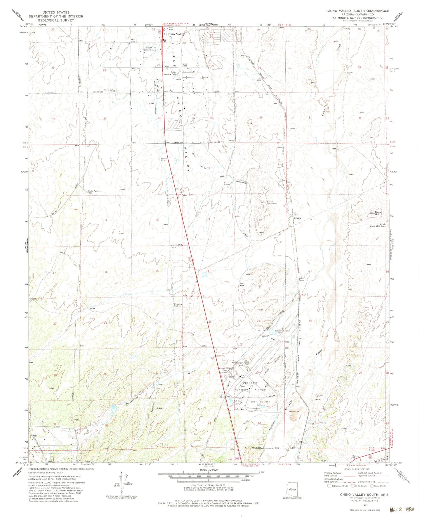
Classic USGS Chino Valley South Arizona 7.5'x7.5' Topo Map
Couldn't load pickup availability
Historical USGS topographic quad map of Chino Valley South in the state of Arizona. Map scale may vary for some years, but is generally around 1:24,000. Print size is approximately 24" x 27"
This quadrangle is in the following counties: Yavapai.
The map contains contour lines, roads, rivers, towns, and lakes. Printed on high-quality waterproof paper with UV fade-resistant inks, and shipped rolled.
Contains the following named places: Antelope Hills Golf Course, Apostolic Christian Church, Black Hill, Bottleneck Wash, Bottleneck Wash Dam, Chino Valley Cemetery, Chino Valley Fire District Station 62, Chino Valley High School, Chino Valley Irrigation Ditch, Chino Valley United Methodist Church, Cooper Farm Landing Strip, Federal Aviation Administration Tower, Grace Baptist Church, Granite Siding, Little Black Hill Tank, Prescott Fire Department Station 73, Prescott Regional Airpark and Commerce Center, Prescott Regional Airport - Ernest A Love Field, Robin Airport, Rolling Hills Cemetery, Saint Luke's Columbarium, Saint Lukes Episcopal Church, Tri - city College Preparatory High School, Tutt, Westside Christian Church