MyTopo
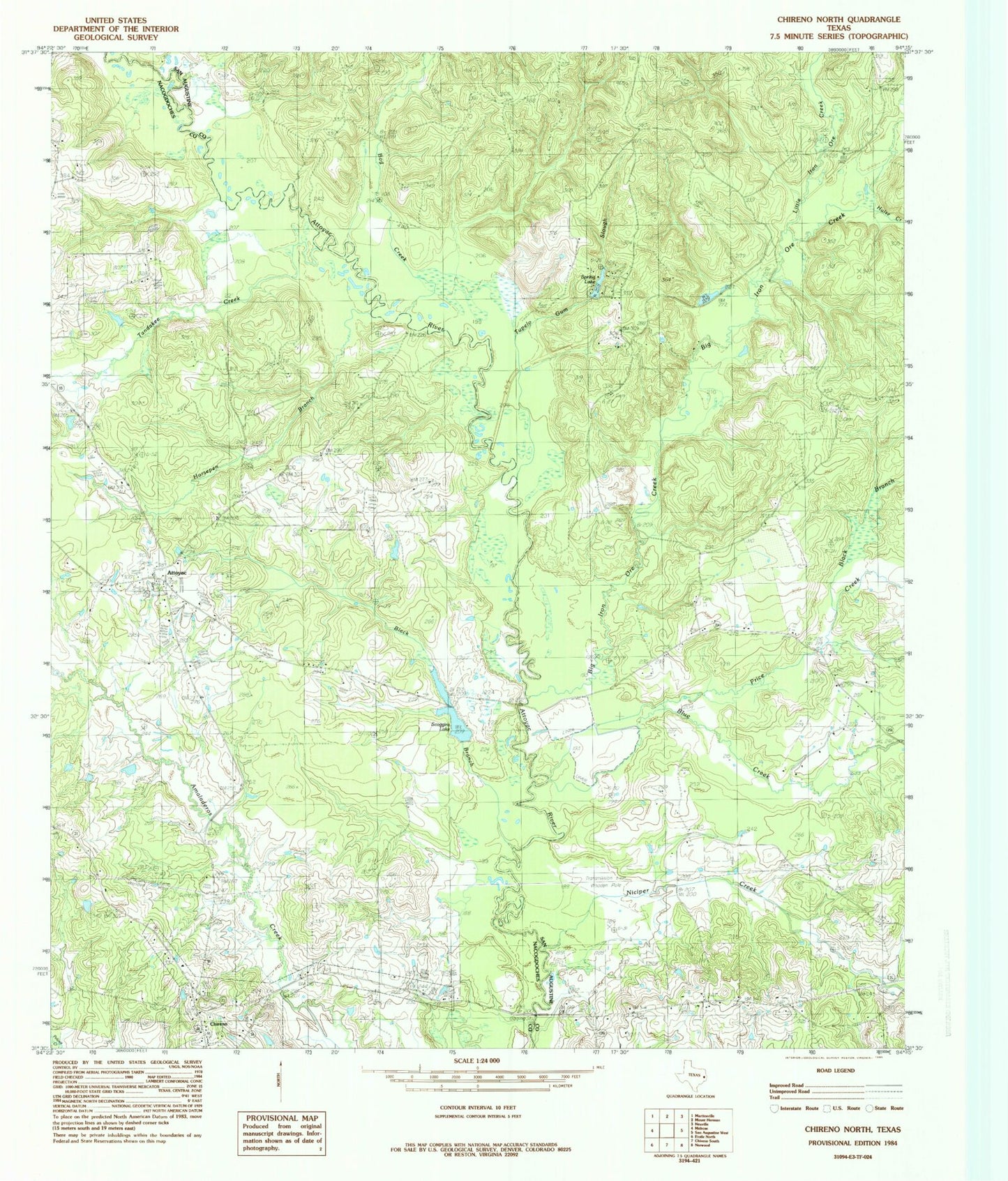
Classic USGS Chireno North Texas 7.5'x7.5' Topo Map
Couldn't load pickup availability
Historical USGS topographic quad map of Chireno North in the state of Texas. Map scale may vary for some years, but is generally around 1:24,000. Print size is approximately 24" x 27"
This quadrangle is in the following counties: Nacogdoches, San Augustine.
The map contains contour lines, roads, rivers, towns, and lakes. Printed on high-quality waterproof paper with UV fade-resistant inks, and shipped rolled.
Contains the following named places: Apostolic Church, Attoyac, Big Iron Ore Creek, Black Branch, Blue Creek, Bog Creek, Camp Worth, Gethsemane Cemetery, Horsepen Branch, Hulse Creek, Little Iron Ore Creek, New Hope, Niciper Creek, Pat Scoggins Dam, Price Creek, Ratcliff Church, Rocky Mound Church, Scoggins Lake, Spring Lake, Spring Lake Dam, Spring Ridge Cemetery, Tandakee Creek, Tupelo Gum Slough