MyTopo
Classic USGS Chloride Arizona 7.5'x7.5' Topo Map
Couldn't load pickup availability
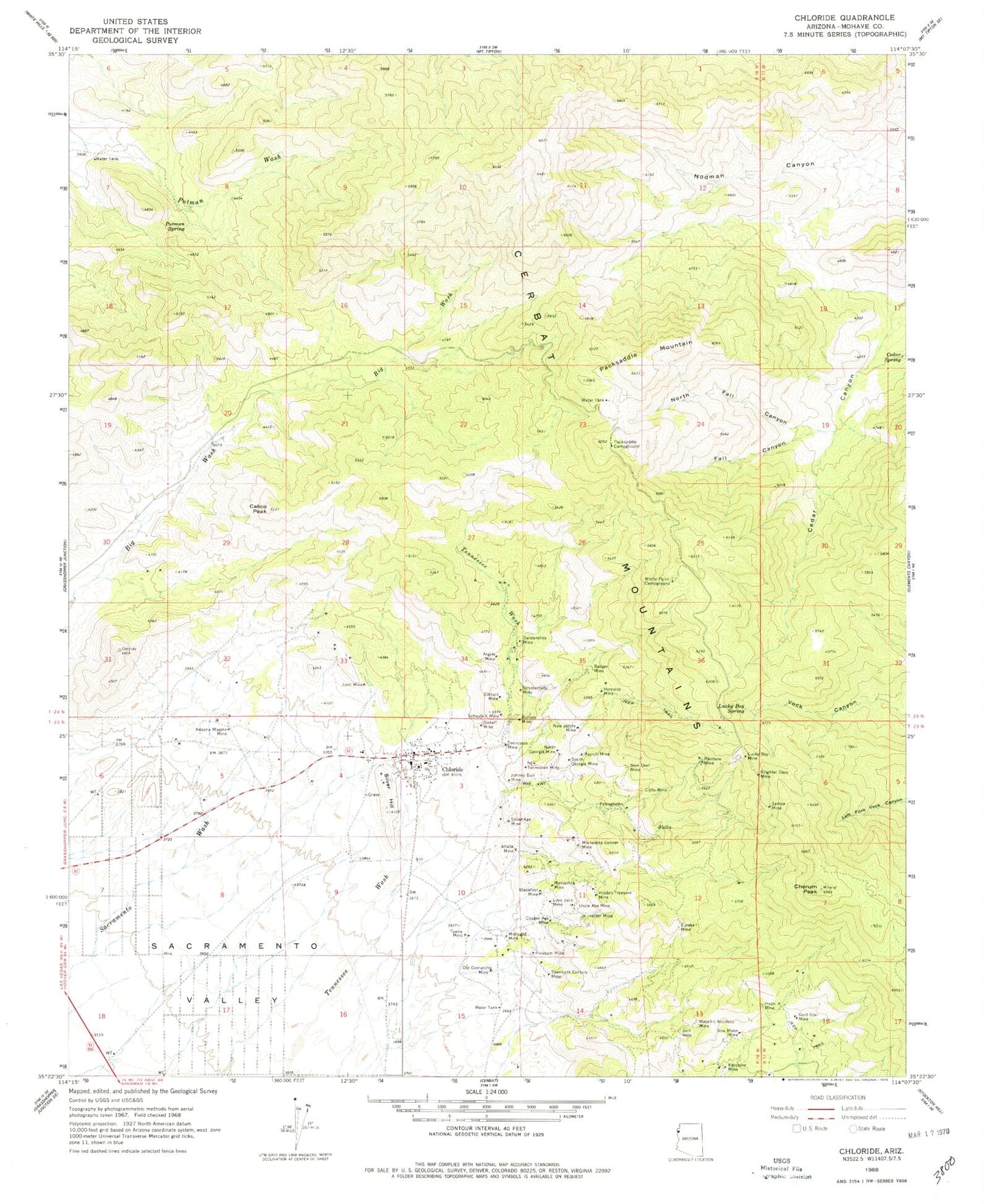
Historical USGS topographic quad map of Chloride in the state of Arizona. Map scale may vary for some years, but is generally around 1:24,000. Print size is approximately 24" x 27"
This quadrangle is in the following counties: Mohave.
The map contains contour lines, roads, rivers, towns, and lakes. Printed on high-quality waterproof paper with UV fade-resistant inks, and shipped rolled.
Contains the following named places: Altata Mine, Argyle Mine, Arizona Magma Mine, Badger Mine, Big Wash Well, Blackfoot Mine, Brighter Days Mine, Bullion Mine, Calico Peak, Cedar Spring, Cerbat Mountains, Cherum Peak, Chloride, Chloride Cemetery, Chloride Census Designated Place, Chloride Community Park, Chloride Elementary School, Chloride First Baptist Church, Chloride Post Office, Clyde Mine, Copper Age Mine, Dardanelles Mine, Distaff Mine, Elkhart Mine, Eureka Mine, Fall Canyon, Fall Spring, Gold Star Mine, Hazel K Mine, Hercules Mine, Hidden Treasure Mine, Johnny Bull Mine, Juno Mine, Jupiter Mine, Keystone Mine, Lone Jack Mine, Lucky Boy Mine, Lucky Boy Spring, Manzanita Mine, Metallic Accident Mine, Midnight Mine, Minnesota Conner Mine, New Deal Mine, New Jersey Mine, New Moon Mine, New Tennessee Mine, North Fall Canyon, North Georgia Mine, Northern Arizona Consolidated Fire District Station 39, Old Comanche Mine, Packsaddle Campground, Packsaddle Mountain, Payroll Mine, Pinkham Mine, Putman Spring, Rainbow Mine, Samoa Mine, Schenectady Mine, Schuylkill Mine, Silver Age Mine, Silver Hill, South Georgia Mine, Swicker Spring, Tennessee Mine, Towne Mine, Twentieth Century Mine, Uncle Abe Mine, Windy Point Campground, ZIP Code: 86431