MyTopo
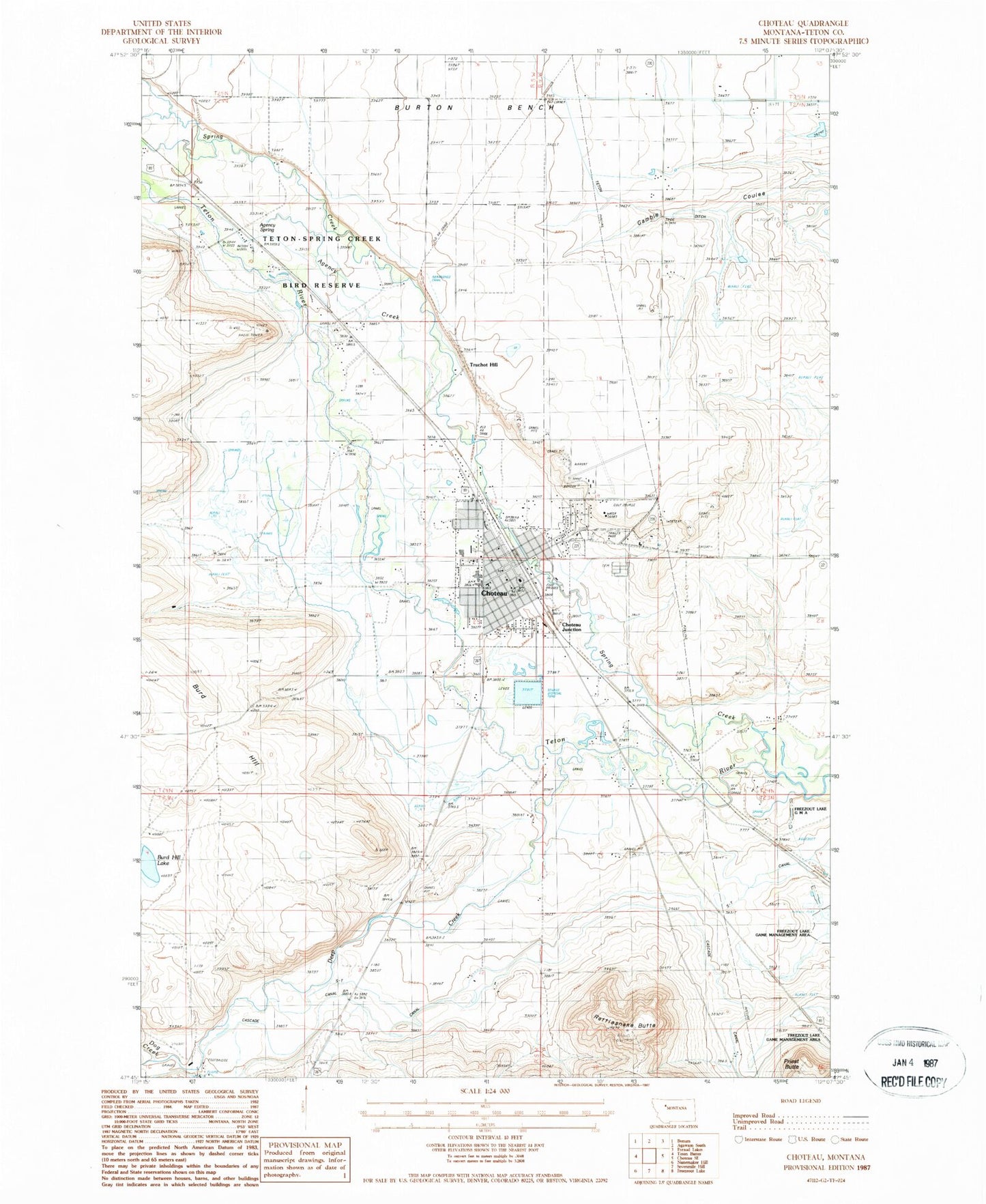
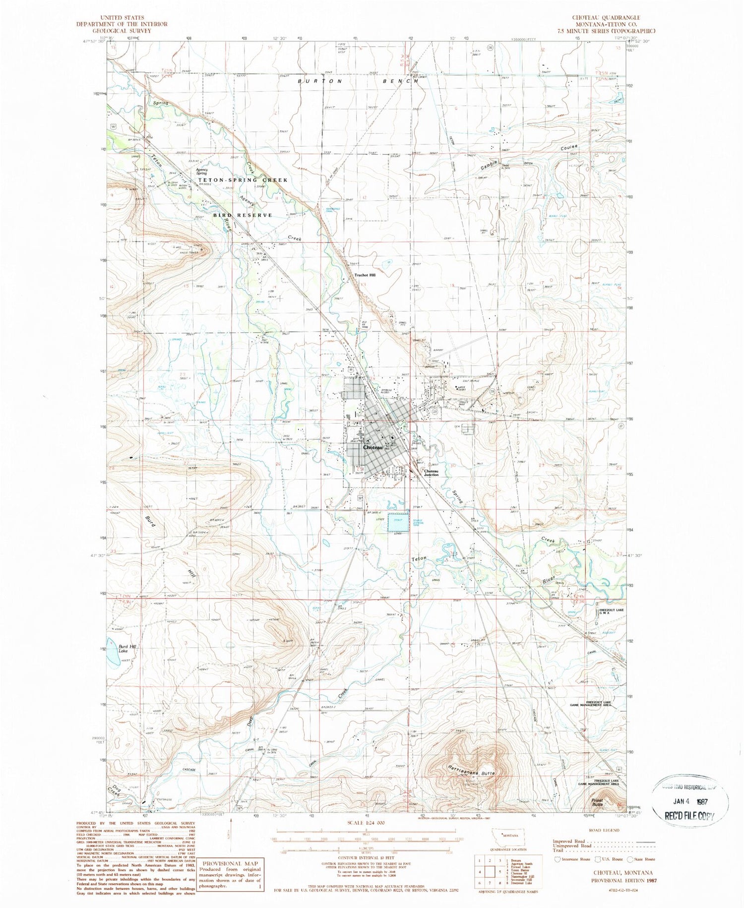
Classic USGS Choteau Montana 7.5'x7.5' Topo Map
Couldn't load pickup availability
Historical USGS topographic quad map of Choteau in the state of Montana. Map scale may vary for some years, but is generally around 1:24,000. Print size is approximately 24" x 27"
This quadrangle is in the following counties: Teton.
The map contains contour lines, roads, rivers, towns, and lakes. Printed on high-quality waterproof paper with UV fade-resistant inks, and shipped rolled.
Contains the following named places: 24N04W05A___01 Well, 24N04W05C___01 Well, 24N04W08CBB_01 Well, 24N04W19C___01 Well, Agency Creek, Agency Spring, Bible Baptist Church, Burd Hill, Burd Hill Lake, Cashman Coulee, Choteau, Choteau Airport, Choteau Cemetery, Choteau Country Club, Choteau Elementary School, Choteau High School, Choteau Junction, Choteau KOA Kampground, Choteau Park and Campground, Choteau Police Department, Choteau Post Office, Choteau Public Library, Choteau Sewage Lagoon Dam, Choteau Volunteer Fire Department, City of Choteau, Claude, Deep Creek, Dog Creek, General Mills Incorporated Elevator, Golden Triangle Community Mental Health Center, Gospel Mission, Harvest States Cooperatives Elevator, New Song Assembly of God Church, Old Agency on the Teton Historical Marker, Old Paths Strict Baptist Church, Old Trail Museum, Priest Butte, Rattlesnake Butte, Saint Josephs Catholic Church, Saint Stephens Episcopal Church, Seventh Day Adventist Church, Spring Creek, S-T Canal, Teton County, Teton County Ambulance Service Choteau, Teton County Courthouse, Teton County Sheriff's Office, Teton Ditch, Teton Medical Center, Teton Medical Center Nursing Home, Teton Medical Office, Teton Nursing Home, Teton-Spring Creek Bird Reserve, The Church of Jesus Christ of Latter Day Saints, Trinity Lutheran Church, Truchot Hill, United Methodist Church