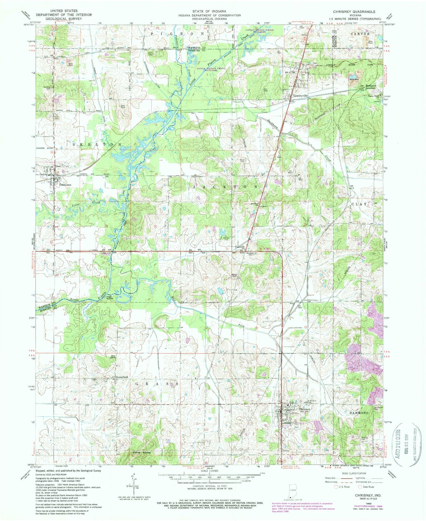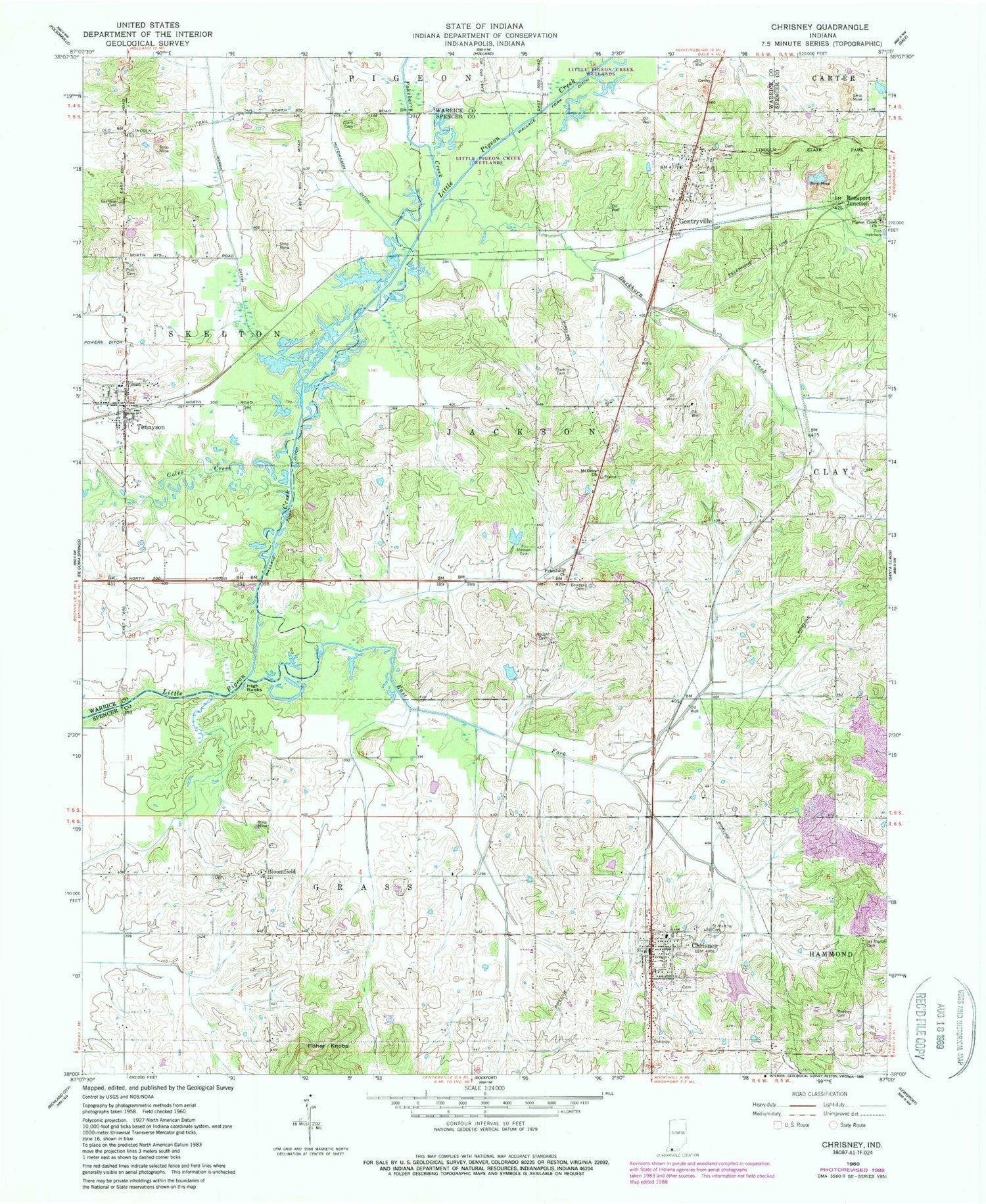
MyTopo
Classic USGS Chrisney Indiana 7.5'x7.5' Topo Map
Couldn't load pickup availability
Historical USGS topographic quad map of Chrisney in the state of Indiana. Map scale may vary for some years, but is generally around 1:24,000. Print size is approximately 24" x 27"
This quadrangle is in the following counties: Spencer, Warrick.
The map contains contour lines, roads, rivers, towns, and lakes. Printed on high-quality waterproof paper with UV fade-resistant inks, and shipped rolled.
Contains the following named places: Beasley Cemetery, Bender Cemetery, Bloomfield, Buckhorn Creek, Chrisney, Chrisney Ditch, Chrisney Elementary School, Chrisney Lake, Chrisney Lake Dam, Chrisney Post Office, Chrisney Town Marshal's Office, Chrisney Volunteer Fire Department, Clark Cemetery, Coles Creek, East Fork Little Pigeon Creek, Friendship Church, Garrison Cemetery, Gentryville, Gentryville Post Office, Hesson Cemetery, High Banks, Hutchinson Ditch, Jackson Township Volunteer Fire Department Gentryville, Kercheval, Little Pigeon Creek, Mount Moriah Cemetery, Mount Olive Church, Pigeon, Pigeon Creek Church, Polk Cemetery, Polkberry Ditch, Rockport Junction, Saint Martins Catholic Cemetery, Skelton - Owen Fire Territory, Spencer County, Stark Cemetery, Tennyson, Tennyson Post Office, Tennyson Town Marshal, Town of Chrisney, Town of Gentryville, Town of Tennyson, Township of Grass, Township of Jackson, Wallace Fork Ditch, Wires Ditch, Wright Cemetery, ZIP Codes: 47537, 47611