MyTopo
Classic USGS Christenson Reservoir Montana 7.5'x7.5' Topo Map
Couldn't load pickup availability
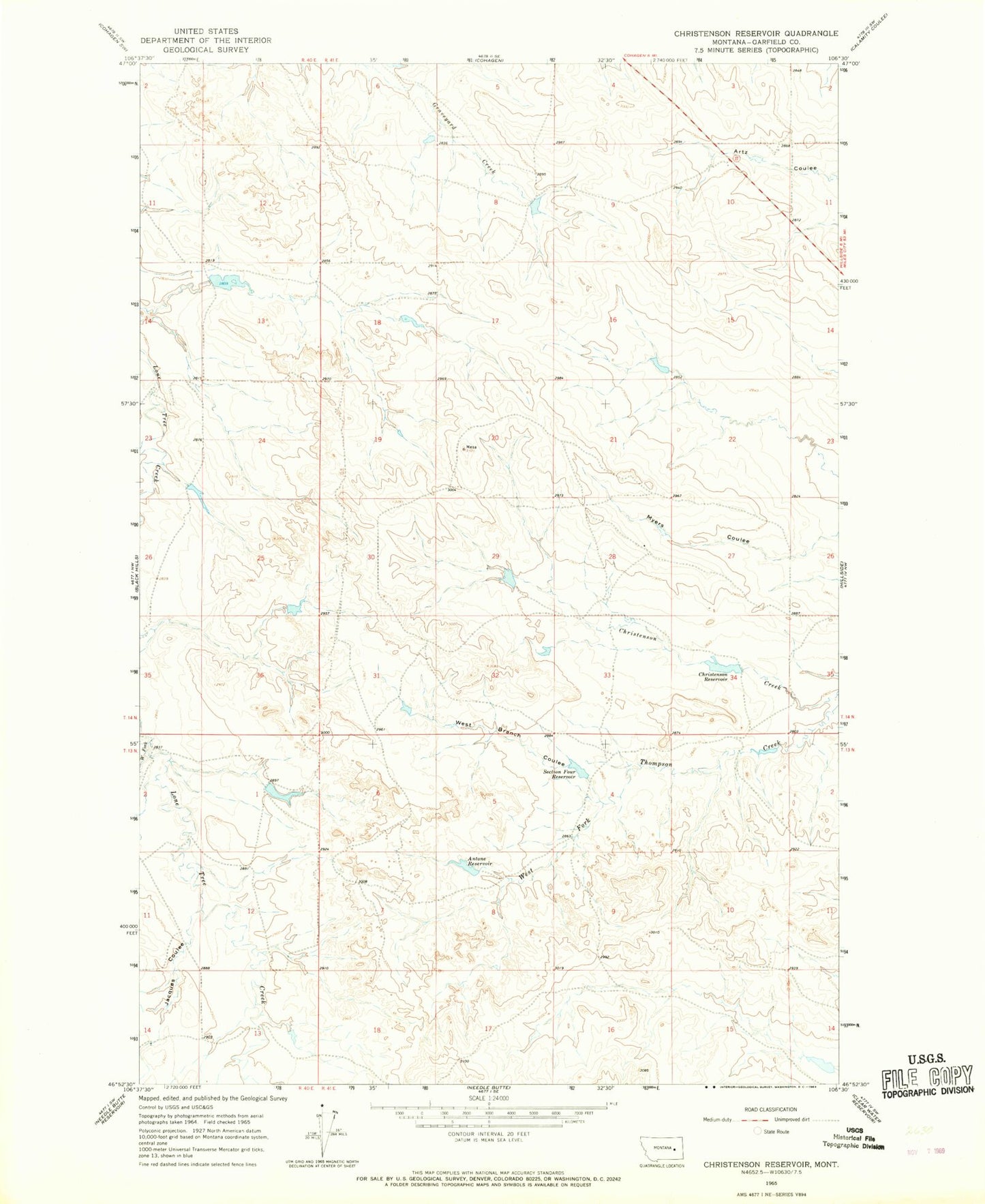
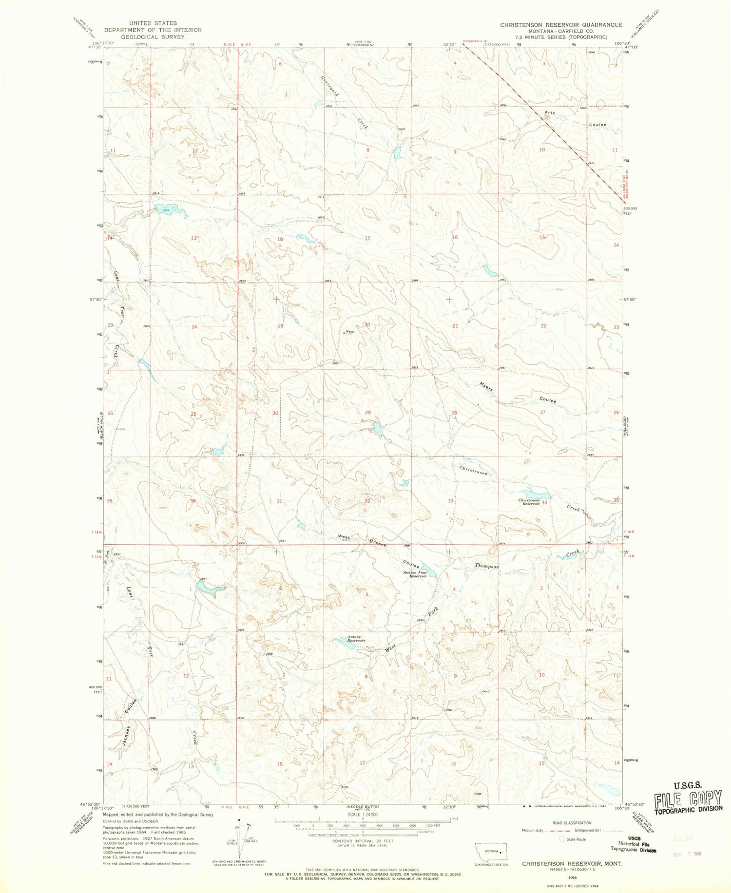
Historical USGS topographic quad map of Christenson Reservoir in the state of Montana. Map scale may vary for some years, but is generally around 1:24,000. Print size is approximately 24" x 27"
This quadrangle is in the following counties: Garfield.
The map contains contour lines, roads, rivers, towns, and lakes. Printed on high-quality waterproof paper with UV fade-resistant inks, and shipped rolled.
Contains the following named places: Antone Reservoir, Bob Number 4 Dam, Bob Number 6 Dam, Bob Number 8 Dam, Christenson Creek, Christenson Dam, Christenson Reservoir, Disco Creek Dam, Harmony Dam, Jacques Coulee, Myers Coulee, Section Four Dam, Section Four Reservoir, Smith Ranch 4 Dam, West Branch Coulee, West Fork Lone Tree Creek