MyTopo
Classic USGS Christmas Arizona 7.5'x7.5' Topo Map
Couldn't load pickup availability
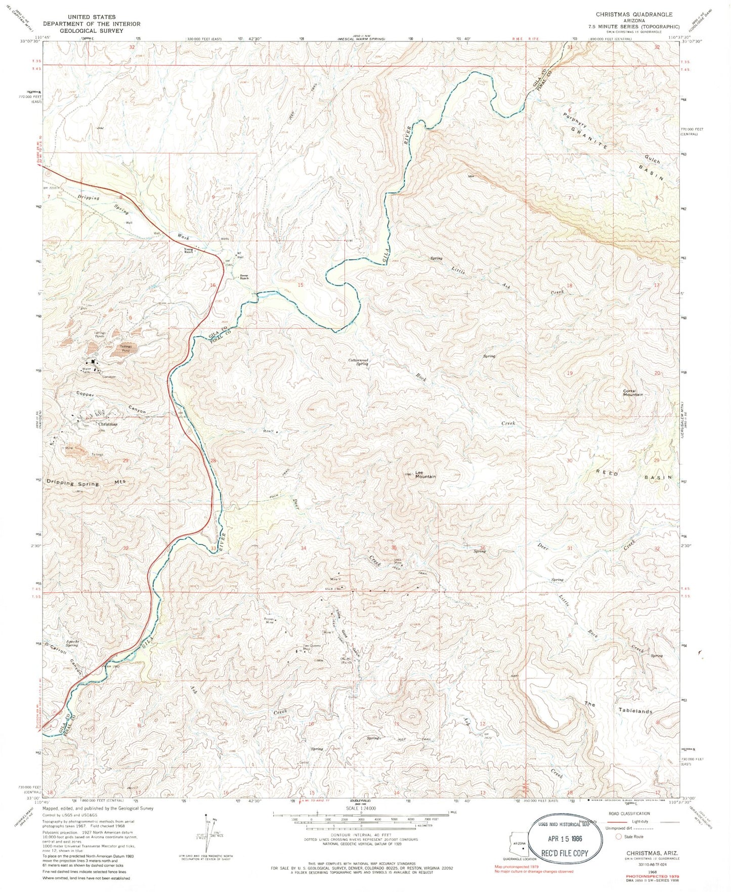
Historical USGS topographic quad map of Christmas in the state of Arizona. Map scale may vary for some years, but is generally around 1:24,000. Print size is approximately 24" x 27"
This quadrangle is in the following counties: Gila, Pinal.
The map contains contour lines, roads, rivers, towns, and lakes. Printed on high-quality waterproof paper with UV fade-resistant inks, and shipped rolled.
Contains the following named places: Apache Spring, Ash Creek, Christmas, Christmas Mill and Mine, Christmas Tailings Dam Number Five, Christmas Tailings Dam Number One, Christmas Tailings Dam Number Seven, Christmas Tailings Dam Number Six, Christmas Tailings Dam Number Three, Christmas Tailings Dam Number Two, Copper Canyon, Corral Mountain, Cottonwood Spring, Deer Creek, Dripping Spring Wash, Dripping Springs Valley, Granite Basin, Lee Mountain, Lees Mine, Little Ash Creek, Little Gold Gulch, Little Rock Creek, O'Carroll Canyon, Old Mill, Pooles Mine, Porphyry Gulch, Reese Ranch, Rock Creek, The Tablelands, Two Queens Mine, Young Ranch