MyTopo
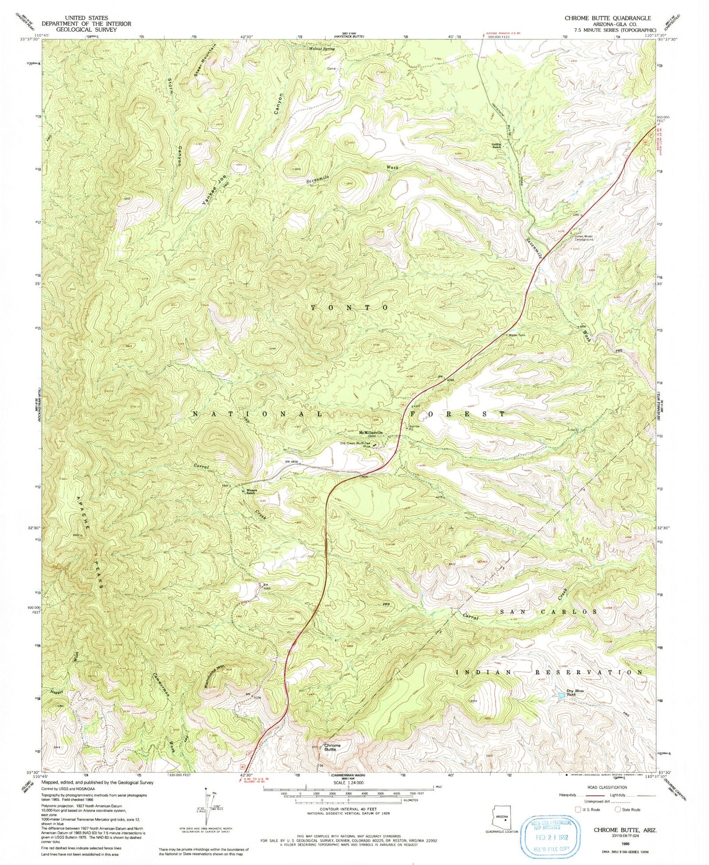
Classic USGS Chrome Butte Arizona 7.5'x7.5' Topo Map
Couldn't load pickup availability
Historical USGS topographic quad map of Chrome Butte in the state of Arizona. Map scale may vary for some years, but is generally around 1:24,000. Print size is approximately 24" x 27"
This quadrangle is in the following counties: Gila.
The map contains contour lines, roads, rivers, towns, and lakes. Printed on high-quality waterproof paper with UV fade-resistant inks, and shipped rolled.
Contains the following named places: Apache Peaks, Bixby Well Number Two, Bootleg Spring, Butte Tank, Chalky Butte, Chalky Butte Well, Chrome Butte, Coburn Spring, Coburn Spring Number Two, Coburn Tank, Coburn Well, Corral Canyon Spring, Cottonwood Well, Double Corral Spring, Dry Mesa Dam, Dry Mesa Tank, Griffin Ranch, Hudson Spring, Indian Garden Spring, Indian Garden Well, Jones Water Campground, Last Chance Spring, Left Fork Honeysuckle Spring, Little Buttes Well, Little Pipe Spring, Little Richmond Tank, Little Woodcamp Spring, Lower Wood Camp Spring, McMillanville Town Well, McMillianville, Montes Spring, Mud Spring, Oak Spring, Oakie Spring, Old Owen McMillan Mine, Richmond Mountain, Richmond Spring, Right Fork Honeysuckle Spring, Rock Hole Spring, Rock Spring, Saint John Tank, Seven Mile Well, Slinkard Spring, Steer Mountain, Storm Canyon Spring, Stutter Spring, Surveyor Spring, Sycamore Spring, Trap Mesa Spring, Upper Cox Canyon Spring, Upper Yankee Joe Spring, Walnut Spring, Willow Spring, Winters Ranch, Winters Well, Woodcamp Spring, Yankee Joe Spring