
MyTopo
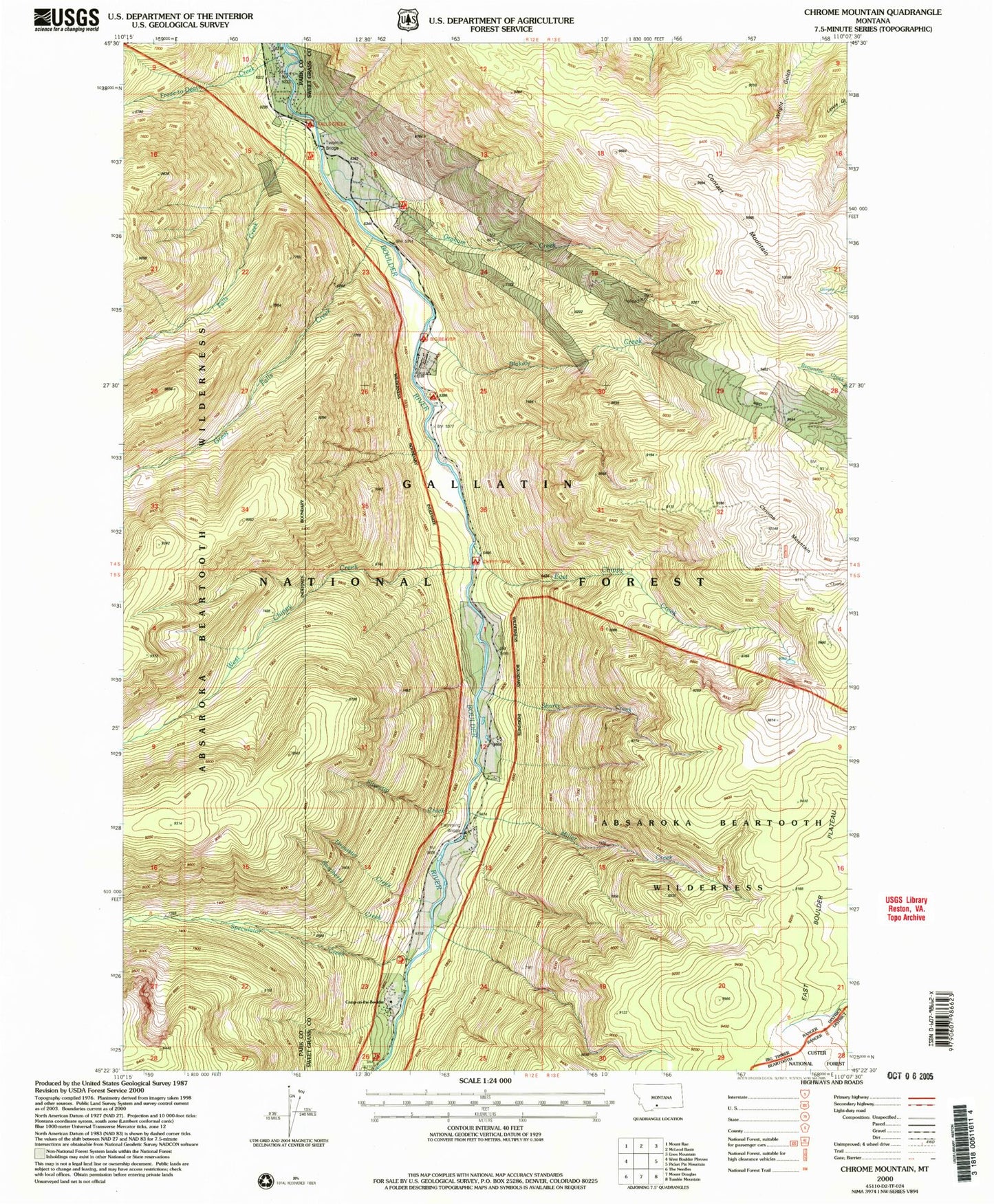
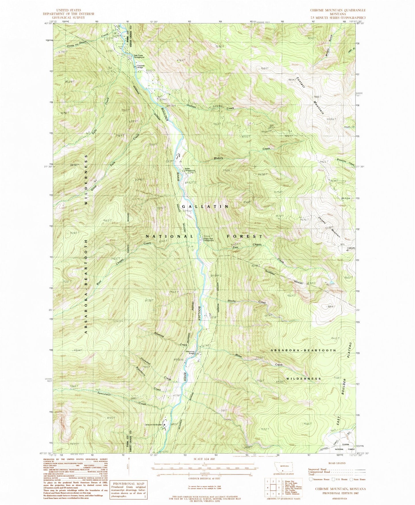
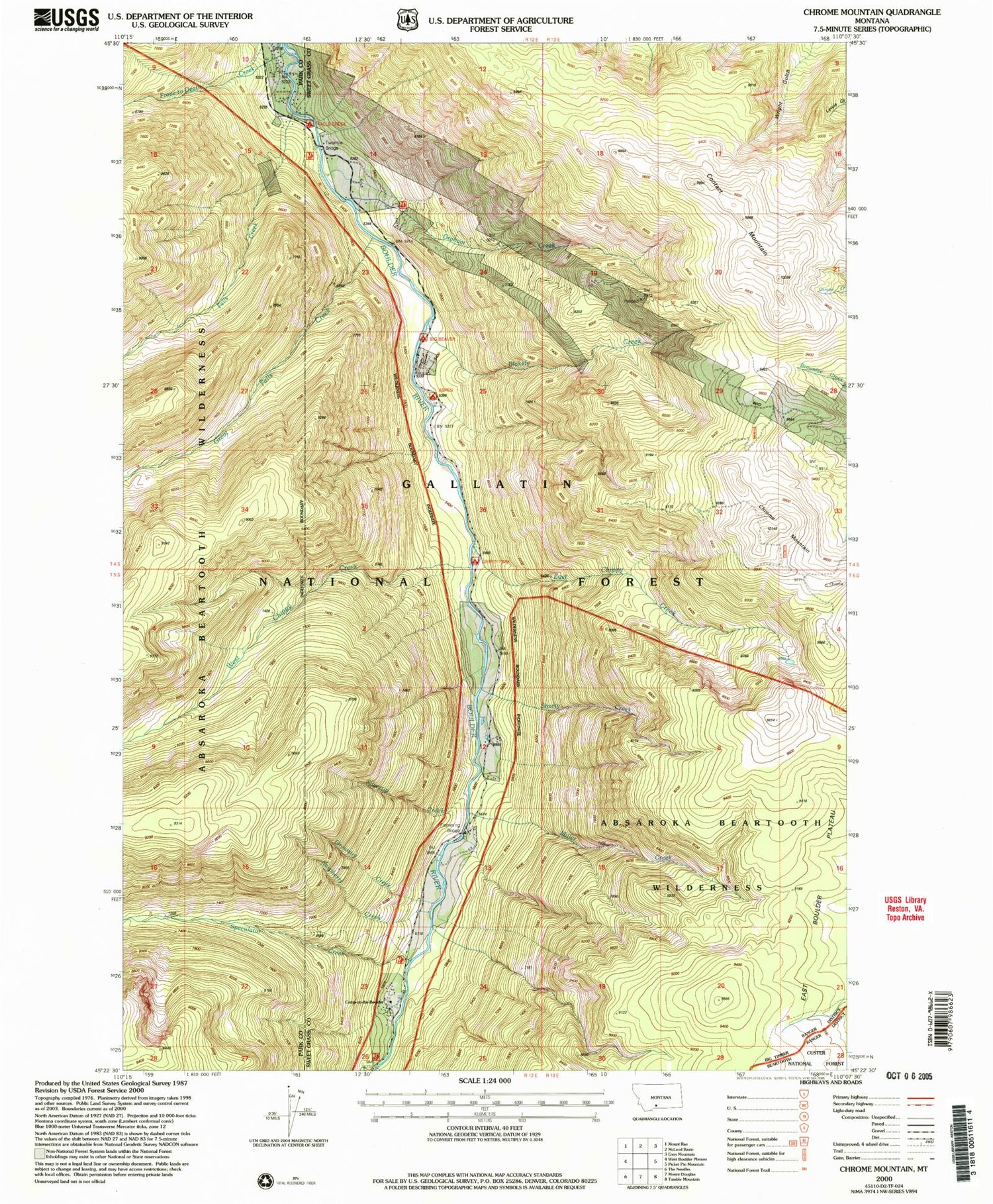
Classic USGS Chrome Mountain Montana 7.5'x7.5' Topo Map
Couldn't load pickup availability
Historical USGS topographic quad map of Chrome Mountain in the state of Montana. Map scale may vary for some years, but is generally around 1:24,000. Print size is approximately 24" x 27"
This quadrangle is in the following counties: Park, Sweet Grass.
The map contains contour lines, roads, rivers, towns, and lakes. Printed on high-quality waterproof paper with UV fade-resistant inks, and shipped rolled.
Contains the following named places: 04S12E25CBBD02 Well, 59052, Aspen Campground, Big Beaver Campground, Blakely Creek, Bonanza Number 3 Mine, Boulder River Number 1 Mine, Camp-on-the-Boulder, Chippy Park Campground, Chrome Mountain, Clydehurst Ranch, Contact Mountain, East Chippy Creek, Falls Creek, Falls Creek Campground, Firewater Creek, Flemming Bridge, Froze-to-Death Creek, Gish Mine, Graham Creek, Great Falls Creek, Hells Canyon Ranch, Lower Gish Mine, Middle Gish Mine, Miller Creek, Nicon Number 1 Mine, Raspberry Creek, Red Fox Claim Mine, Shorty Creek, Silvertip Creek, Skillman Mine, Speculator Creek, Twomile Bridge, Upper Gish Mine, West Chippy Creek