MyTopo
Classic USGS Chrome California 7.5'x7.5' Topo Map
Couldn't load pickup availability
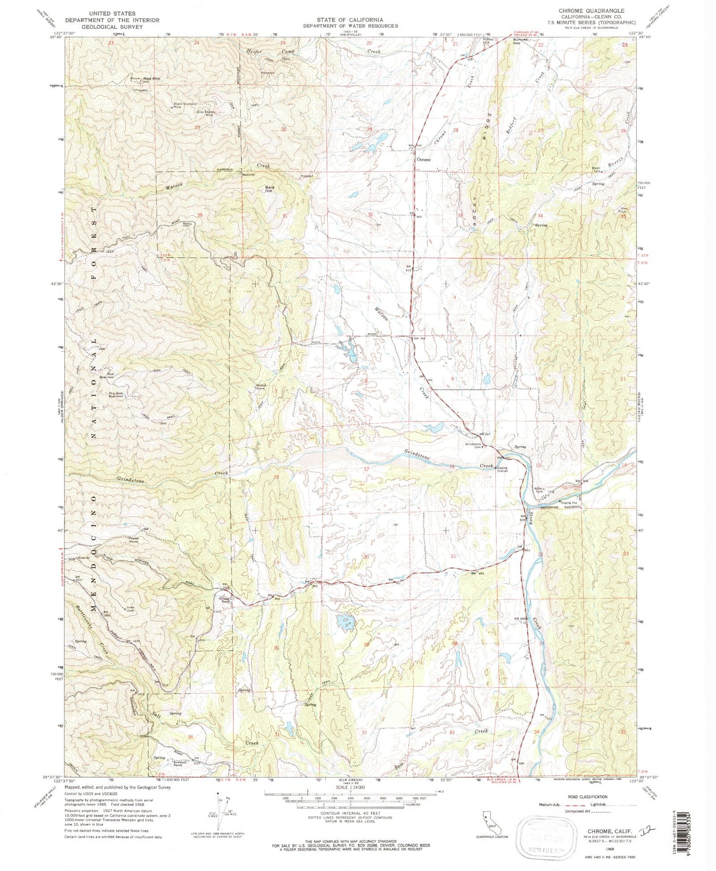
Historical USGS topographic quad map of Chrome in the state of California. Map scale may vary for some years, but is generally around 1:24,000. Print size is approximately 24" x 27"
This quadrangle is in the following counties: Glenn.
The map contains contour lines, roads, rivers, towns, and lakes. Printed on high-quality waterproof paper with UV fade-resistant inks, and shipped rolled.
Contains the following named places: Bald Hill, Black Diamond Mine, Chrome, Chrome Cemetery, Dry Lake Reservoir, East Reservoir, Gillaspy Ranch, Gray Eagle Mine, Grindstone Cemetery, Grindstone Creek, Grindstone Indian Rancheria, Hamilton 374 Dam, James E Drew 373 Dam, Powder House, Rattlesnake Creek, Red Mountain, Rocky Ridge, Rowcroft Ranch, Salt Creek, Watson Creek, Watson Grave