MyTopo
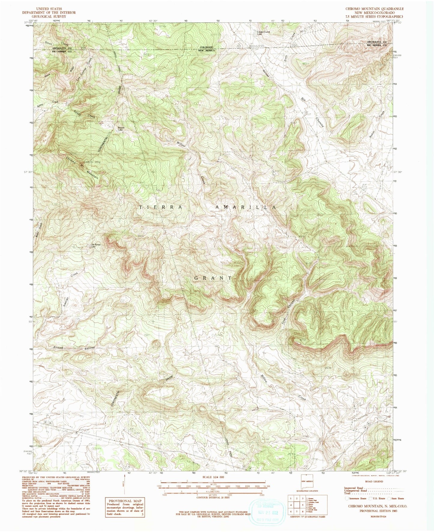
Classic USGS Chromo Mountain New Mexico 7.5'x7.5' Topo Map
Regular price
$16.95
Regular price
Sale price
$16.95
Unit price
per
Couldn't load pickup availability
Historical USGS topographic quad map of Chromo Mountain in the states of New Mexico, Colorado. Map scale may vary for some years, but is generally around 1:24,000. Print size is approximately 24" x 27"
This quadrangle is in the following counties: Archuleta, Rio Arriba.
The map contains contour lines, roads, rivers, towns, and lakes. Printed on high-quality waterproof paper with UV fade-resistant inks, and shipped rolled.
Contains the following named places: Arroyo Salitrar, Azotea Tunnel, Beaver Lake, Chromo Mountain, Clydes Corral Lake, Estufa Creek, Las Ranas Lake, Los Cuatas Creek, Nabor Creek, Sixto Creek, Stove Ridge, Tuck Canyon, Willow Creek, ZIP Code: 87520