MyTopo
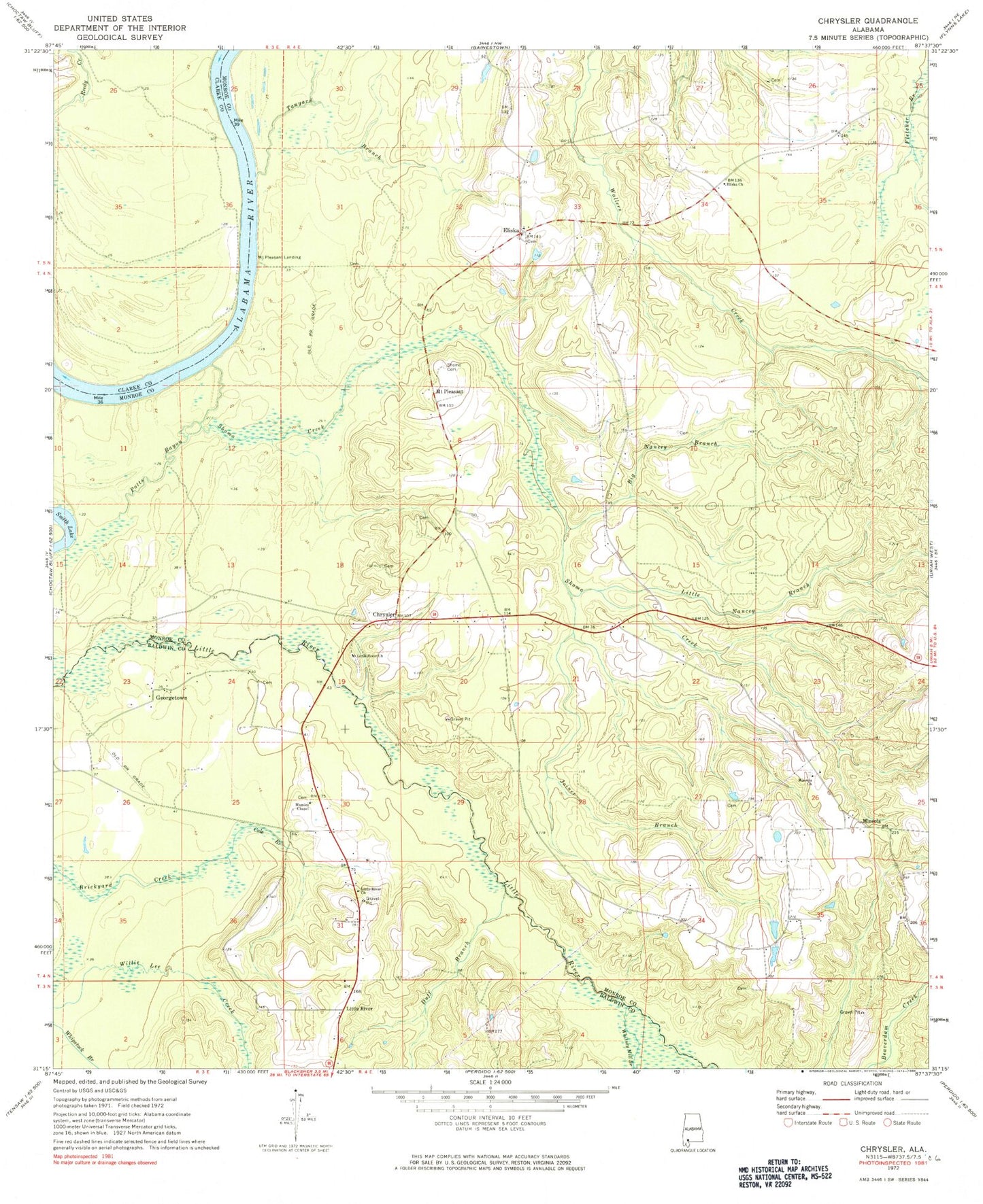
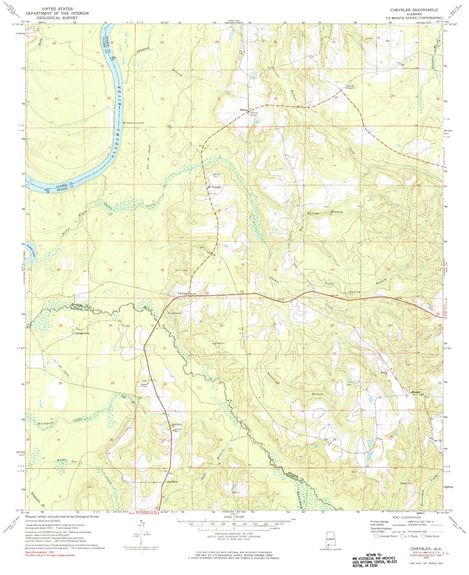
Classic USGS Chrysler Alabama 7.5'x7.5' Topo Map
Couldn't load pickup availability
Historical USGS topographic quad map of Chrysler in the state of Alabama. Typical map scale is 1:24,000, but may vary for certain years, if available. Print size: 24" x 27"
This quadrangle is in the following counties: Baldwin, Clarke, Monroe.
The map contains contour lines, roads, rivers, towns, and lakes. Printed on high-quality waterproof paper with UV fade-resistant inks, and shipped rolled.
Contains the following named places: Big Nancey Branch, Cole Branch, Duff Branch, Eliska Church, Georgetown, Joiner Branch, Little Nancey Branch, Little River, Mamies Chapel, Potts Bayou, Shomo Cemetery, Shomo Creek, Tanyard Branch, Whitney Mill Branch, Triumph Church, Gentry Store (historical), Kellum Landing, Mineola Cemetery, Mount Pleasant Church, Mount Pleasant Church, Potts Bar, Strider Store (historical), Tucker School (historical), Weatherford Mill (historical), Chrysler, Little River Baptist Church, Mineola Baptist Church, Reedy Creek, Williams Cemetery, Ferrell Cemetery, Grove Hill Church, Weatherford Cemetery, Mineola Church, Little River Church, Eliska, Mineola, Mount Pleasant, Mount Pleasant Landing, Beat 1 Volunteer Fire Department, Little River Post Office