MyTopo
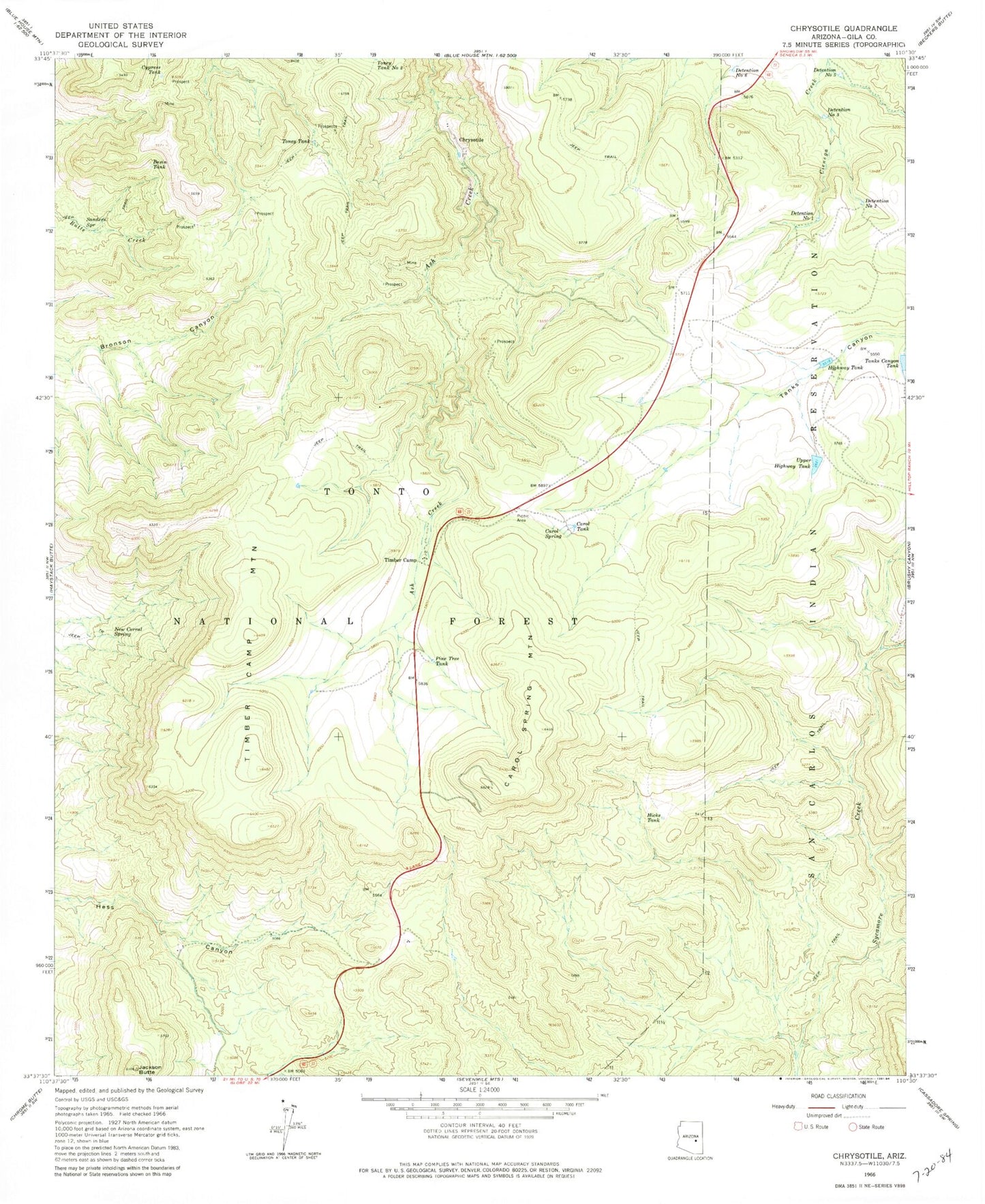
Classic USGS Chrysotile Arizona 7.5'x7.5' Topo Map
Couldn't load pickup availability
Historical USGS topographic quad map of Chrysotile in the state of Arizona. Map scale may vary for some years, but is generally around 1:24,000. Print size is approximately 24" x 27"
This quadrangle is in the following counties: Gila.
The map contains contour lines, roads, rivers, towns, and lakes. Printed on high-quality waterproof paper with UV fade-resistant inks, and shipped rolled.
Contains the following named places: Basin Tank, Bear Canyon Spring, Black Jack Tank, Borrow Pit Tank, Bronson Trick Tank, Carol Number One Tank, Carol Number Two Tank, Carol Spring, Carol Spring Mountain, Carol Tank, Chrysotile, Cypress Tank, Detention Number Five, Detention Number One, Detention Number Six, Detention Number Three, Detention Number Two, Hess Flat, Hicks Tank, Highway Tank, Highway Tank Dam, Jackson Butte, Jackson Tank, New Corral Spring, Pine Tank, Pine Tree Tank, Rock Spring Well, Sanders Spring, Survey Spring, Tanks Canyon Tank, Timber Camp, Timber Camp Mountain, Timber Camp Tank, Toney Tank, Toney Tank Number Two, Tucker, Turkey Tank, Upper Highway Tank, Upper Highway Tank Dam, White Tank