MyTopo
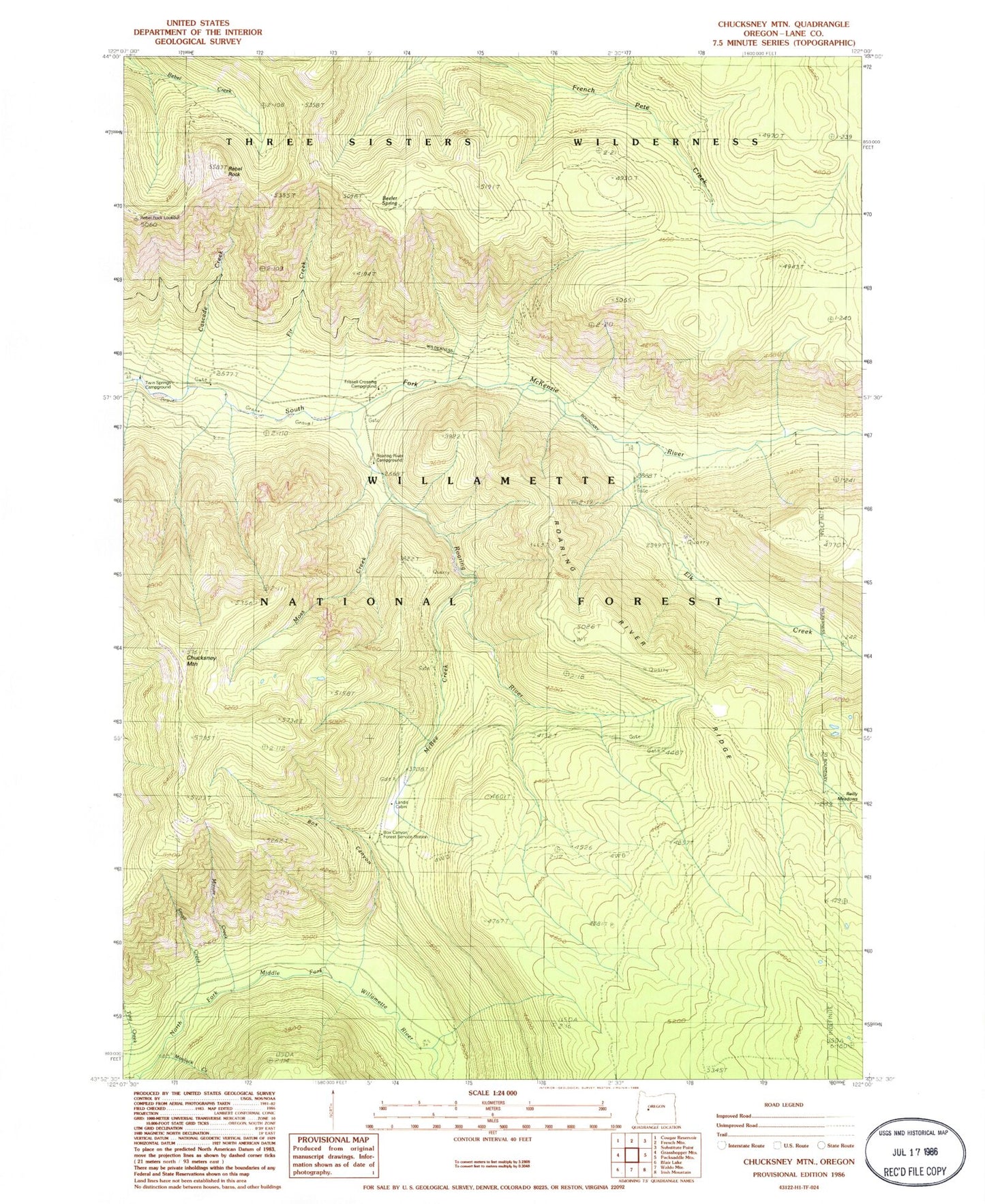
Classic USGS Chucksney Mountain Oregon 7.5'x7.5' Topo Map
Couldn't load pickup availability
Historical USGS topographic quad map of Chucksney Mountain in the state of Oregon. Map scale may vary for some years, but is generally around 1:24,000. Print size is approximately 24" x 27"
This quadrangle is in the following counties: Lane.
The map contains contour lines, roads, rivers, towns, and lakes. Printed on high-quality waterproof paper with UV fade-resistant inks, and shipped rolled.
Contains the following named places: Beeler Spring, Box Canyon, Box Canyon Horse Camp, Bull Creek, Cascade Creek, Chucksney Creek, Chucksney Mountain, Elk Creek, Fir Creek, Frissell Crossing Campground Boat Ramp, Frissell Crossing Recreation Site, Landis Cabin, McBee Creek, Minute Creek, Moolack Creek, Moss Creek, Rebel Rock, Rebel Rock Lookout, Reilly Meadows, Roaring River, Roaring River Group Camp, Roaring River Ridge, Small Creek, Tiny Creek, Twin Springs Campground, Wapiti Creek