MyTopo
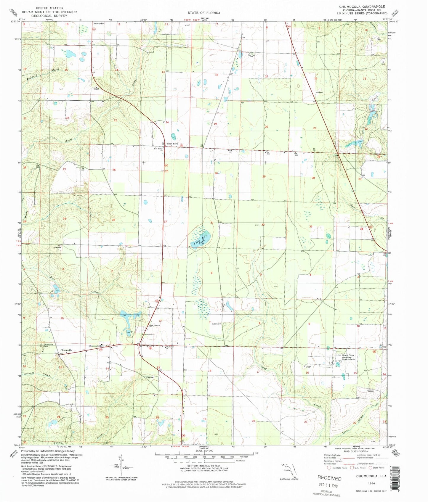
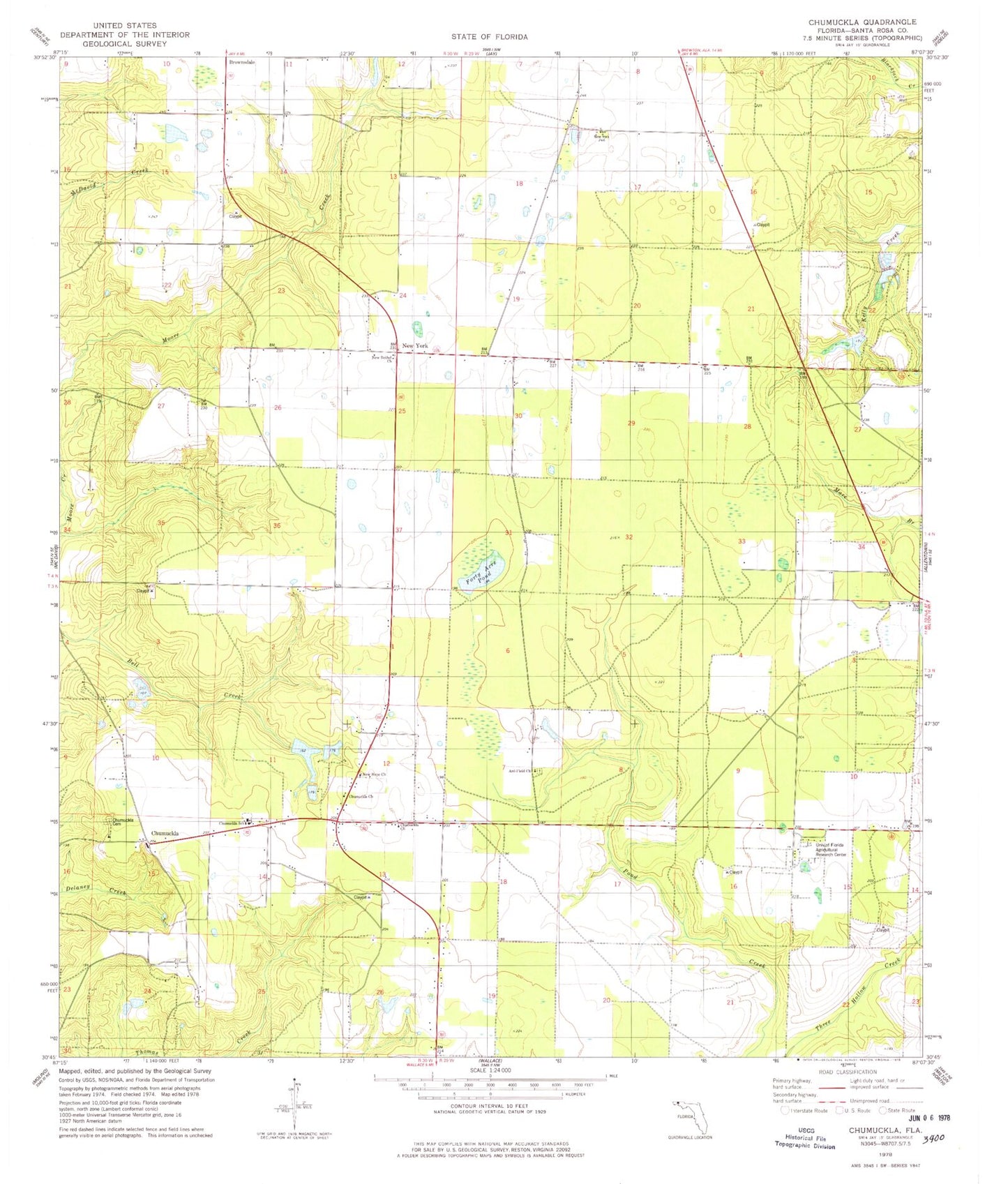
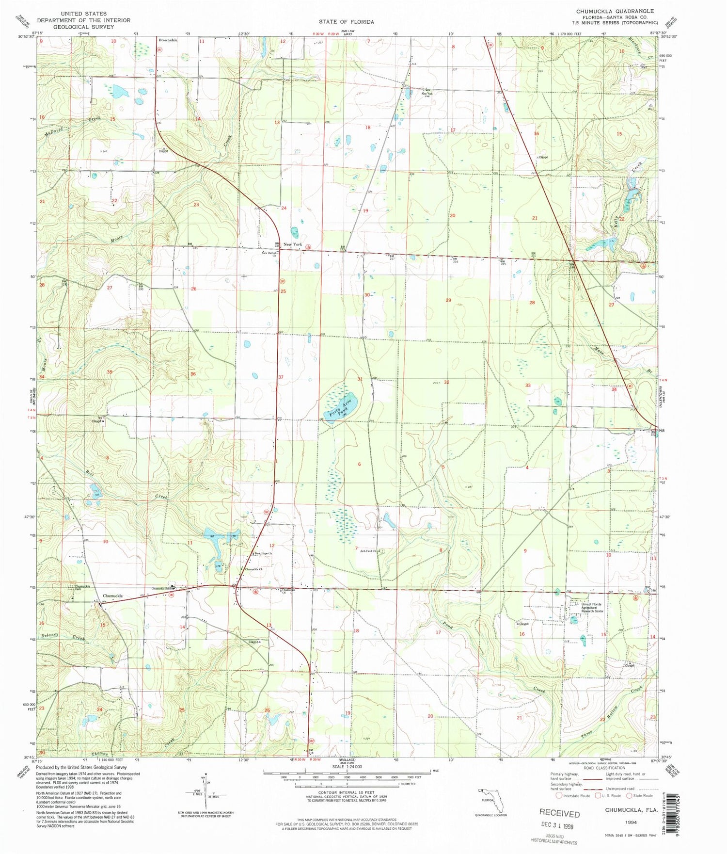
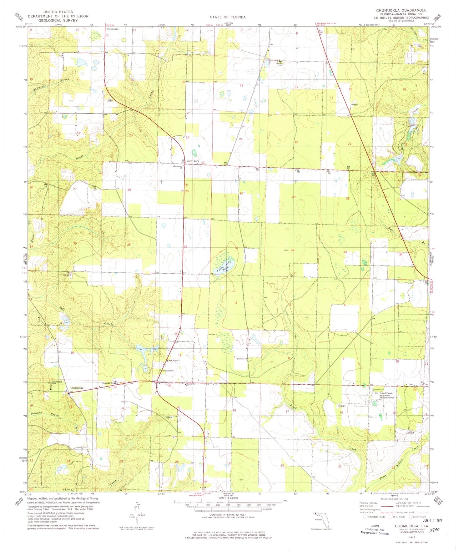
Classic USGS Chumuckla Florida 7.5'x7.5' Topo Map
Couldn't load pickup availability
Historical USGS topographic quad map of Chumuckla in the state of Florida. Map scale may vary for some years, but is generally around 1:24,000. Print size is approximately 24" x 27"
This quadrangle is in the following counties: Santa Rosa.
The map contains contour lines, roads, rivers, towns, and lakes. Printed on high-quality waterproof paper with UV fade-resistant inks, and shipped rolled.
Contains the following named places: Allentown Division, Allentown Volunteer Fire Department Substation 11, Ard-Field Church, Chumuckla, Chumuckla 20-20 Airport, Chumuckla Cemetery, Chumuckla Census Designated Place, Chumuckla Church, Chumuckla School, Forty Acre Pond, John C Pace Pond One, John C Pace Pond Two, New Bethel Church, New Hope Church, New York, Odom's Flying Service, University of Florida Agricultural Research Center, W B Jordon Pond, Wells Flying Service